


Wine Country County Counts for Half of California’s Repeat Home Flooding

Photo: Beth Schlanker, Press Democrat
On February 15, 1986, somewhere along the Russian River amid the quiet woodlands of unincorporated Sonoma County, a home flooded.
The same home flooded again in 1995. Then again in 1997. And again and again.
By 2019, the same property had flooded eight times since the 80s, and received more than $750,000 in disaster money from the National Flood Insurance Program. In nearby neighborhoods, dozens of other properties were flooding every five years or more on average, and one unit flooded 20 times — almost every other year. They are among more than 40,000 parcels nationwide that have suffered multiple catastrophic floods since 1978, according to an interactive map recently updated and re-released by the Natural Resources Defense Council called Losing Ground: Severe Repetitive Flooding in the United States.
Losing Ground reveals that Sonoma has more of these “Severe Repetitive Loss Properties” than any other county in the Western U.S. Unearthing that tidbit from the cavernous databases of the Federal Emergency Management Agency would prove near-impossible for even the savviest fact-finder, but I was able to reach the same conclusion in under a minute thanks to the map’s intuitive interface.
To create the free tool, the NRDC mapped the number of Severe Repetitive Loss Properties from FEMA’s data in every county in the U.S., for every year from the late 1970s to 2022. Perhaps more importantly for preventing future flooding, the map also shows how many properties underwent efforts to reduce flood risk, also called “mitigation,” and what proportion had insurance in any given year at the county, state, or national level.

The tool houses lots of details without sacrificing simplicity in viewing and comparing the data — a feat I found far more impressive after poking through some of the source information. My Internet browser balked at loading subsets of the nearly 45,000 rows of data, and unknown acronyms occasionally led to dry FEMA documents. But viewing the source data alongside the Losing Ground map led to some surprising insights that would be hard to glean from either one on its own — like how a quarter of all California’s Severe Repetitive Loss Properties come from a single zip code in Sonoma County that’s home to the unincorporated community of Guerneville and fewer than 5,000 people.
Ultimately, the data may only be as useful as regulators make it. Exhausted property owners and tenants in the riskiest areas are often perversely incentivized to rebuild in place. Even people with flood insurance often lack the resources to rebuild more flood-resilient structures. And in California, only one of the 300-500 repeat-offender properties has achieved a lower flood risk in any way since 2005, from setting back the property to a government buyout to engineering projects designed to improve flooding.
During the same time, Losing Ground shows a 36% increase in the number of Severe Repetitive Loss Properties in California, with more than 200 new parcels joining the ranks of the perpetually at-risk. This year-by-year breakdown reflects a sobering nationwide trend in flooding: policy and funding for solutions are far outpaced by the growth of places at risk.
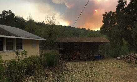
Top Photo: A little pink house, the kind often on the frontlines of a lost American dream according to 1980s songwriter John Mellencamp, gets flooded during the atmospheric river rains of February 2024 in Guerneville. Photo: Beth Schlanker, Press Democrat
Other Recent Posts
Saving Two Marshes From the Squeeze
Centennial marshes formed by Gold Rush-era sediment shield critical infrastructure from flooding and sea level rise, but these wetlands are “disintegrating,” planners warn.
The Climate Questions Facing Bay Area Voters This Spring
Important details about votes on transit funding, open space preservation, wildfire prevention, and earthquake prep this Election Day.
Alviso Stays Strong, With Help from NGO
Annexed by San José in 1968, the bayside community has long felt the effects of flooding and neglect, but one community organization is finding hope.
Finding the Sweet Spot for Local Economies
The theory of Doughnut Economics proposes a society that balances environmental sustainability with social well-being.
A New Tax to Maintain Green Spaces Around Santa Clara?
If passed, Measure D would would raise $17 million annually for the Santa Clara Valley Open Space Authority.
Could Avocados Be A Transformational Fruit for the Bay Region?
Local growers and activists are planting avocado trees to build climate resilience, local food systems, and alternatives to imported fruit.
Radar Gap Filled on Marin Mountaintop
A new weather radar installation will help the region’s northern counties read incoming storm clouds, hours before they drop their rain.
New Shoreline Projects Could Add 168 Acres of Parks to the East Bay
New plans could transform Golden Gate Fields and an Oakland industrial lot into public parks, with sea-level rise resilience built in.
Is Rising Heat Making It Harder for West Oakland to Breathe?
West Oakland has asthma rates 7x higher than the rest of California. As heat waves get more frequent, residents like longtime activist Ms. Margaret Gordon are sounding the alarm.
Flores, Flautas, and an Invitation Outside
The Bay Area chapter of Latino Outdoors offers an invitation to outdoor adventure with free, bilingual hikes and camping trips.
More
- FEMA Updates Flood Maps in Sonoma County, Santa Rosa and Windsor (July 2023)
- Atmospheric rivers drive flood damages in the western United States | Science Advances
- More U.S. homes are repeatedly flooding as the nation’s flood risk grows – The Washington Post
- Why California’s Water Extremes are Wilder than Ever April 2023, KneeDeep Times
- Two Towns Shortlisted for FEMA Millions, November 2022, KneeDeep Times


