


A South Bay Levee Breaks Ground, And Records
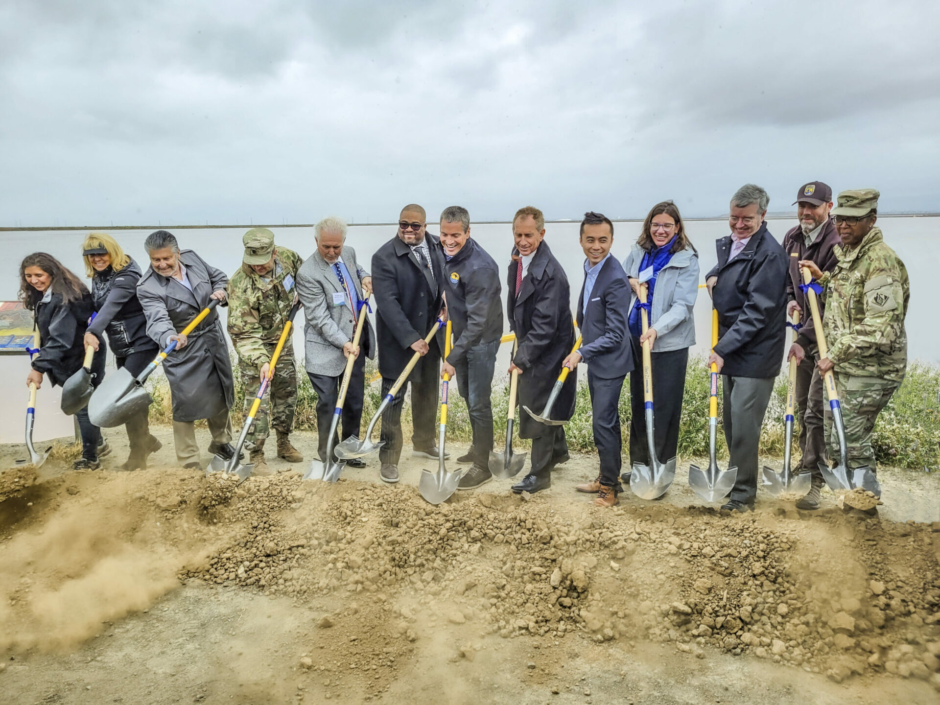
On a drizzly Thursday in April, dozens of reporters, government officials, military brass, conservationists, and bureaucrats gathered beside a weedy shoreline on the edge of San Jose to break ground on an effort worth hundreds of millions of dollars.
“We have a grave responsibility to take action, and what you see behind me is an example of that action,” declared Wade Crowfoot, the California Secretary for Natural Resources.
The humble surroundings belied the significance of the South San Francisco Bay Shoreline Project Groundbreaking. The project will include four miles of new levee and 2,900 acres of restored habitats, like tidal wetlands, to buffer the South Bay from rising seas. It is the culmination of nearly two decades worth of planning. The project is also the first in the nation in which the U.S. Army Corps of Engineers has incorporated sea-level rise into its planning and design, according to a Valley Water press release. And crucially, it’s distinct from piecemeal city-by-city levee improvements in that it aims to protect a vast swath of the South Bay at once.
Valley Water (formerly the Santa Clara Valley Water District) hosted the groundbreaking event alongside an alphabet soup of contributing organization members: the San Francisco Water District, Bay Conservation and Development Commission, U.S. Army Corps of Engineers, California State Coastal Conservancy, and the United States Fish and Wildlife Service, alongside city, county, and state level elected officials. For many involved, the project’s broad popularity and multi-use benefits represent a best-case-scenario for sea level rise adaptation, and they’re impatient to see it working.
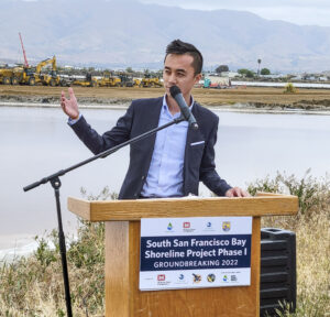
“We are at the crossroads and forefront of climate change,” said California Assemblymember Alex Lee. “It is very important that we continue to use natural solutions.” Nature-based infrastructure is the lynchpin of the South San Francisco Shoreline Project. Rather than walling off the most vulnerable areas from the Bay, the project will defend them from the encroaching sea with deployments of restored marshlands and sloping transition habitats along the levee.
These same defenses will also protect the San José-Santa Clara Regional Wastewater Facility, which serves over a million people. It is one of 36 wastewater treatment plants identified in California as vulnerable to sea level rise — 30 of which are in the Bay Area.
Other Recent Posts
Plants Facilitate Transition to Higher Water
Save The Bay is restoring habitat transition zones with native plants to accommodate rising sea levels and support wildlife.
Hundreds Protest Proposed Cuts to San Francisco Environment Department
Mayor Daniel Lurie’s office has introduced sweeping budget cuts for the next fiscal year, including reduced support for climate action.
El Cerrito Bets on Car-Free Living
An East Bay city is building more than 700 housing units on BART parking lots.
The Nuances of Tapping North Bay Sediment Supplies
How Adobe Creek and the Petaluma River can help three parcels, including a popular park, evolve into one resilient shore.
Meet the Oakland Biologist Making Native Plants Go Viral
Saumitra Kelkar shares videos about local biodiversity and native plants through his account, Oakland.bio.
Mountain View’s Shoreline Gets Serious SLR Attention
After four breaches, imports of clean fill, and the addition of rocks, bird islands and bridges the South Bay’s Shoreline Park has more climate resilient environs.
Adaptation Atlas
Thirty places to focus on nature-based adaptation around the Bay’s 400-mile shoreline.
Agroecology Commons Weathers a Weird Winter and Political Storms
A year after our first Agroecology Commons visit, the El Sobrante farm has a new greenhouse foundation, thriving farmer training program, and some unexpected wildlife.
Finding Community at the Bay Area Climate Literacy Exchange
A third of our food supply goes to waste, and Bay Area students are learning how to fix it one school cafeteria at a time.
Easy Spring Vegetables for Small Gardens
Snap peas and Tokyo turnips are hardy, cool-season vegetables well-suited to Bay Area gardens. Here’s how to grow and cook them.
 Funding for the effort comes in part from Measure AA, a regional parcel tax for shoreline restoration work which Bay Area voters passed in June 2016. San Mateo County Supervisor Dave Pine, who is chair of the San Francisco Bay Restoration Authority charged with managing funds collected from the measure, said in his event speech that the Shoreline Levee project has been their number one priority for using those funds “from the very beginning, from the very design of Measure AA.” Although this large-scale levee project has years of frenetic work ahead to build the blueprint into reality, Pine and other officials are already envisioning future projects, to the tune of restoring 15,000 more acres of tidal wetlands across the Bay Area protecting and transforming its shoreline at once.
California Assemblymember Alex Lee. Photo: USACE.

Plan for Phase 1 Shoreline Levee construction. Map: Valley Water/USACE.
