


A South Bay Levee Breaks Ground, And Records
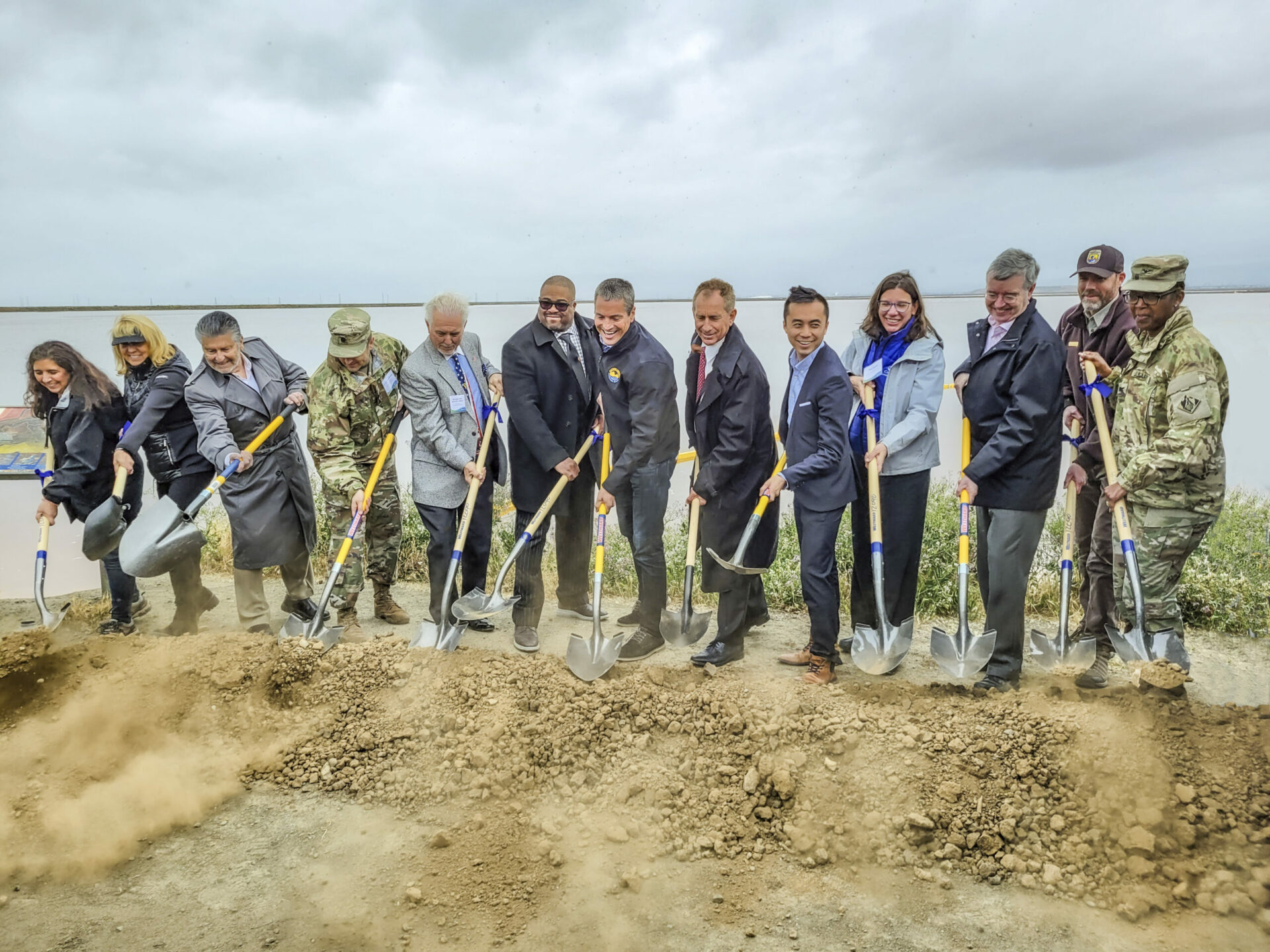
On a drizzly Thursday in April, dozens of reporters, government officials, military brass, conservationists, and bureaucrats gathered beside a weedy shoreline on the edge of San Jose to break ground on an effort worth hundreds of millions of dollars.
“We have a grave responsibility to take action, and what you see behind me is an example of that action,” declared Wade Crowfoot, the California Secretary for Natural Resources.
The humble surroundings belied the significance of the South San Francisco Bay Shoreline Project Groundbreaking. The project will include four miles of new levee and 2,900 acres of restored habitats, like tidal wetlands, to buffer the South Bay from rising seas. It is the culmination of nearly two decades worth of planning. The project is also the first in the nation in which the U.S. Army Corps of Engineers has incorporated sea-level rise into its planning and design, according to a Valley Water press release. And crucially, it’s distinct from piecemeal city-by-city levee improvements in that it aims to protect a vast swath of the South Bay at once.
Valley Water (formerly the Santa Clara Valley Water District) hosted the groundbreaking event alongside an alphabet soup of contributing organization members: the San Francisco Water District, Bay Conservation and Development Commission, U.S. Army Corps of Engineers, California State Coastal Conservancy, and the United States Fish and Wildlife Service, alongside city, county, and state level elected officials. For many involved, the project’s broad popularity and multi-use benefits represent a best-case-scenario for sea level rise adaptation, and they’re impatient to see it working.
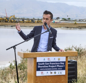
“We are at the crossroads and forefront of climate change,” said California Assemblymember Alex Lee. “It is very important that we continue to use natural solutions.” Nature-based infrastructure is the lynchpin of the South San Francisco Shoreline Project. Rather than walling off the most vulnerable areas from the Bay, the project will defend them from the encroaching sea with deployments of restored marshlands and sloping transition habitats along the levee.
These same defenses will also protect the San José-Santa Clara Regional Wastewater Facility, which serves over a million people. It is one of 36 wastewater treatment plants identified in California as vulnerable to sea level rise — 30 of which are in the Bay Area.
Other Recent Posts
Wild Pigs Rough Up Bay Area Greens
They tear up landscapes in search of food, prey on native wildlife, and damage streams, and warming could bring them closer to urban areas.
Delta Residents Absorb the Flood Challenge, And Choose Different Ways to Act
Graduates of a shoreline leadership program in Contra Costa County recently pitched their ideas for sea level rise education and adaptation.
Strong Leader, Light Touch: Caitlin Sweeney
Ahead of her retirement earlier this month, the Estuary Partnership director sat down with KneeDeep to discuss her achievements and the future of the Bay.
Unmasking Regionalism
Regional leaders say the Bay Area has built ambitious climate resilience plans. Now comes the harder task: funding and implementing them.
Pacheco Pass Is Getting a Second Wind
In Pacheco Pass, a decades-old wind farm is getting an upgrade that will double CleanPowerSF’s wind energy.
Climate Change, A Scorpion’s POV
From the Sierra Nevada to the Mojave Desert, the state’s native scorpions are losing habitat as heat, wildfires, and development reshape ecosystems.
12 Creek Types: Which One Is In Your Backyard?
Geomorphologist Gregory Pasternack and his team documented 12 types of Bay Area creeks to help residents protect themselves from flood threats.
Could Avocados Be A Transformational Fruit for the Bay Region?
Local growers and activists are planting avocado trees to build climate resilience, local food systems, and alternatives to imported fruit.
Radar Gap Filled on Marin Mountaintop
A new weather radar installation will help the region’s northern counties read incoming storm clouds, hours before they drop their rain.
The Climate Questions Facing Bay Area Voters This Spring
Important details about votes on transit funding, open space preservation, wildfire prevention, and earthquake prep this Election Day.
 Funding for the effort comes in part from Measure AA, a regional parcel tax for shoreline restoration work which Bay Area voters passed in June 2016. San Mateo County Supervisor Dave Pine, who is chair of the San Francisco Bay Restoration Authority charged with managing funds collected from the measure, said in his event speech that the Shoreline Levee project has been their number one priority for using those funds “from the very beginning, from the very design of Measure AA.” Although this large-scale levee project has years of frenetic work ahead to build the blueprint into reality, Pine and other officials are already envisioning future projects, to the tune of restoring 15,000 more acres of tidal wetlands across the Bay Area protecting and transforming its shoreline at once.
California Assemblymember Alex Lee. Photo: USACE.

Plan for Phase 1 Shoreline Levee construction. Map: Valley Water/USACE.


