



Is Placing Sediment in the Shallows to Feed Marshes Working?

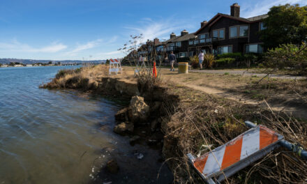
USGS conducts bathymetry survey off Eden Landing. Photo: Tim Elfers
Scientists experimenting with placing mounds of dredged sediment in the shallows near marshes to see if it helps them build up elevation in the face of sea level rise have more promising results. As reported in this Boxes of Mud story in KneeDeep in March 2025, the experiment involved dredging materials from the Redwood City harbor, barging them over to the East Bay shore near Eden Landing, depositing 950,000 cubic yards back into the Bay, and then carefully monitoring the outcomes.
A year since the first reported results, the team of researchers from the U.S. Army Corps of Engineers and the U.S. Geological Survey now have further confirmation that the idea of beneficial reuse to bump up sediment supply for mudflats and marshes is working, and has minimal impacts on creatures in the oozes, fish, or nearby beds of eelgrass.
“The mounds have continued to erode slowly and disperse,” says lead scientist Julie Beagle with the Corps. Initially, she says, they thought it would be more dispersive, like a “one time boost,” but “the slow release feeder system” that resulted turns out to be even more promising in the long run.
Since the 2025 article, researchers have continued to monitor the response of local bay life and map the bathymetry around the mound sites and in the surrounding shallows, mudflats, and marshes. Based on data collected by USGS on jet skis (equipped with GPS and single beam echo sounders), and on hundreds of sediment samples, they can see that nearby mudflats and marshes have gained sediment. Some of the particles (labeled with tracers) travelled much farther up local sloughs.
“That tells us there is a pathway between the placement footprint and the Eden Landing marsh complex,” says Beagle.
USGS is also trying to figure out if the mounds dampen waves, and thus protect the marsh “scarp” (edge). (Farther north at Point Pinole, a different research group is also measuring the effects of nearshore structures — oyster reefs — on wave energy eroding the marsh behind them.)
Monitoring also suggests that the clams, worms, and other invertebrates that got buried under the mounds are pretty resilient. “We wanted to know how long it took, after a disturbance like this, for the community to recover. After 12 months, it’s looking pretty similar to what was there before,” says Beagle.
The team is also trying to create a data-based conceptual model of how the sediment moves between mudflats and marshes, and gets resuspended and deposited over time, a model which they can then use at other potential shallow water placement sites around the bayshore.
As Beagle often remarks, this pilot matching local supplies of dredged material to marshes that need to bulk up offers a critical “maintenance” plan for existing habitats needed by both humans and wildlife to withstand sea level rise: “These marshes are going to drown if we don’t feed them more building materials.”
Two years in, and still more surveys ahead, these results are still preliminary: publication of a final report is scheduled for late 2026.
Other Recent Posts
Fire Weather in the Wind
As the hot Nevada air cools every fall, it gets pushed west to lower pressure areas over the Central Valley, where the wind heats up and dries out.
My Morning Cleaning Up the Oakland Estuary
On Oakland’s Creek to Bay Day, I joined 100 volunteers for I Heart Oakland-Alameda Estuary to remove shoreline trash.
RCDs Pay Extra Attention to North Bay High Schoolers
A $15,000 grant will help three North Bay conservation districts evaluate youth education programs and prepare high school students for environmental careers.
Creeks Make Good & Bad Homes
San Jose State researcher Costanza Rampini explores why the houseless favor creek banks, and how they weather the flood risk.
Bay Area Braces for Record-Breaking El Niño
Record high water temperatures in the Pacific are expected to bring dangerous sea level rise, waves, and rain to the region this winter.
Regional Housing Agency Invests in Affordability
The Bay Area Housing Finance Authority is launching a loan program to support the construction of mixed-income rental properties.
The End is Coming for California’s Untouchable Grass
The law, which applies to grass that isn’t used for recreational purposes, could cut urban water use across California by more than 20% says Oakland thinktank.