


12 Creek Types: Which One Is In Your Backyard?
Many Bay Area residents live near a creek, whether it’s the billionaire on the ridge, a family in the foothills, the urbanites in the metropolitan zone, or the houseless seeking nature, water, and privacy on public land. Bay Area creeks come in all shapes and sizes — some are lined with concrete to carry storm flows, and others have been patched or propped up or culverted here and there as humans try to moderate the effects of these waterways on their homes, businesses, roads, and bridges.
Creeks can be both a benefit (wildlife habitat, groundwater recharge) and a liability (erosion, flooding), especially with climate change, as storms fueled by big winds and bigger rains send torrents of water and debris down them in a flash.
“Depending on the stream type, almost everyone is vulnerable,” says UC Davis geomorphologist Gregory Pasternack, who has led the development of a classification system he hopes every creek neighbor will familiarize themselves with. In science papers and colorful ID cards published earlier this year, Pasternack’s team documents 12 types of Bay Area creeks and offers various useful details about topography, function, relative flood threats, and restoration or management options.
Other Recent Posts
Can Nature Help California’s Coast Fight Fire and Floods?
Local and state leaders gather for September summit on how to mainstream nature-based infrastructure.
Guide to Nature-Based Infrastructure Around the Bay Area
Regional leaders are testing eight types of climate adaptation and shoreline flood protection projects that work with nature instead of against it. Here’s an overview.
How Can I Get Clean, Green, Climate-Forward Job Training in the Bay Area?
Looking for a hands-on job working outdoors that actually pays? Here’s a list of training programs.
Santa Rosa Residents Rethink Trees
The heat-burdened Roseland neighborhood is learning how to monitor temperatures and developing an action plan focused on tree shade.
How to Make Conservation a Career
California nonprofits are developing paid apprenticeships to prepare workers for the growing ecological restoration economy.
Raft of Resilience Initiatives Keeps Tahoe Blue
Beach robots, boat inspections, forest thinning, and wetland restoration are among the projects helping the lake confront environmental threats.
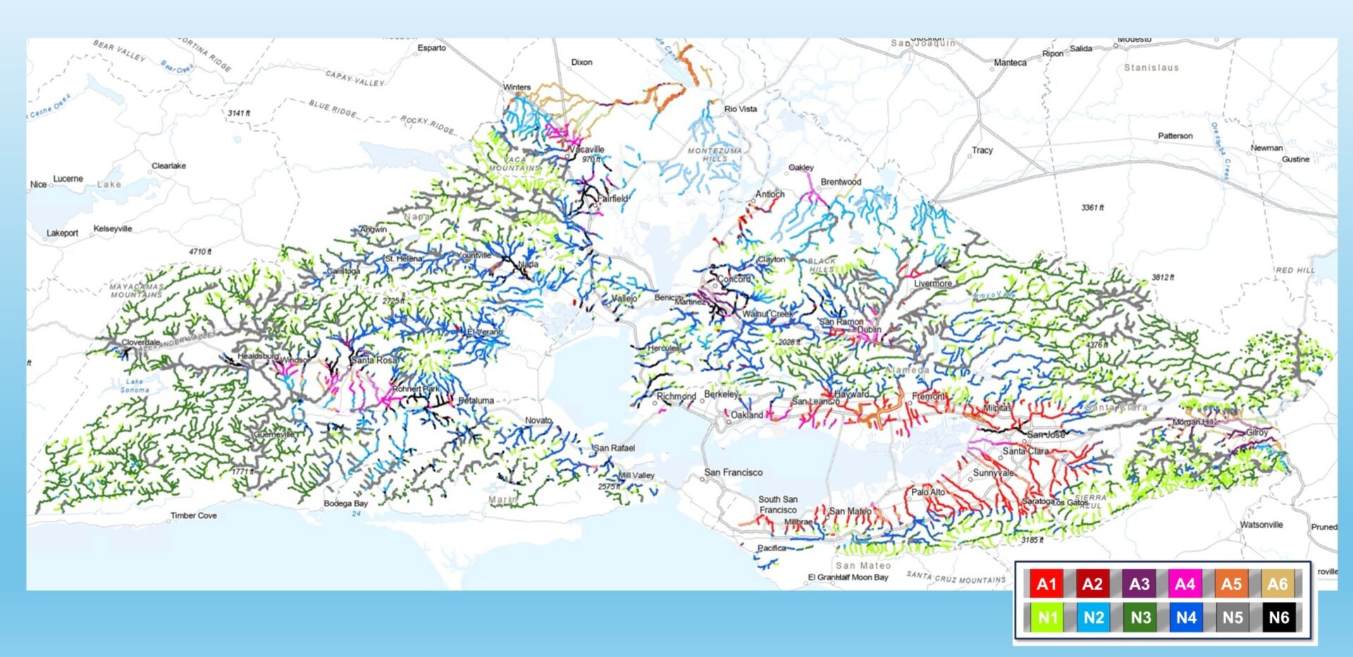
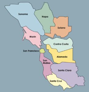
Map: Color coded map of Bay Area stream types based on 2,435 site checks and the UC Davis’ team’s resulting classification and prediction system (A1-armored channel; A2-bank-hardened river; A3-naturalizing channel; A4-large canal; A5-bank-hardened canal; A6-ditch; N1-headwater steep stream; N2-lowland/meadow small stream; N3-mountain stream; N4-entrenched riffle pool system; N5-valley floor riffle-pool system; N6-large entrenched lowland stream. Source: Pasternack et al 2026
“Creeks today require even more mindful stewardship. Whether you’re wealthy or not, most homeowners can’t handle the costs of cleanup and a fix, or don’t even know how to get a permit,” he says.
Pasternack imagines a person in a Marin canyon or Santa Clara Valley floodplain looking at the creek or canal in their backyard, identifying the type from the ID cards, and getting enough information to think about appropriate repair or restoration measures for that creek type. “Maybe one canal is totally bare and lined with rip rap, but another canal has a wetland full of turtles and toads in a strip down the middle of it,” he says. “Each site or section of river has a unique personality.”
Pasternack is now printing up his ID cards in English, Spanish, and Chinese, and building out the supporting website.
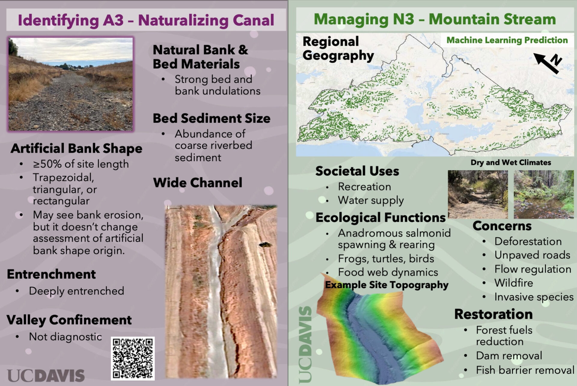
Two sample creek ID cards: Source: Pasternack et al
A thought leader, Pasternack hopes to see the region’s hundreds of nonprofit stewardship and creek groups think more about supporting homeowners struggling with competing goals: fuel reduction for wildfire management versus leaving hillsides and creek banks bare of stabilizing roots and more susceptible to erosion. He hopes they can propose best practices in the “$500-$5,000” range of price tags that more people can afford. “Somebody may be fairly wealthy, but that doesn’t mean they want to spend $500,000 on a stream bank stabilization project,” he says.
“I want people living and working in the Bay Area to know that the streams in their region, their backyards, their communities come in a wide variety, and there’s not a one-size-fits-all solution to the problems they bring.”
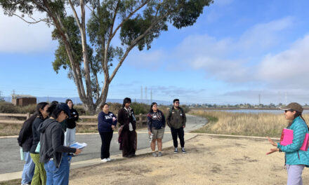
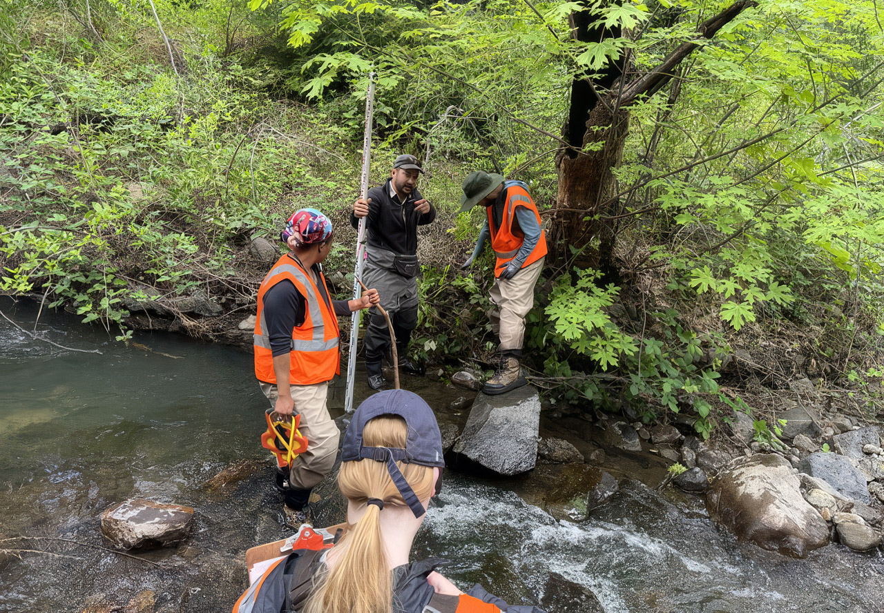
Top photo: Creek surveys (Martin Perales, Napa RCD, and Tasha Royal, Dr. Nikhil Kumar, and Sarah Pyle of UC Davis). Photo: Greg Pasternack.