




A South Bay Levee Breaks Ground, And Records
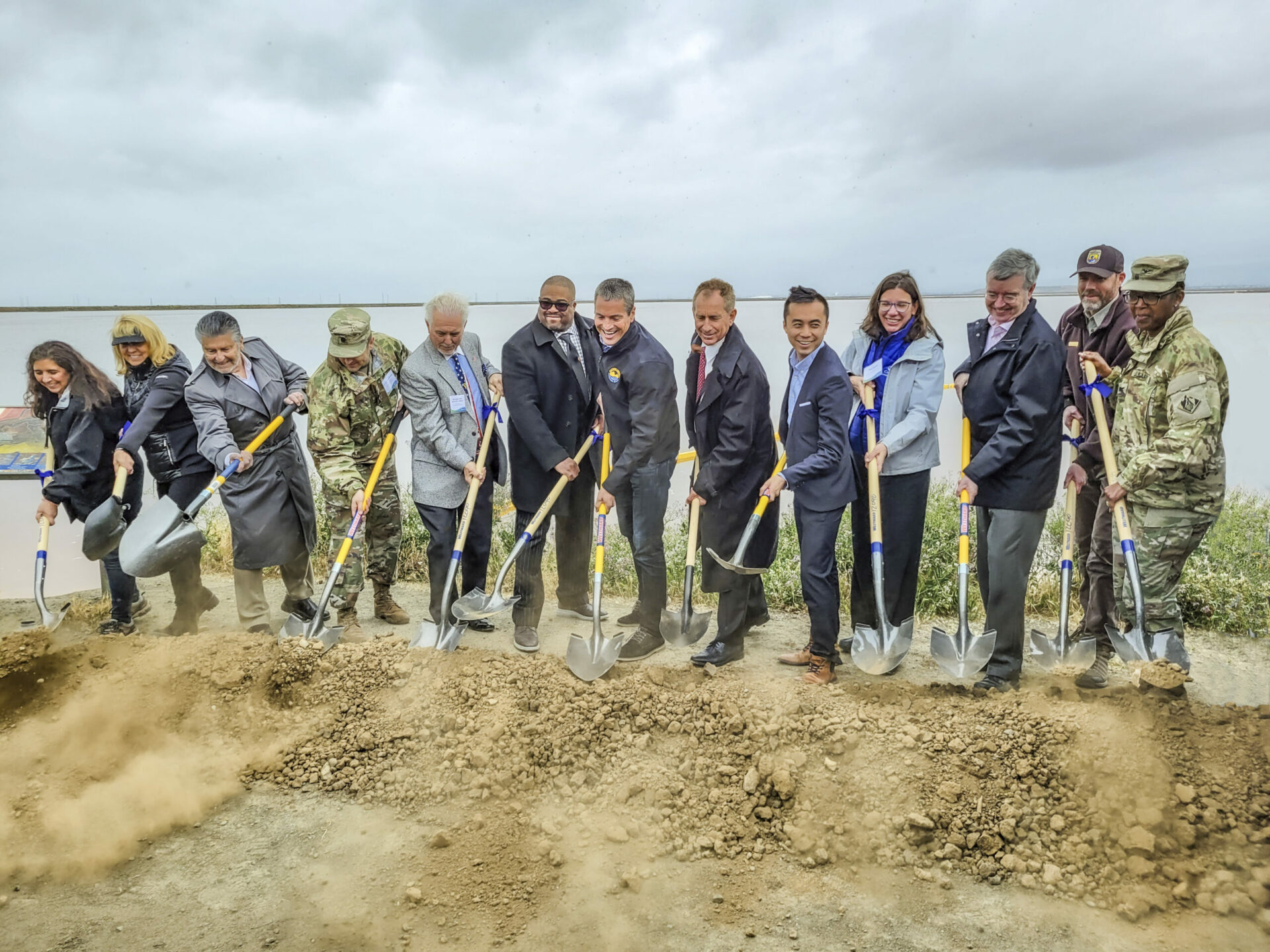
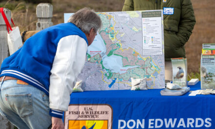
On a drizzly Thursday in April, dozens of reporters, government officials, military brass, conservationists, and bureaucrats gathered beside a weedy shoreline on the edge of San Jose to break ground on an effort worth hundreds of millions of dollars.
“We have a grave responsibility to take action, and what you see behind me is an example of that action,” declared Wade Crowfoot, the California Secretary for Natural Resources.
The humble surroundings belied the significance of the South San Francisco Bay Shoreline Project Groundbreaking. The project will include four miles of new levee and 2,900 acres of restored habitats, like tidal wetlands, to buffer the South Bay from rising seas. It is the culmination of nearly two decades worth of planning. The project is also the first in the nation in which the U.S. Army Corps of Engineers has incorporated sea-level rise into its planning and design, according to a Valley Water press release. And crucially, it’s distinct from piecemeal city-by-city levee improvements in that it aims to protect a vast swath of the South Bay at once.
Valley Water (formerly the Santa Clara Valley Water District) hosted the groundbreaking event alongside an alphabet soup of contributing organization members: the San Francisco Water District, Bay Conservation and Development Commission, U.S. Army Corps of Engineers, California State Coastal Conservancy, and the United States Fish and Wildlife Service, alongside city, county, and state level elected officials. For many involved, the project’s broad popularity and multi-use benefits represent a best-case-scenario for sea level rise adaptation, and they’re impatient to see it working.
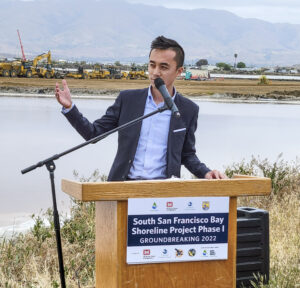
“We are at the crossroads and forefront of climate change,” said California Assemblymember Alex Lee. “It is very important that we continue to use natural solutions.” Nature-based infrastructure is the lynchpin of the South San Francisco Shoreline Project. Rather than walling off the most vulnerable areas from the Bay, the project will defend them from the encroaching sea with deployments of restored marshlands and sloping transition habitats along the levee.
These same defenses will also protect the San José-Santa Clara Regional Wastewater Facility, which serves over a million people. It is one of 36 wastewater treatment plants identified in California as vulnerable to sea level rise — 30 of which are in the Bay Area.
Other Recent Posts
Regional Housing Agency Invests in Affordability
The Bay Area Housing Finance Authority is launching a loan program to support the construction of mixed-income rental properties.
The End is Coming for California’s Untouchable Grass
The law, which applies to grass that isn’t used for recreational purposes, could cut urban water use across California by more than 20% says Oakland thinktank.
Sonoma Vineyard Workers Burn toward a Better Future
A group of immigrant farmworkers are forming a worker-owned cooperative to bring back Indigenous burning practices that used to revitalize the soil.
Los trabajadores de los viñedos de Sonoma queman por un futuro mejor
Un grupo de trabajadores agrícolas inmigrantes está formando una cooperativa de propiedad de los trabajadores para recuperar las prácticas indígenas de quema que solían revitalizar el suelo año tras año.
New Voices Shape Design of Berkeley’s North Basin Strip
Twenty acres of parkland between the highway and the Berkeley shore are slated for a coast-resilient makeover, with input from locals and stakeholders.
It’s Always Sunny In North Fair Oaks
Residents of the unincorporated community launched their second campaign in two years to get the county to care for dying street trees.
Siempre está soleado en North Fair Oaks
Los residentes de la comunidad no incorporada lanzaron su segunda campaña en dos años para lograr que el condado se ocupe de los árboles de la calle que se están muriendo.
Can Nature Help California’s Coast Fight Fire and Floods?
Local and state leaders gather for September summit on how to mainstream nature-based infrastructure.
Guide to Nature-Based Infrastructure Around the Bay Area
Regional leaders are testing eight types of climate adaptation and shoreline flood protection projects that work with nature instead of against it. Here’s an overview.
How Can I Get Clean, Green, Climate-Forward Job Training in the Bay Area?
Looking for a hands-on job working outdoors that actually pays? Here’s a list of training programs.
 Funding for the effort comes in part from Measure AA, a regional parcel tax for shoreline restoration work which Bay Area voters passed in June 2016. San Mateo County Supervisor Dave Pine, who is chair of the San Francisco Bay Restoration Authority charged with managing funds collected from the measure, said in his event speech that the Shoreline Levee project has been their number one priority for using those funds “from the very beginning, from the very design of Measure AA.” Although this large-scale levee project has years of frenetic work ahead to build the blueprint into reality, Pine and other officials are already envisioning future projects, to the tune of restoring 15,000 more acres of tidal wetlands across the Bay Area protecting and transforming its shoreline at once.
California Assemblymember Alex Lee. Photo: USACE.
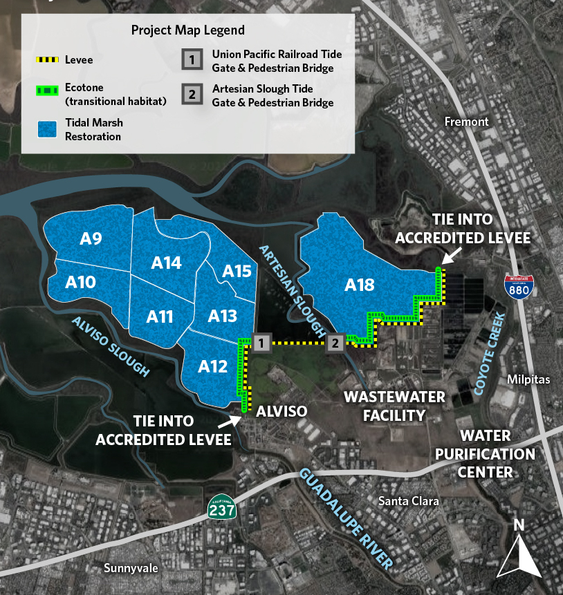
Plan for Phase 1 Shoreline Levee construction. Map: Valley Water/USACE.