

Check Your Project Status: It’s All Here
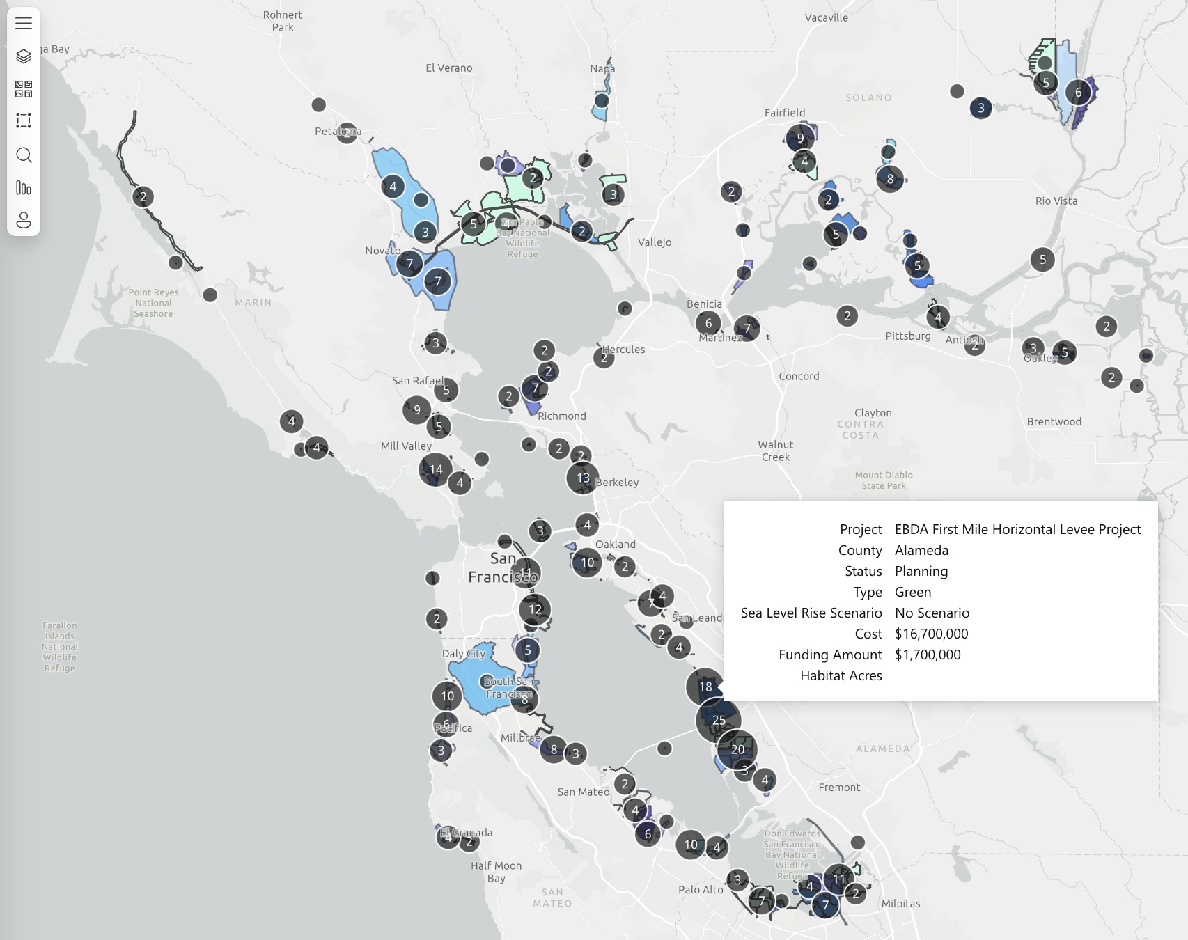
An interactive map of projects in BCDC's new Bay Adapt Project and Funding Navigator. Source: BCDC
Finding reliable information about sea level rise adaptation projects across the San Francisco Bay just got a lot easier. A new web tool developed by the Bay Conservation and Development Commission helps planners, designers, and funders of more than 700 such projects connect — and hopefully work together.
The new tool, called the Bay Adapt Project and Funding Navigator, was developed over the course of 18 months beginning in 2024 and went live in mid-September, says Cory Copeland, a BCDC data and science manager. It’s a first-of-its-kind, one-stop shop where cities, planning agencies, nonprofits, and philanthropists can learn about the status of existing adaptation projects and find new ideas for financing.
Friendly to even non-technical users, the tool allows easy navigation of information sourced from the California EcoAtlas, a statewide database of aquatic resources and wetland management that functions as a sort of clearinghouse for adaptation projects in the commission’s Regional Shoreline Adaptation Plan.
But EcoAtlas is just a starting point. The navigator also incorporates “placeholder projects” developed through a 2023 BCDC sea level rise investment framework that represent “vulnerable shoreline segments where no locally developed adaptation concepts currently exist,” according to its analytical methodology report.
In addition, the navigator includes new data and analyses not featured in EcoAtlas, such as levels of flood protection afforded by specific actions, according to Copeland. A living tool designed to be updated continually, it currently covers 716 total projects.
Other Recent Posts
Your Nine-County Guide to Bay Area Storm Prep
KneeDeep has you covered with this nine-county list of resources available in case of storm-related emergencies this winter.
A Man Who Wears Many Hats
The leader of the San Mateo RCD’s Forest Health and Fire program says his mantra is to “be open to being wrong.”
Solano Samples Air And Finds Dirt
After helping shut down a polluting Vallejo cement plant, residents are working to expand community-led air quality monitoring across Solano County.
Who’s In Charge? What Projects Make the Cut?
The region has made progress planning for sea level rise, but who will coordinate a $100 billion effort over the coming decades remains an open question.
A Bulwark for San Francisco’s Skyscrapers?
A new joint federal and local plan maps out 13 strategies to protect 7.5 miles of San Francisco’s waterfront from sea level rise and future flooding.
Will El Niño Winter Bring Climate Chickens Home to Roost?
A dangerous combination of warm Pacific waters, Kelvin waves, king tides, and storms could disrupt life and infrastructure across the region this winter.
Inside SLR Baseball, My Summit Takeaways
A gathering of 300+ Bay Area climate leaders highlighted growing momentum on sea level rise planning — and the challenges that could slow progress.
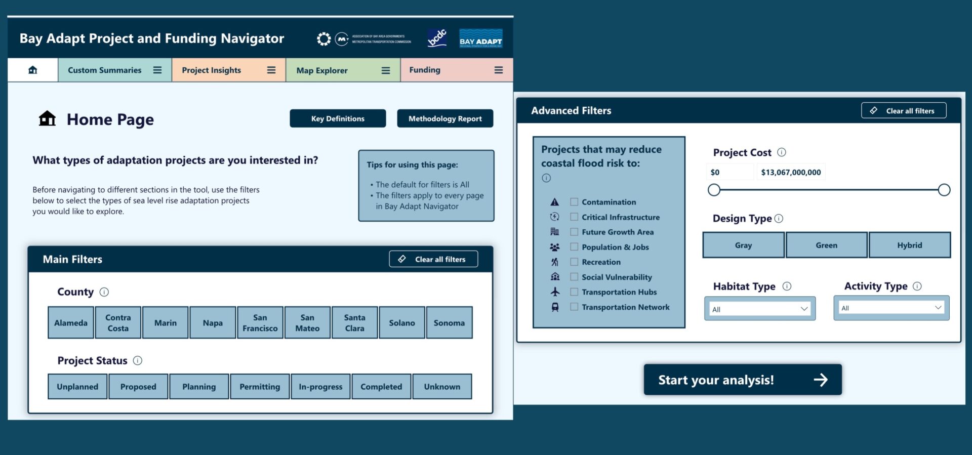
Navigator home page. Source: BCDC
Three Audiences
Copeland says his team developed the interface with three specific audiences in mind.
The first is organizations like the San Francisco Estuary Partnership or San Francisco Bay Restoration Authority and local jurisdictions that pass funding to groups seeking to implement adaptation projects. The new tool will help them find suitable projects to support, Copeland says.
The second audience is the other side of that coin: planners currently developing projects in need of financing, as the navigator is designed to help them identify appropriate grants and funders. (These planners might work for cities, counties, or public agencies, or for consultants to local jurisdictions. City and county planners can also find technical assistance and track funding through the local government climate collaborative BayCAN.)
And the third audience includes users who aren’t formally involved in funding or developing projects, but are positioned somewhere in between — regional advocacy groups like Save the Bay, for example. They can use information from the database “to make persuasive cases that the protection is worth it for the community,” Copeland says.
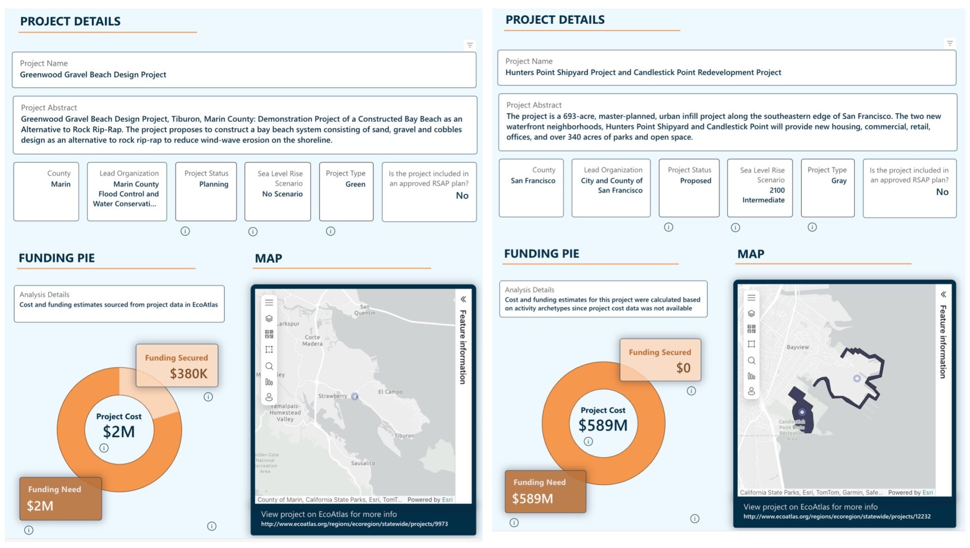
Information available for two sample projects. Source: BCDC
How It Works
The home page features a master search function allowing users to filter all project information in the database by county, status, cost, design type, benefits, habitat type, and physical elements.
For instance, a search for proposed projects in Sonoma County that reduce coastal flood risk to transportation networks returns two results. The first is one of the largest adaptation projects proposed for the entire region, the State Route 37 corridor realignment and elevation project, estimated to cost $11 billion. And the second is a small effort straddling Sonoma and Marin counties to develop an adaptation and resilience plan for the Petaluma River baylands at a price of about $250,000.
To better understand and contextualize projects in the database, a banner across the top of the website includes four buttons: Custom Summaries, Project Insights, Map Explorer, and Funding. Each has its own drop-down menu with additional options. One particularly unique feature, for example, is a “Benefits Summary” that estimates what’s at risk in terms of critical infrastructure, transportation, contamination, habitat, and the Bay Trail if selected projects are not built.
“We’re excited about being able to unlock technical information for decision-making much more quickly,” Copeland says. “The kind of analysis that we can do in 15 minutes with a few clicks of the button used to take a year.”