



A Bulwark for San Francisco’s Skyscrapers?
Elevating historic buildings? Replacing wharves? Building two-foot-tall walls around pier perimeters? Creating a rocky intertidal zone in front of the skyscrapers of Rincon Park?
These are all suggested actions in the Recommended Plan for preventing future flooding of 7.5 miles of San Francisco’s most urban waterfronts released by the Port of San Francisco and the U.S. Army Corps of Engineers in August 2026.
The plan lays out 13 specific actions designed to rebuild and bolster the city’s flood defenses and safeguard transit systems and utilities, while also preserving the historic character and public amenities of San Francisco’s waterfront.
“Locally, it’s a big shift toward developing place-specific plans,” says port resilience planner Luiz Barata.
While a lot of sea level rise planning is in progress around the region, getting down to the specifics of what to do around Mission Bay versus the Ferry Building versus Fisherman’s Wharf is a new level of detail for the Bay Area and the city itself. What’s also different, in terms of the partnership between the Port and the Corps in developing their recent recommendations, is the use of a new, much more comprehensive cost-benefit analysis model.
The old model focused on property damage, while the new one takes into account many other factors, including public safety and social vulnerability, according to Barata. “We got a much more robust total benefits evaluation for the entire area, as opposed to just the downtown area,” he says. It was also the first use of the new cost-benefit model nationwide, he notes.
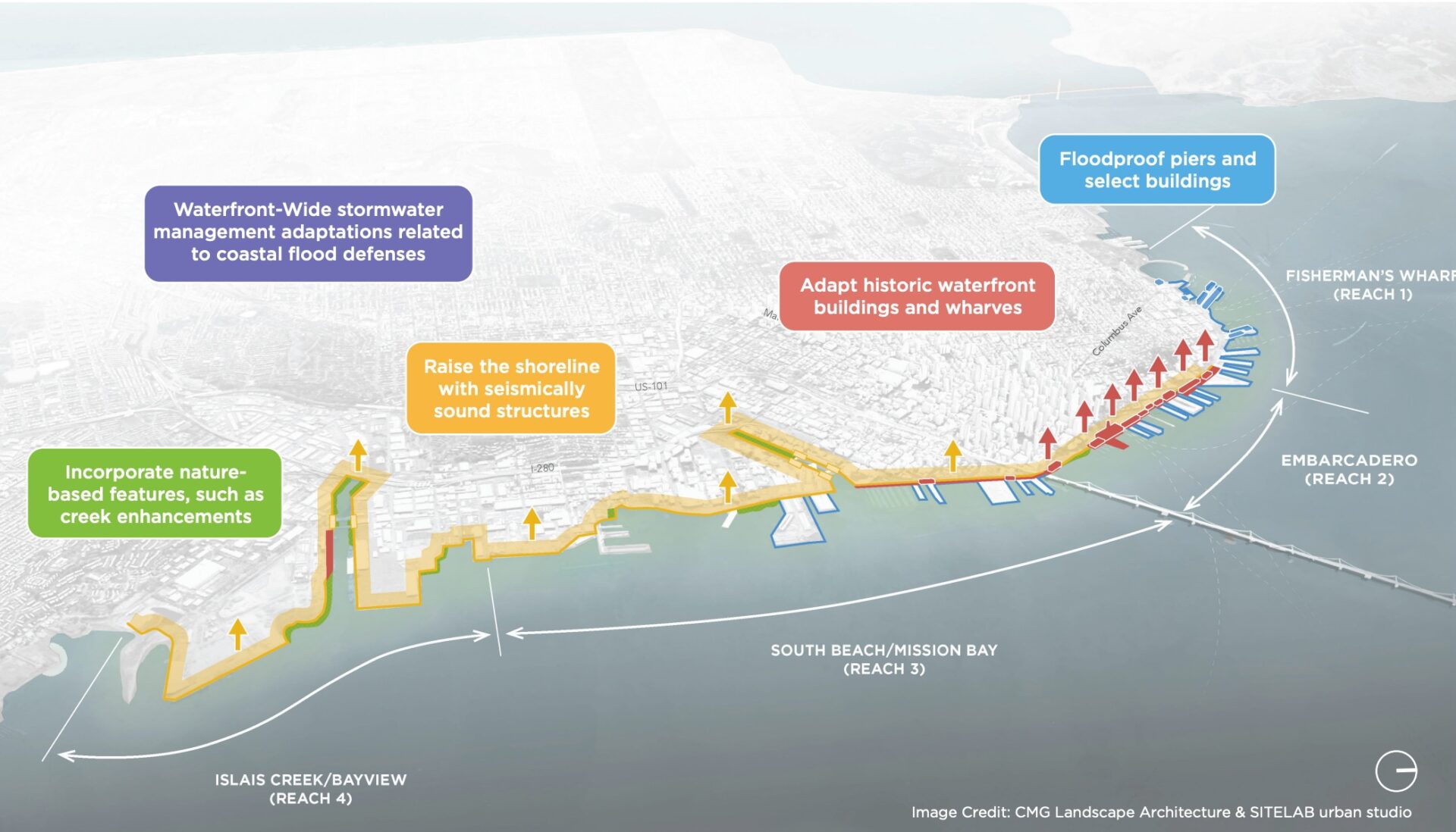
Recommendations for protecting San Francisco’s urban waterfront in the future. Graphic: CMG and SITELAB
Maps in the Recommended Plan lay out the path forward in clear, simple graphics. Not only will piers and buildings be floodproofed, stormwater drainage and seismic strength improved, but also the waterfront, the Embarcadero roadway, and a number of buildings between Harrison and Chestnut streets will need to be raised.
“It’s mainly the bulkheads of the piers that need raising to protect the city, not the piers themselves,” says Barata. Apparently raising the piers themselves would offer little in the way of protection.
Even though San Francisco’s shore is more concrete and asphalt than earth and ecosystem, a considerable effort was also made by the Port and the Corps to find opportunities for more nature-based flood defenses using less concrete. The Corps screened a number of strategies for suitability to conditions on the waterfront. While barrier strategies such as polders and submerged breakwaters failed to pass muster, the final plan includes living seawalls, creek enhancements, coarse beaches, and pocket wetlands.
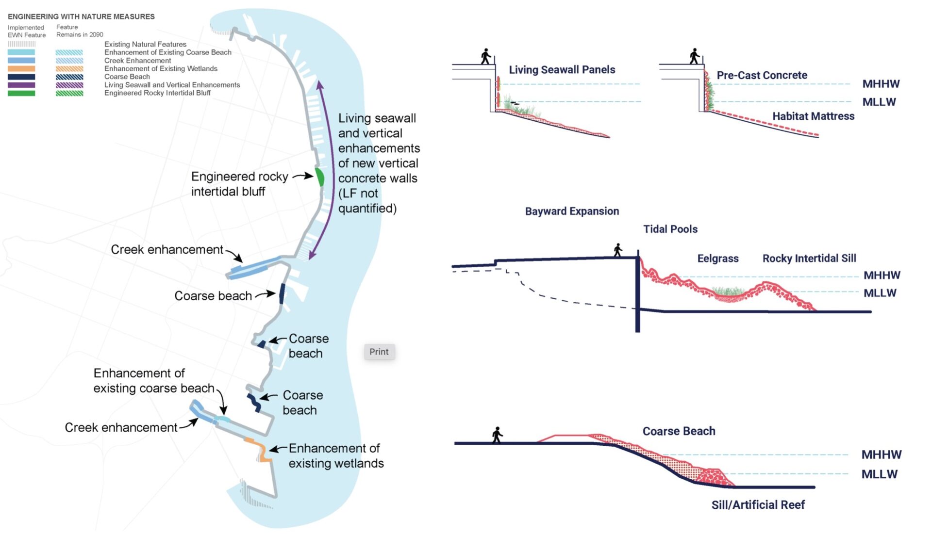
Plans for nature-based infrastructure on the waterfront. Graphic: Army Corps
“It’s absolutely amazing that we were able to justify three out of seven miles of highly urbanized waterfront as suitable for nature-based strategies worthy of federal flood defense,” says Julie Beagle, a scientist originally with the Corps who now heads the SF Estuary Partnership. “I am concerned, however, about this huge win for an urban area getting lost in the fits and starts of the current administration.”
Beagle saw a particularly unique opportunity for nature-based flood defenses at Rincon Park on the eastern end of Mission Street. “Most of the Embarcadero fronts deep water, but the Bay off Rincon is shallower,” she says. Examining the area, the Corps team looked across to Yerba Buena Island and saw rocky cliffs and bluffs, which gave them an idea.
“It’s a man-made, craggy structure mimicking the bluffs we see across the water, the kind that were on San Francisco’s shore before but were all blown out for navigation purposes,” she says.
At the base of the new structure, the Corps and the Port hope to include a sill where eelgrass might take root. “What’s most exciting is that the site’s highly accessible and visible to the public, and it’s also one of the first investments the Port has decided to make” in terms of developing a more detailed design, Beagle says.
Whether the feds go to the mat on the joint actions to protect San Francisco’s downtown assets remains unclear, as the overall waterfront resilience project is still only at 20% design. But the Port is already meeting with other city departments and finance leaders to begin strategizing how to raise the 35% local match for the $17.8 billion price tag already certified by the Corps using the new cost-benefit model.
“It’s a lot of money,” says Barata.
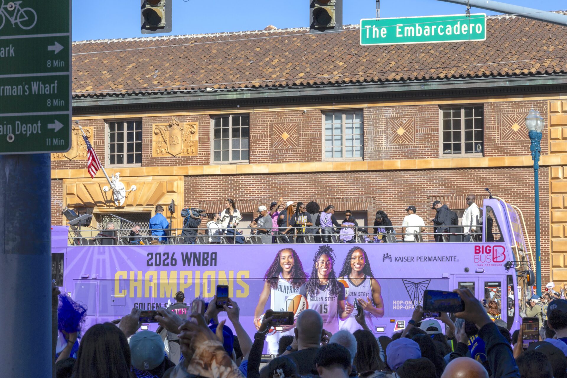
Top Photo: Raising this historic agricultural building on San Francisco’s Embarcadero is part of the Port’s Recommended Plan for adapting to sea level rise. Photo: Joey Kotfica