


Shores that Can Shapeshift AND Stay Put?

Photo: Mario Accordino, ESA.
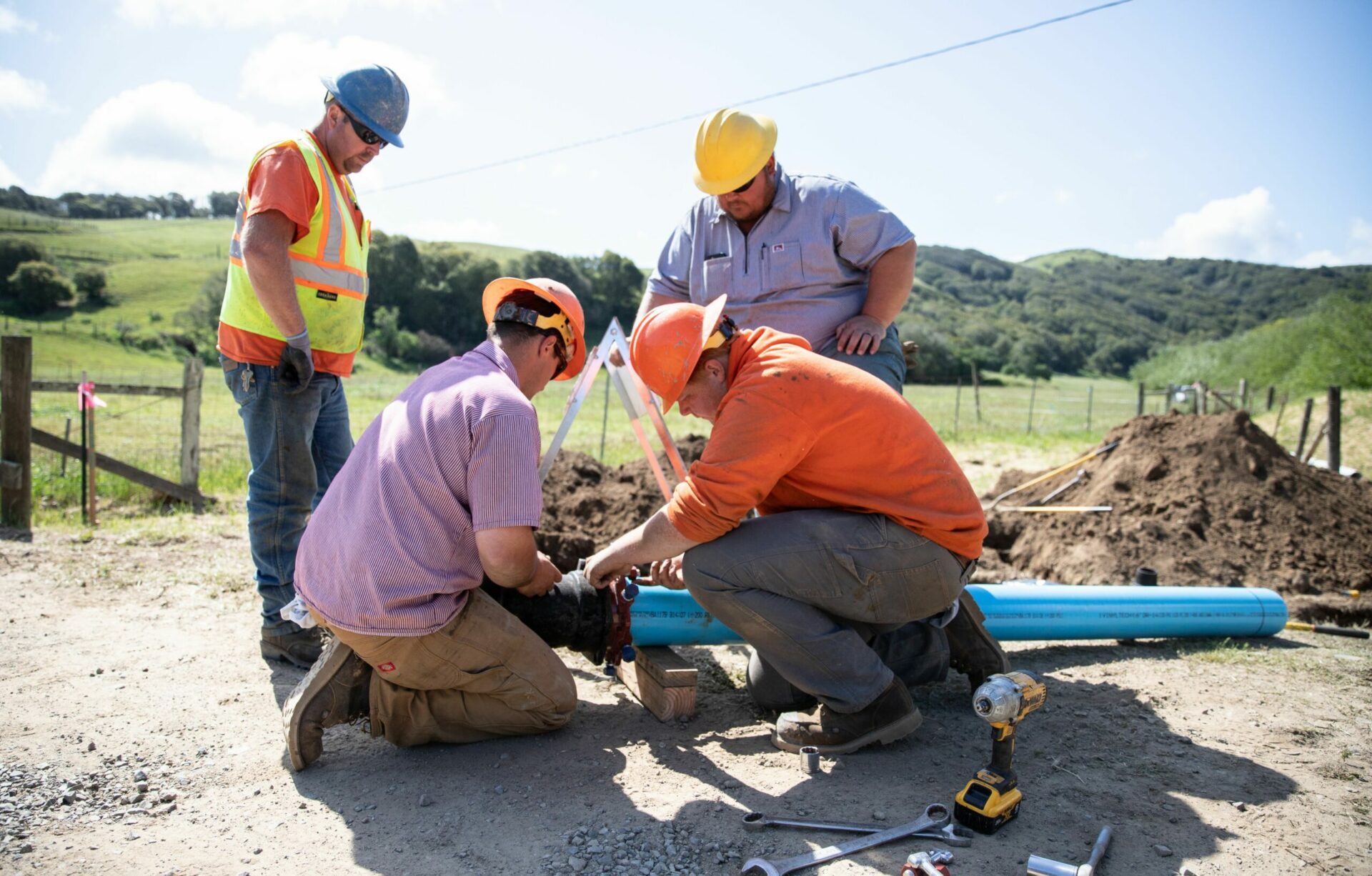
The shore remained elusive on the drizzly May morning as a crack technical team of expert engineers and scientists assembled near one of the oldest and biggest sandspits in the South Bay. Local cities had sounded the alarm last year when tides overwhelmed the sandspit and left a gaping breach.
The team, at least half a dozen, began rolling into the gloomy parking lot at 9 am, opening their trunks, shaking hands, and pulling out rubber boots — accustomed as they were to traipsing through the soggy, marshy, oozy bits of the bayshore.
The line between tactical and technical team blurred in the mist, they were here not on some Kevlar-clad SWAT mission of extraction but on a rescue mission nonetheless, made more urgent by the steady rise of sea level. Assembled by the City of San Leandro and the SF Bay Restoration Authority to come up with a plan to save the eroding landscape, some that day were new to the job and some so seasoned that as soon as the mist cleared they saw something much more alarming than the sandspit breach.
“We’re all looking at the mudflats that go out for close to a mile and the rows of sandbars, there used be 15-20 of them, were just gone,” says Peter Baye, an ecologist joined that day by colleagues in the field from the SF Estuary Institute, the environmental consulting group ESA, UC Davis, and the City of San Leandro. “With most of the shore from Oakland to San Leandro armored, the loss of those bars tells me there isn’t much hope for natural resupply to the spit.”
As the bay level rises, sand and other beach-building materials, ranging in size from grains and specks to gravel and cobbles, are now more precious than ever. These natural elevators feature in many of the latest shoreline protection designs materializing on digital screens for eroding areas. Whether it’s a degraded salt marsh in downtown San Rafael, a sliver of wetlands near the old San Francisco shipyards, or the breached sandspit called Long Beach at San Leandro’s Robert’s Landing, the region’s obsession with beaches as buffers against waves and rising seas is playing out on projects large and small around the Bay.
Paired with moveable materials in the designs is often a muscular, bright green shrub called Suaeda, which holds the sand in place. Many projects also include barriers or groins to hold or direct the sand and sediment, and/or a stretch of a new kind of levee. These “ecotone” or “setback” levees are built farther back from the water’s edge than your average dike, and slope more gently to allow more space for habitat and floodwaters. Putting all these pieces in the adaptation toolbox to work on small properties at the hearts of local towns is usually complicated, but the region is making progress.
For Baye, closing the breach on the 1000-foot-long sandspit it not necessarily an ecological priority. The sand that used to make bars on the mudflat and feed Long Beach wasn’t likely there naturally — it was probably a result of historic urban development and fill. “We don’t really have the option of keeping these inherited legacy shorelines from the 19th century or the post-war levee-building boom exactly in their current alignments,” he says. “We have to expect some retreat.”

Such expectations are clear in a series of reports from the “New Life for Eroding Shores” project, led by San Francisco State University’s Estuary & Ocean Science Center. These reports, written by a technical team that includes many sources in this story, confront the increase in erosion around the Bay and the prospect of sea level rise, and then lays out the scientific and engineering basis for what to do about it. One thing they emphasize is allowing for dynamic change.
“Change is normal for coasts.” says the State Coastal Conservancy’s Marilyn Latta. “We can harness the buffering capacity of natural habitats and the many green infrastructure functions they provide as we plan for a more dynamic future, and collectively test and learn what methods will work best in different conditions and locations.” The Conservancy and the region’s Restoration Authority, both tapping taxpayer dollars, are footing the bill for a lot of the design, planning and construction going on around the Bay today as we experiment with adapting to higher water.
The Case for Coarse Gravel
Building beaches is nothing new. For decades oversized recreational sandboxes like Alameda’s Crown Beach have been replenished with sand, as needed. But building smaller, narrower estuarine beaches as barriers to protect marshes or waterfronts is something of an innovation for the Bay Area. In the late 2010s, the first serious experiments took place on Marin County’s Arambaru Island and San Francisco’s Pier 94. More recently, a number of shoreline protection projects are shaping up to include the barrier beach element.
“Right now, if you’re an engineer and you have an eroding shoreline, you add rip rap. But rip rap doesn’t move with natural processes, beaches do,” says Marin County engineer Roger Leventhal, who spearheaded the Arambaru project. (Rip rap refers to a mix of large rocks, rubble and broken concrete used to armor shores and levees). “I tell my engineering friends to think of coarse sediment as tiny little rip rap…”
Indeed, the buzz about buffering beaches centers on “coarse” material, namely the bigger, bulkier stuff that’s nonetheless smaller than rip rap.
“It could be sand, but usually ‘coarse’ means gravel, cobble or shell, or some combo,” says SF State’s Katharyn Boyer, a lead scientist for restoration projects in the shorezone and the New Life projects.
More specifically, it refers to non-cohesive sand, gravel, and cobble, in contrast to fine sediment like silt and clay that is cohesive and sticky, according to Peter Baye. Only coarse sediment can build beaches above tide.

Fine sand and quartz particles common to the region and bay fill. Photo: Peter Baye.
The key thing is that unlike your average “sand,” the coarse stuff is heavy enough to stay in place when the average bay wave rolls in, and mainly moves during stormy conditions or big rain events. More than anything, the nature of the build up or loss of material (sediment, sand, gravel, cobble) on our shores is where one answer to adaptation lies.
“The first impact we are feeling from sea level rise is not so much flooding but increased shoreline erosion,” says Leventhal. He adds that though wetlands offer good shoreline protection, they take up more space and are slower to evolve into mature habitats than beach elements.
“Beaches are a totally natural part of the bayshore, there are just not that many left,” he says. “My interest is in using them, or coarse gravel placement, is as an engineering tool for coastal erosion protection.” They also, of course, offer an alternative to habitat-averse, ugly, ankle-breaking rip rap, he says.

Large chunks of rip rap harden many stretches of East Bay waterfront. Photo: Ariel Okamoto
Leventhal is advising on numerous projects that place coarse beaches in various locations of impacted areas: fronting the marsh, at the edge of marsh, or anywhere the waves hit the shore.
“The porosity and permeability of the beach is important in these designs, because wind-waves on a beach dissipate due to infiltration into the gravel,” he says, underscoring the importance of bigger, bulkier materials water can pass through. Also there’s higher wave energy on steeper slopes which can move bigger rocks.
Under a grant for one of his projects, Leventhal is monitoring eight reference beach sites around the Bay to track how wave energy interacts with sediment size. “The main dials we have to play with in placing coarse sediment are slope and grain size.”
Beach Elements At 60-90% Design Ready for Two Marin Jewels
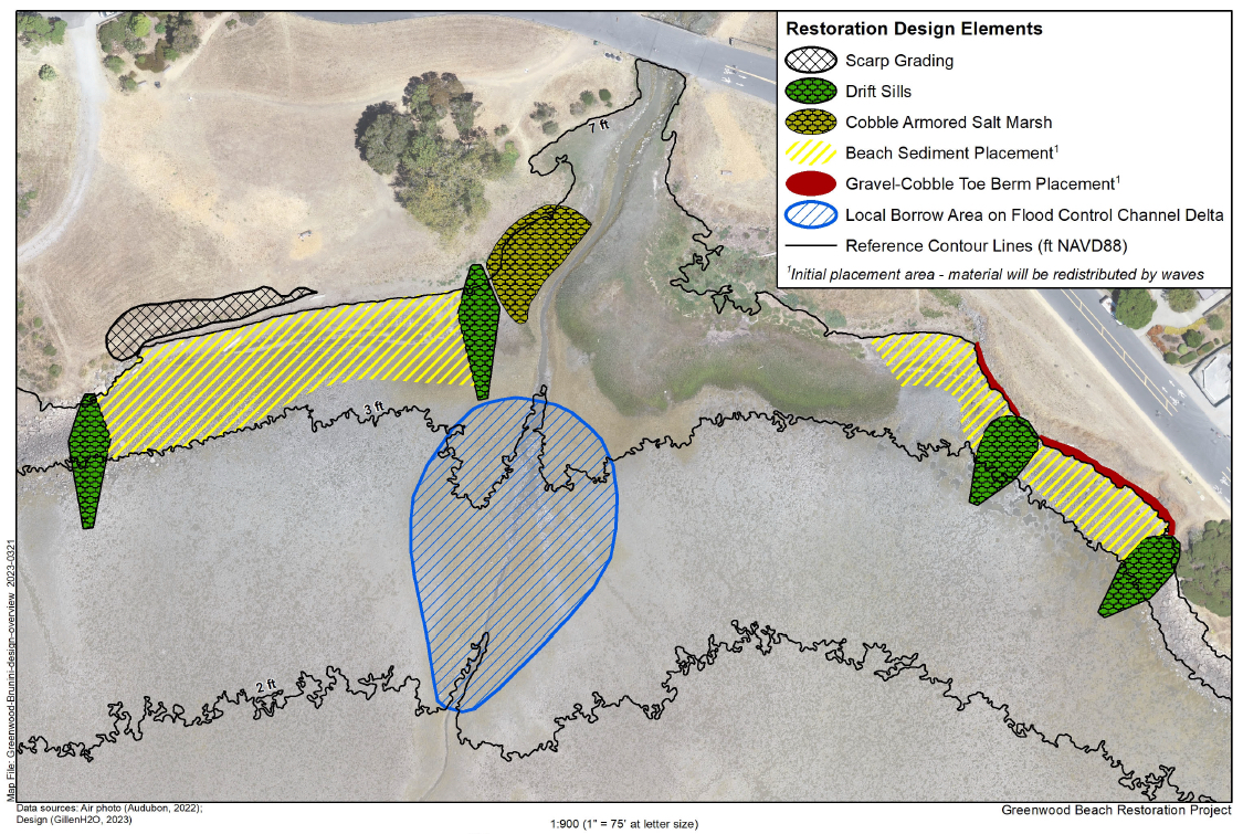
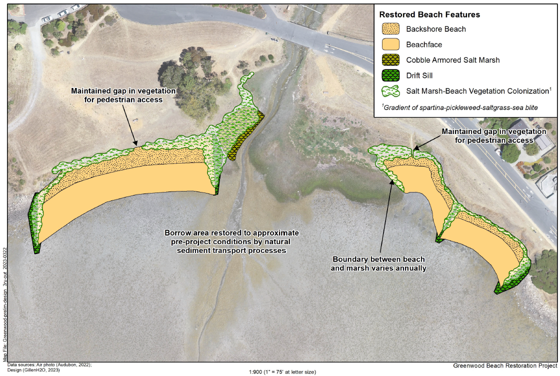
For those who live in Tiburon, a favorite haunt is a waterfront called Blackie’s Pasture and two adjacent beaches, Greenwood and Brunini. When erosion and change are so visible to people living next to the waterfront, they are sure to get more attention as plans to protect or restore them move forward. The Greenwood/Brunini Beach project, now 60% done in terms of design, addresses erosion, marsh degradation, beach loss, and sea level rise in a public bayside park. The park includes a beach and marsh complex at the mouth of a flood control channel; the main beach has eroded so much that locals can see the underlying concrete rubble and asphalt from old bay fill when they walk their dogs by the water.
“In the last decade, many beaches and baylands seem to have lost a lot of their local sediment supply,” says Leventhal, who has seen both Greenwood and the nearby Sears Point restoration project erode dramatically. Leventhal tested this hypothesis by dyeing sand particles and tracking their movements at the project site. “Greenwood was so stripped of its sand, it was starting to be more rubble than beach.”
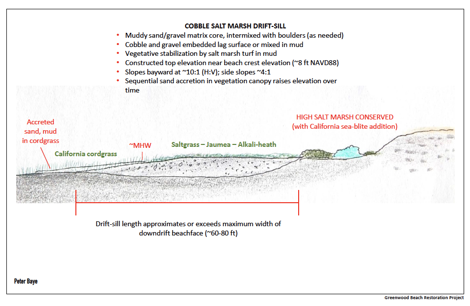
As designed, the Tiburon project includes multiple components: beaches with both sandy fronts and backshore heights, taking the brunt of bay waves and erosion for tiny strips of tidal marshes around their inner edges and the flood control channel. At four protruding points, “drift sills,” another term for a kind of “downscaled groin,” says Leventhal, will guide and collect the much-needed beach sediment. Groins are generally made of rock, but these drift-sills are made of salt marsh vegetation above a cobble layer that acts as under-armor.
“It’s not so much protecting marsh as an endgame, but protecting a shoreline that has some marsh, some beach, some beloved public park,” says SF State’s Boyer.
In terms of using the latest ideas for adding coarse material to the shoreline protection palette, the idea Boyer, Leventhal, Baye and others have come up with for Greenwood is to strategically place a mound of coarse gravel near the eroding edge of the marsh, and allow winds and waves to do the work of building a new berm.
“It’s gentle engineering, working with natural processes,” she says. “We’re placing material nearshore in a band, and guiding it up onto the shore by using wood groins, perpendicular to the shore. The waves do the heavy lifting.” (Groins are often built from wood and other materials culled from landscaping.)

Barbara Salzman from Marin Audubon meets project partners at Tiscornia Marsh in San Rafael, where Audubon and others are working to save a degraded marsh. Photo: SCC
North of Tiburon in San Rafael, another project at the heart of an urban community is considering a similarly complex project combining various forms of shoreline protection such as beaches. Unlike Tiburon, the community surrounding Tiscornia Marsh, as the project site is known, is underserved; they are much more likely to use the site for recreation and open space than to own a house on the water. But like Tiburon, erosion is eating away at a popular waterfront and remnant marsh, and threatening nearby residents.
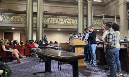
“The levee behind our project site is one of the lowest, weakest parts of the chain for San Rafael,” says project manager Dane Behrens of ESA. Fixing that is urgent, he says, because in a 100-year storm the area that would flood first is the Canal District where so many workers, families, and low-income renters live. A ten-year effort to involve this largely Latinx community in shoreline protection decisions continues, while the planning and design side of the Tiscornia Marsh project is now nearing 100% completion. Putting together several parcels, one a diked marsh and another a degraded marsh owned by the Marin Audubon Society, not to mention a stretch of Bay Trail and a PG&E tower, the project would restore marsh, add flood protection, and improve public access.

Plans for Tiscornia Marsh would reconstruct four acres of eroded tidal marsh, preserve eight remaining acres of marsh, and restore five acres of diked marsh by reconnecting it to the tides. In addition, the project would construct a new 600-foot setback levee and improve 1,100 feet of shoreline levee. Source: ESA.
On the bay side, where the most erosion is occurring, the design includes a 1,000-foot-long gravel beach with retention groins to hold the material in place. The material size chosen, according to Behrens, is in the “Goldilocks zone” tested at Aramburu Island and Heron’s Head: light enough to be pushed upward by the largest waves, but too heavy to be washed away offshore. Along the inland edge between the restored marsh and San Rafael residences, businesses and roads the design calls for 600-feet of raised levee with transition-zone slope on one side, another landscape feature in the region’s new toolbox of flood protection measures.
Behrens sees Tiscornia as different from other similar projects around the bayshore because it pilots so many adaptive measures on one tiny patch of waterfront. “We’re actually rebuilding the eroding marsh and placing a beach in front of it,” he says. He also mentions all the “iterations” of levee alignment that the team went through with the City of San Rafael to achieve the best possible results for all. “Tiscornia is a small but mighty demonstration of techniques we may be able to use elsewhere around the Bay, where preparing for sea level rise isn’t always going to be as easy as building setback levee on some unused parcel of bayfront.”
A Plant That Holds Fast and Clambers

Another hidden warrior in the battle to secure our shores is a succulent pale green plant called California seablite. Adaptation engineers are adding seablite to the dune tops and high beaches in their projects to secure the material and offer high tide refugia to marsh mice and Ridgway’s rails. The species is a drought resistant, highly salt tolerant perennial shrub.
“I noticed early on that there were ecosystem engineering properties to Suadea applicable to the recovery of other species,” says Peter Baye, who helped facilitate the plant’s return from the local extinction in 1960. At the time, Baye saw the potential for the endangered plant to help save equally endangered marsh mice and rails, by providing refuge in its branches from high tides. “Suaeda loves to clamber. In Morro Bay, I saw it climbing up bluffs and over fallen trees,” he says. At Heron’s Head Park in San Francisco, that clambering over arbors will be key in sustaining a newly rebuilt and fortified tidal wetland.
Heron’s Head is a small peninsula near Hunter’s Point, where the Port of San Francisco undertook a tidal marsh restoration in 1999. Since then, waves crossing the Bay all the way from Hayward have steadily carved away at this small peninsula of tidal habitat and public park. For Carol Bach, a port scientist who oversaw the original restoration, the erosion was hard to miss: steep escarpments developed along the shore; the size of the marsh shrank; a tidal pool favored by shorebirds breached and became an embayment.
Bach asked ESA and other experts to help the Port figure out how to protect the shore for at least 30 more years. “We couldn’t go with a green-only, vegetation-only shoreline resilience solution because the erosive forces at the site were too strong. So we came up with the idea of a vegetated beach protecting interior wetlands,” she says.
Suaeda thriving at Heron’s Head in 2022. Photo: Kathy Boyer.
The result, constructed this past winter, is actually two beaches: one out at the farthest end of the peninsula where the waves roll in; and one inland. The first beach is a “feeder” for the second, offering a long-term supply of coarse gravel where no local natural supply is available to maintain the beach. Other key features built into this eroding landscape encourage the sand and gravel to stay in place: two groins, three headlands perpendicular to the shore, and seablite planted in and around the marshes and beaches.
Even before the project was built, Heron’s Head had one of the largest and heathiest populations of seablite in the region, says SF State’s Katharyn Boyer. This was the result of very recent efforts to experimentally determine where the plant can best thrive at the site while waiting for the new beach work to be complete. Experimental plantings of Suaeda in 2021 and 2022, by both SFSU wetland ecology students and local youth from Literacy for Environmental Justice, succeeded especially in well drained soils. “We expect the newly completed coarse-sediment addition along the south shore will provide similarly favorable habitat for Suaeda,” says Boyer.
The entire Heron’s Head shoreline protection project was completed in record time (four months) before Christmas 2022. One can only imagine how the project managers must have been on tenterhooks throughout the sopping weeks of atmospheric river storms this January and February. “It really held up well in the extreme weather,” says Bach.
A post-construction monitoring report yields a few interesting insights for those trying to save old projects for the brave new future of higher water, faster rainfall, and stormy weather.
An evaluation after the punishing storms of December and January found that the coarse gravel beach got steeper, but didn’t migrate into the marsh. The drift sills and groins worked as designed, functioning as baffles to reduce the rate of gravel migration laterally across the beach. The pond sills are holding tidal water at low tide, and the tidal channel is working as it should to provide desired circulation to the tidal marsh.
“I see Heron’s Head as part of an important regional movement toward shape-shifting but stable shorelines,” says Bach.
Nature-Based at Giant Marsh
 as dark dashed lines, and then post winter storms (Feb 2023) as lines of xxx. Storm waves clearly pushed the gravel up the beach slope, building up the crest of the beach by about one foot. Source: ESA.")
Cross sections of three Heron’s Head beach locations surveyed, before and after storms, show how waves moved gravel up the beach and over the crown. Source: ESA
If there is one project that is the poster child for experimenting with the full scope of potential “nature-based” shoreline adaptation strategies it’s the Giant Marsh Living Shoreline near Point Pinole in Contra Costa County. Though no coarse gravel beaches have been built here, an expansive natural beach on the site offers some clues as to how recent habitat improvements to the shore zone — oyster reefs, eelgrass beds, Pacific cordgrass plantings, rockweed plugs, suaeda patches — might interact with the local lay of the land.
Most interesting, right now, is that after four years in the water the state of all these habitat improvements is being surveyed to assess success. Earlier monitoring results were pretty promising. A new monitoring report at the four-year mark is forthcoming.

A drone overflight of the nearshore oyster reefs in January 2023. Source: ESA.
In terms of erosion protection, however, project planners designed one particular oyster reef near shore to see if it could slow waves, help build mudflat, and protect the coastline. Early results from wave data are still being analyzed. But starting this fall, ESA’s Damien Kunz will be reviewing and comparing all his pre- and post-project data and imagery, looking especially at shoreline migration both within and without the nearshore reef wave shadow zone of influence. He also plans to conduct an elevation survey of the surrounding mudflat to evaluate the sediment trapping potential of the nearshore reef. “If it is in fact trapping sediment in its lee, the resulting elevated mudflats could help reduce wave energy as they approach the shoreline,” he says.

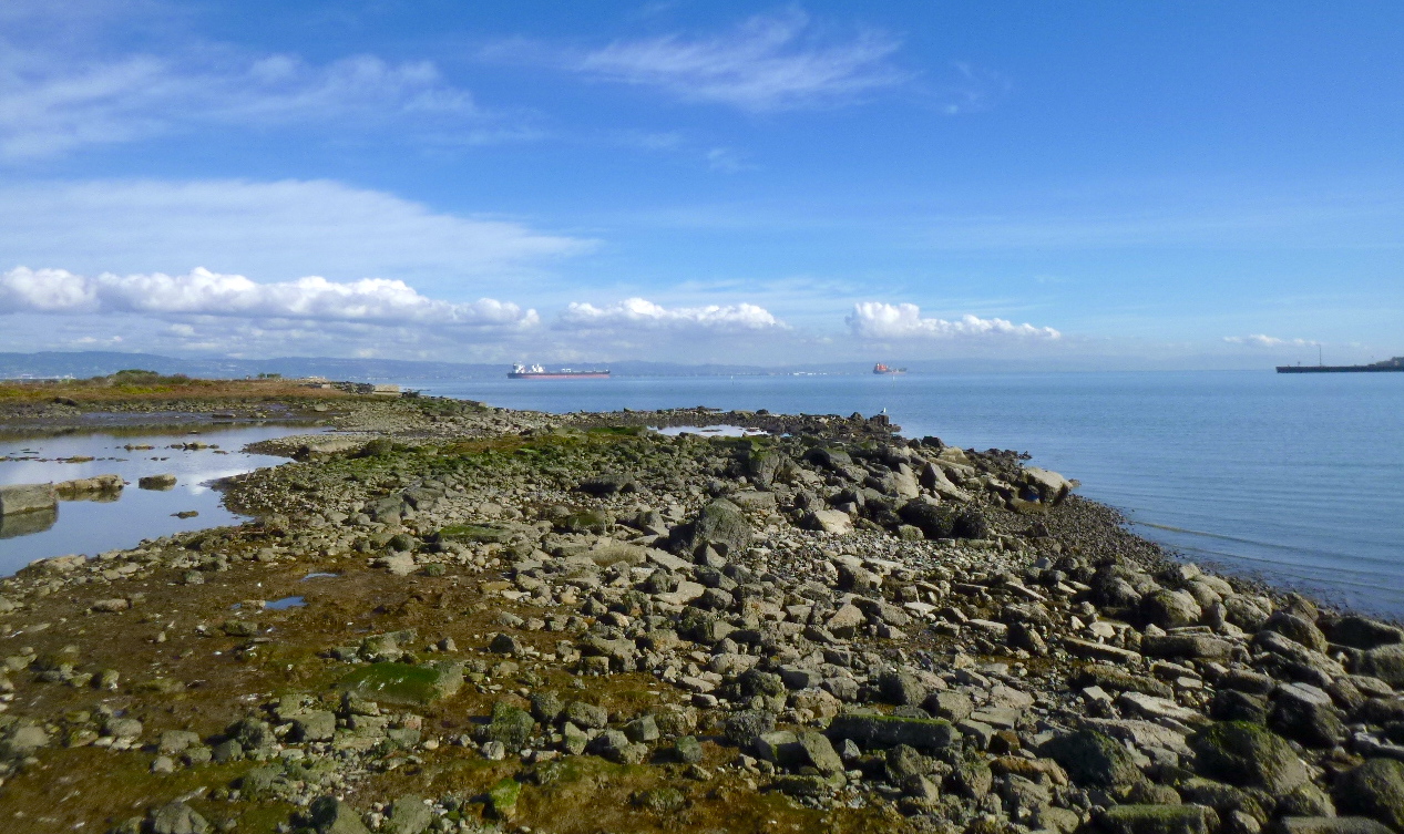
Meanwhile, the oysters do seem to be thriving by the millions, and not just colonizing the new human-built reefs but also Point Pinole’s natural substrates. “It’s one of the reason’s we chose this site for our living shorelines experiment, the natural population of oysters on the north Richmond shoreline, and it’s great to see oysters interspersed over the cobble beach,” says Giant Marsh project manager Marilyn Latta. “These beaches occur naturally at many bay locations and the restoration of cobble beaches are an increasing focus of living shorelines designs.”
In terms of the planting palette, the Giant Marsh project is interesting because it includes plants on the full spectrum of tidal and subtidal elevations, from rockweed and eelgrass plantings around the oyster reefs to native cordgrass replants in the tidal marsh to upland slope plantings including Suaeda.
At Giant Marsh, workers planted seablite at the marsh scarp edge to provide something birds and mice could climb up on during a high tide, and to see if the seablite could help stabilize the shoreline. Although high wave energy led to losses of plants in some areas, those protected by marsh in front have persisted and some have even reached a maximum volume as of January 2023 of 6.8 cubic meters, and 80 centimeters in height, according to monitoring results.

Scientist Margot Buchbinder measures Suaeda height at Giant Marsh.
Researchers are finding that adding “arbors” made of small tree branches increased the height and volume of clambering seablite. “Based on everything we’ve learned from our seablite plantings around the Bay, we are now recommending arboring [for every project] to create high tide refuge,” says SFSU’s Katharyn Boyer. But she warns that it can be hard to keep arbors in place, especially in high-traffic areas. “We think people may be removing them for play with dogs or to make fires,” she says.
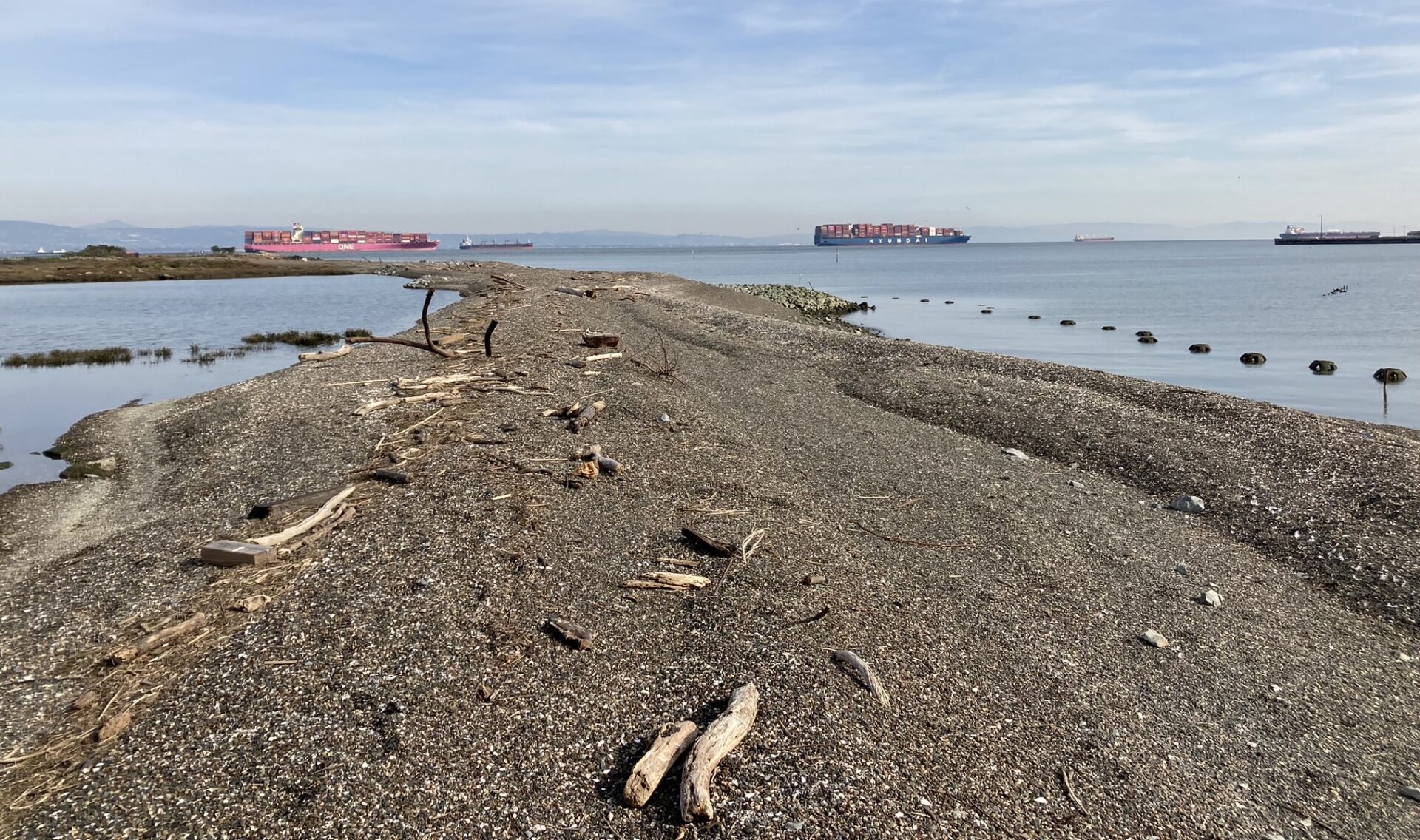
Long Beach Plan Still Misty
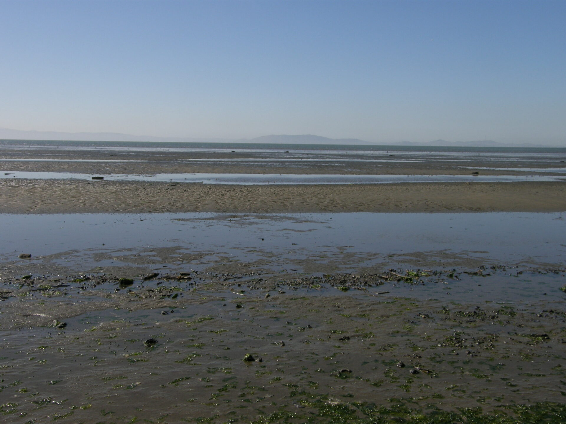
It took two hours for the drizzle to clear back on the San Leandro shore this past May near Roberts Landing. The breach of the sand spit there is just a symptom of the broader change in sediment budgets around the Bay that both Baye and Leventhal have noted in their work. There just isn’t as much supply in the system to rebuild eroded areas as there once was.
Oysters on beach cobbles at Giant Marsh. Photo: Marilyn Latta.

Photo: Mario Accordino.
One challenge for the tactical-technical team surveying Long Beach is whether to take a micro- or a macro- view of the erosion challenge to be addressed.
“As a team we’re still in a little tussle over whether this should be a small, very local fix or a larger-scale project that examines sub-regional problems with sediment supply, habitat loss, and public access,” says Baye. It could still go either way…
Baye points out that unlike the Marin projects right on small-town waterfronts, or Heron’s Head in the heart of San Francisco’s Bayview, people don’t live around Long Beach or even come here much to recreate. Nobody is in immediate danger if the area breaches or floods more. All of which leaves the door open to think about sediment supply and other landscape scale challenges on a bigger scale, he says.
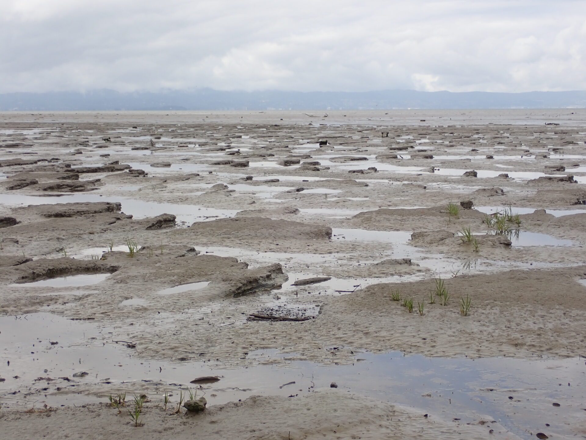
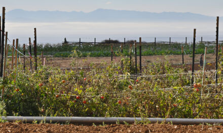
The landscape here, where farmers once delivered floating scows full of fruits and vegetables at Roberts Landing, is visibly going through some “pretty large-scale changes,” says Baye. For one, mudflats are no longer collecting sediment but letting it slip away. And the remnant sandspit at Long Beach is sure to erode more, just as beaches have done since time immemorial. This beach is aligned with longshore drift, no longer connected to intertidal sand flats, and facing more erosion due to sea level rise.

Long Beach shoreline exposed by erosion. Outcrops of naturally deposited, horizontally-bedded marsh muds with root horizons, formerly buried by barrier beach. Photo: Peter Baye
“If we’re willing to be flexible, about changes in the habitats, as the system rolls landward, and as it moves downdrift, we could see this kaleidoscope of shoreline habitats — beach, overwash, marsh pool — rearrange themselves, rather than collapse from erosion and the sediment deficit. So I am hoping we’ll look at this from a sediment management perspective, and give a fair shake to self-organizing habitats and process based restoration, alongside of what we are all trained to do, which is to engineer, build, and deliver, monitor, and maintain constructed projects,” he says.
While the mists clear in the minds of the technical team grappling with an appropriate future for this chunk of the San Leandro bayshore, Baye has started wondering about placing sand or coarse material somewhere further north, and letting the longshore drift carry it down to the area.
Different approaches range from addressing the sand budget and transport pathway corridors updrift to local shoreline treatment by artificial beach construction and nourishment between fast-eroding tidal flats and marsh edges, he says.
“This project could be a good test of the spectrum between process-based restoration and managed retreat at one end, and more engineered bay beach and drift-sill construction like Aramburu, Heron’s Head, and Greenwood Beach at the other. The site context is definitely different at Roberts Landing; no infrastructure or park access to protect,” says Baye.

Heron’s Head project post construction of gravel trapping groins and two beaches. Photo: ESA.
Waves of the Future
Ever since the Coastal Conservancy’s Marilyn Latta realized how much time and energy it took her team to execute Giant Marsh, from idea to design to permit to construction and monitoring, she thought there must be a better, faster way to get these things done.

So this December she brought a resolution to the Conservancy board to allocate $3.5 million to the San Francisco Estuary Institute, Marin and Golden Gate Audubon Societies, Smithsonian Environmental Research Center, San Francisco State University, and additional contractors and grantees to plan and permit ten new living shoreline climate adaptation projects. “Our goal is to work as a coalition to plan and permit ten new projects in a collaborative and programmatic manner to increase efficiency and serve as a model for other projects,” says Latta. The effort will include monitoring existing living shoreline projects, developing regional design and constructability guidance, preparing permit applications, and crafting preliminary site designs for ten locations.
Meanwhile the trudge against time, as San Francisco Bay spreads and swells, continues on all fronts. Many engineers, scientists and planners seem to be doing their best to resist the path of most resistance: hardening the shore. After all, we just restored so much of it (18,000 acres of wetlands added to 40,000 acres of remnant marsh in a decade), and invited the public to walk beside it on miles of new Bay Trail. Shall we hide all this behind seawalls?
Proposed projects to be included in a joint, regional approach to design and permitting. Source: SCC

Erosion around the Bay is on the rise. Scientists working on the 2020 eroding shorelines reports and other adaptation tools collected this data from mapped transects. No change refers to transects falling below the margin of error. Source: EOS
Talking to Leventhal or Baye or Boyer is a bit like opening a fire hose. They are filled with ideas and steeped in years of experience. Every conclusion leads to another question; every discrete piece of the bayscape leads to another piece. They know the Bay, and how it works, from lived experience. They are impatient to get things done but also immensely careful with their actions.
“We want to design with nature, and create self-organizing systems that move with wave energy, and only maybe every ten years or so we have to add sediment,” says Leventhal. “If you can knock down the wave energy, it’s a win-win both for both shoreline habitats and the hard infrastructure behind them. Anytime you can work with the landscape, rather than fight it, there’s a benefit.”
Jeremy Lowe, a San Francisco Estuary Institute geomorphologist also on the tech team, points out that knocking down wave energy will be key in preventing what he calls “lateral erosion” in the future. Lateral erosion at the marsh’s edge, where waves eat away and undercut the marsh face, is a problem for all four projects covered in this story.
“As sea levels rise, water depth over the mudflats gets deeper, larger waves will reach the shoreline, and lateral erosion will increase,” says Lowe. “Deploying natural and nature-based features such as oyster reefs, beaches, ecotone levees, and large woody debris to reduce the wave energy reaching the shore and the erosion of the marsh edge can all help, but no single feature on its own is a silver bullet. Several features must work together to maintain a shore.” And therein lies the rub.

Remembering the late Janice Delfino of Ohlone Audubon, a leading environmental advocate and naturalist for Roberts Landing and the Hayward Shoreline. Delfino helped the region understand the importance of the area, and current efforts to restore the shore are in many ways her legacy, says Peter Baye.