


Mountain View’s Shoreline Gets Serious SLR Attention
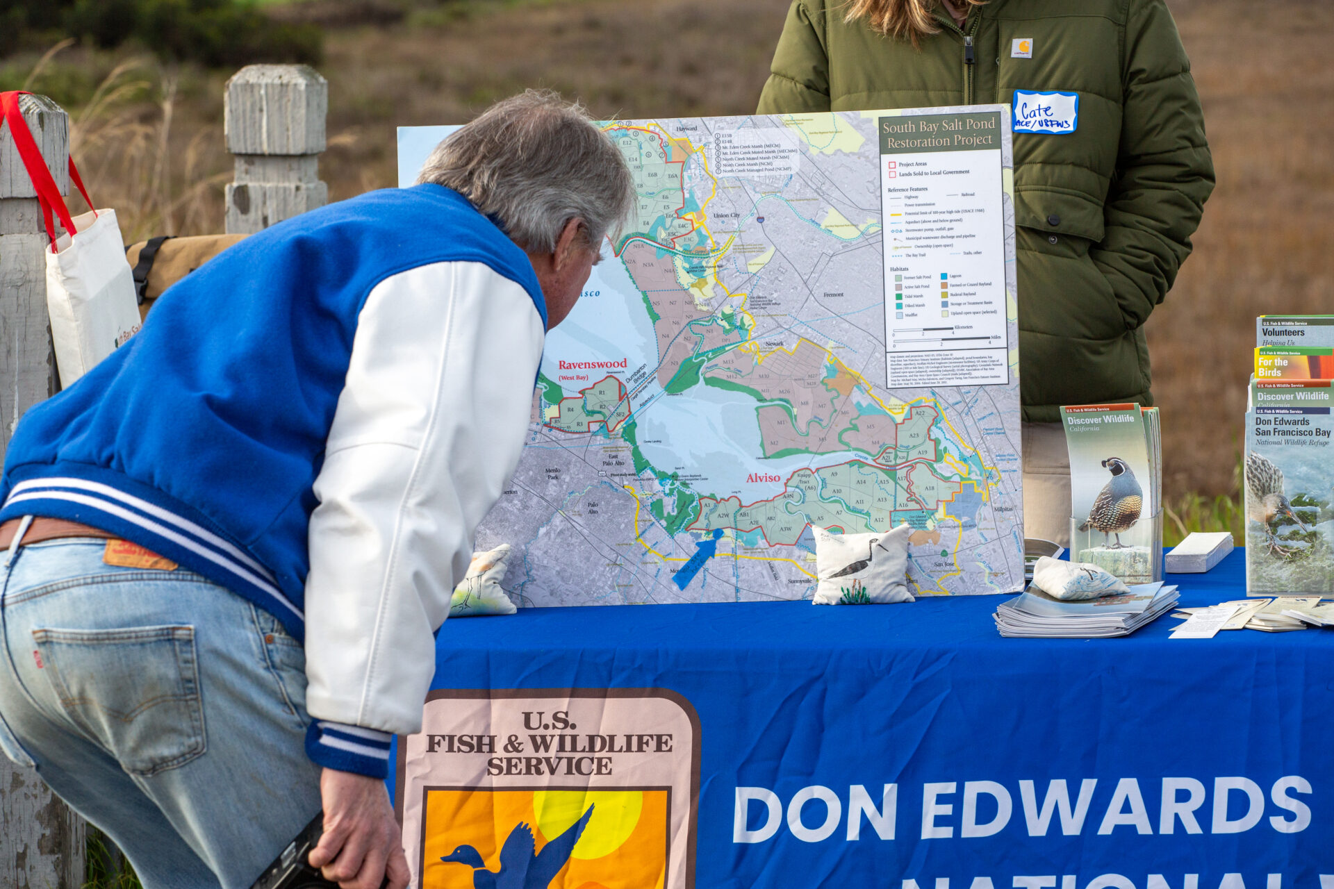
Photo: Charles Anderson, Epicycle Media
The first question any local asks when they hear about a shoreline construction project is always the same, no matter which corner of the Bay Area they hail from: “How long will the trail be closed?”
Almost everyone who enjoys the outdoors is familiar with a specific stretch of the 350-mile-long Bay Trail, whether to jog, walk the dog, or commute to work at the tech campuses of Google, Microsoft, and Intuit on the Mountain View shoreline, for example. Which is why the closure of a portion of the Bay Trail for seven months to raise its elevation and buffer the surrounding properties from sea level rise was one of the biggest challenges for a $20 million project completed this February (detours were provided through Shoreline Park).
“If you walk on that levee trail today, you’d never know there’s a flood protection project out there,” says Raymond Wong, a City of Mountain View engineer who collaborated on the project. “Instead of a typical sea wall, the entire thing is buried and converted back to nature on the surface.”
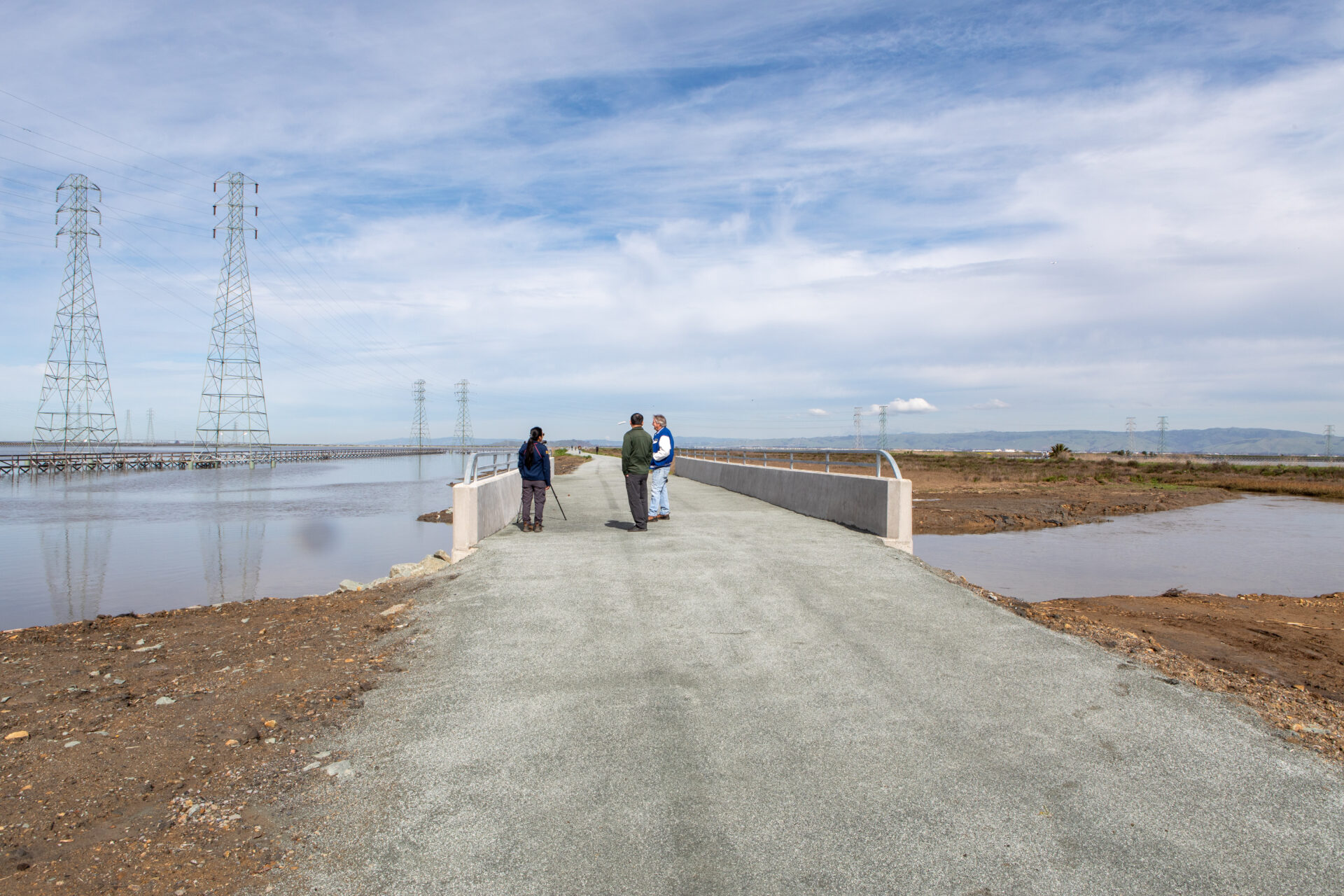
A new bridge and more Bay Trail access across a stormwater channel. Photo: Charles Anderson, Epicycle Media
Other Recent Posts
New Study Shows Rain Gardens Filter Chemicals Out of Stormwater
Scientists found rain gardens dramatically reduce toxic chemicals in stormwater while providing biodiversity and cooling.
The Tricky Art of Growing Oysters in the Lab So They Can Survive in the Field
The Nature Conservancy, the Amah Mutsun Tribal Band, and others are growing oysters in the lab and planting them in the wild in estuaries around San Francisco Bay.
Printing Without Plastic: The Vintage Machine Winning Over Eco-Conscious Artists
This comic guide to risograph printing explains how the 1980s Japanese machine cuts energy use and avoids plastic toner.
East Bay Kids Fight Extreme Heat in their Schoolyards
Many California schools are ill-equipped to tackle heat, with many campuses lacking sufficient tree coverage. These students are fighting to change that.
How a North Bay Regional Park Helped Me Reconnect With Nature — and Myself
A young Fairfield resident reflects on how hiking during the pandemic became a refuge from digital overload and the growing realities of climate change.
Wild Pigs Rough Up Bay Area Greens
They tear up landscapes in search of food, prey on native wildlife, and damage streams, and warming could bring them closer to urban areas.
Residents Chose Different Ways to Respond to Contra Costa Flood Challenges
Graduates of a shoreline leadership program in Contra Costa County recently pitched their ideas for sea level rise education and adaptation.
The second most frequent question from the public is “How long do I have to put up with the traffic?”
The answer is often nebulous. But it took three years to truck in and stockpile enough clean fill — 180,000 cubic yards — to complete all the pieces of the Pond A2W Tidal Marsh Restoration Project. Getting the material, sourced mainly from a Sunnyvale redevelopment project, across the closed and capped city landfill underneath Shoreline Park and past the Googleplex to the restoration site wasn’t easy, but the pandemic, when nobody left home to go to work anyway, helped.
With these mountains of dirt, project partners not only raised and extended the local section of Bay Trail, but also restored tidal action to a 435-acre former salt-making pond, repaired surrounding levees and stormwater drainage systems, built bird islands, and created a habitat transition zone resilient to the rising Bay. The project also added bridges, protected PG&E access to local infrastructure, and connected waterways to Stevens Creek, a steelhead stream, creating a true “multi-benefit” project.
“All of these individual pieces are impressive and important,” says David Halsing, manager of the 15,100-acre South Bay Salt Pond Restoration Project, of which Pond A2W is a part. “But what really matters is the cumulative effect of doing more of them, right? That’s when they have a synergistic effect on habitat values and project costs.”
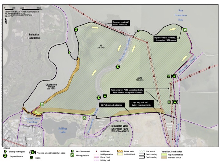
The Pond A2W restoration project area including many additions that made it a multi-benefit project. Original Art: Aecom
Completion of this latest project was grounds for a celebratory ceremony on February 20. “This is the fourth or fifth biggest pond in the whole project, so that’s a big step,” says Halsing.
Breaching an aging levee to reintroduce tidal action to an old salt pond is one thing — coordinating that with flood protection and public access needs of multiple surrounding properties owned by other jurisdictions is another.
“Watersheds don’t follow geopolitical boundaries, and you can be sure water will always cross those boundaries,” says Wong, explaining one of the reasons why the City of Mountain View collaborated on the project. In truth, the city has had a dozen such projects on its list of planned sea level rise adaptation and capital improvements since 2012.
“Some we need right now, some we don’t need till years down the road, but we also have to be ready for sea level rise projections that keep changing,” adds Wong.
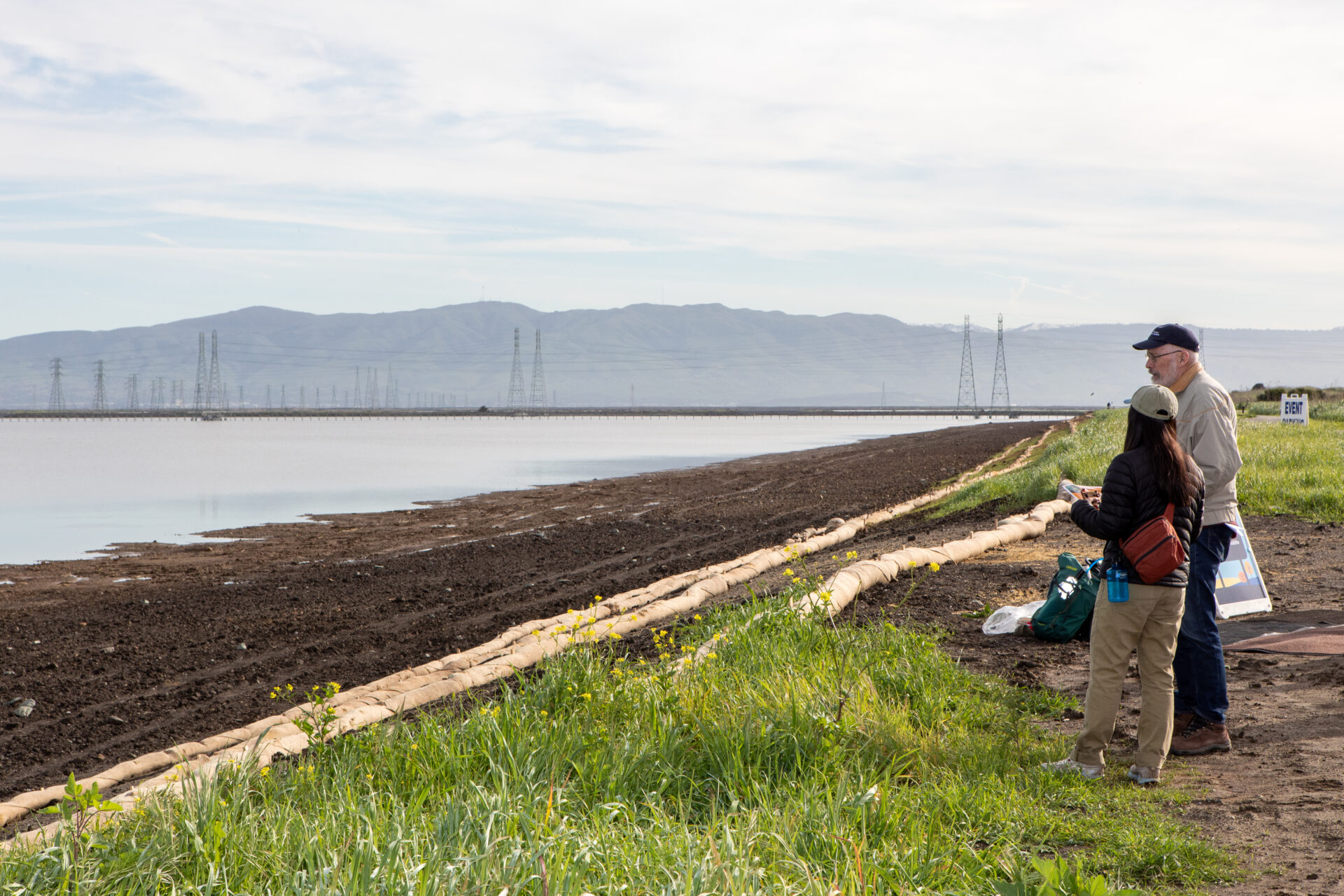
Pond 2W. Photo: Charles Anderson, Epicycle Media
“Almost everything north of Highway 101 is vulnerable,” says Lisa Au, assistant public works director for Mountain View. This North bayshore barea of town is mostly zoned for offices and occupied by tech giants. It’s also part of a special district in terms of assessing property taxes, which perhaps explains how Mountain View could cost-share some expensive reinforcements to the levee protecting its landfill and Shoreline Park as part of the Pond A2W project.
So instead of just building a 16-acre transition zone behind Pond A2W (designed to offer both high tide refuge for marsh life and a ramp for marsh migration upslope as sea level rises), the project extended its reach inland.
“Upslope of our habitat transition zone, we imported riprap, placed it against the landfill’s containment levee, then buried and hydroseeded it, a kind of gray-green solution,” says Halsing.
That extra effort, and the 15 years it took to mesh this part of the restoration project with other erosion and flood control projects that the City of Mountain View’s 2012 sea level rise adaptation plan called for, was worth it in Halsing’s view. Otherwise, he says, the city might have had to come back through the restoration site to do a whole different flood protection project later: “That could have messed up our completed work.”
What also helped keep the project from stalling out, he says, were Mountain View City Council members like Pat Showalter who pushed for forward progress. “Lots of government agencies at every level are understaffed and don’t have time to address huge and complicated projects creatively. That’s a legit constraint,” he says. Which is also why he participates in a Save The Bay working group to engage and educate local officials about adaptation needs.
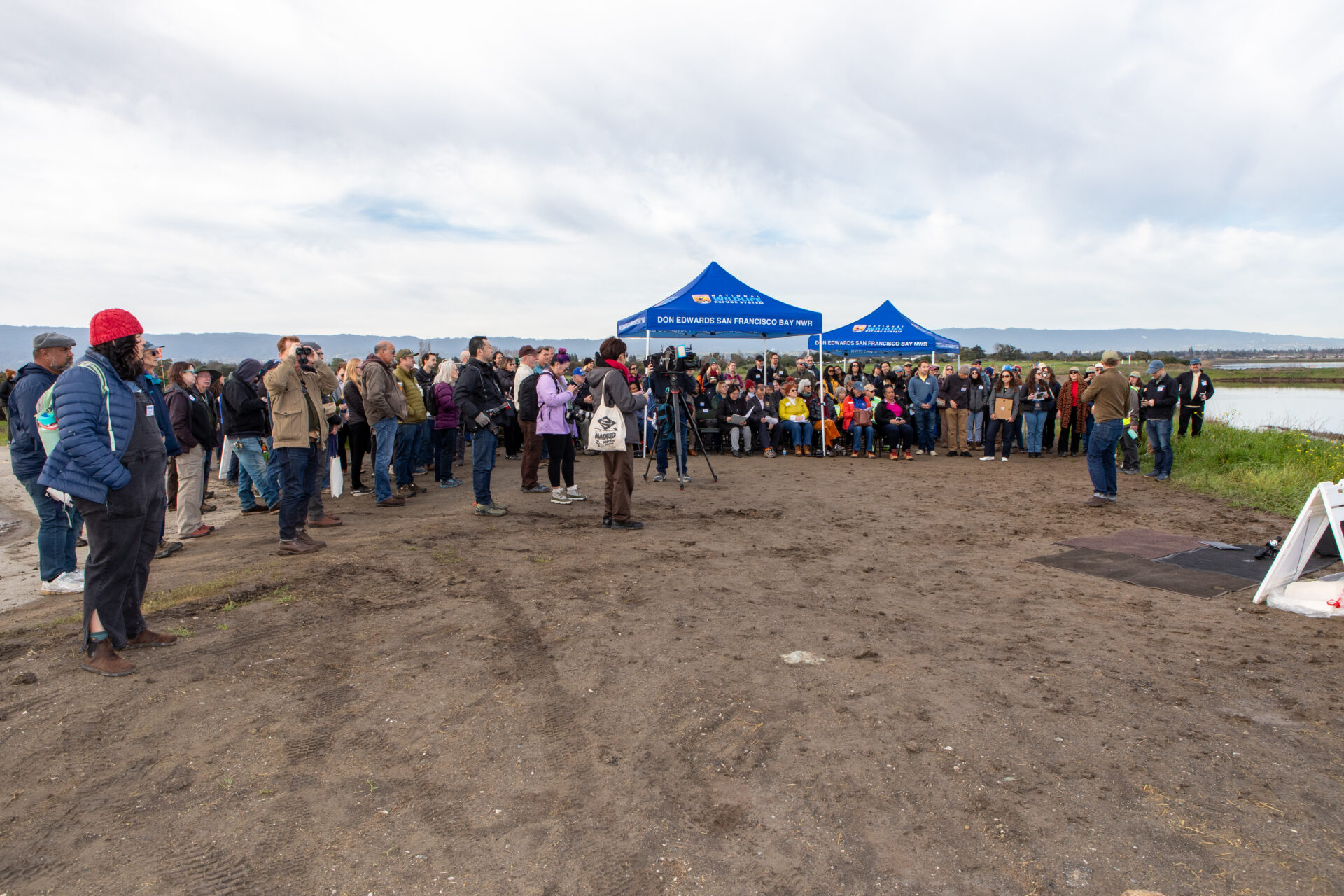
The opening celebration on February 20, 2026. Photo: Charles Anderson, Epicycle Media
Overall, the 435-acre project was paid for by at least seven different federal, state, and local grants and the SF Bay Restoration Authority. Ducks Unlimited managed construction, which was undertaken by Gordon N. Ball, Inc. Come fall, Save The Bay will plant the 16-acre transition zone in the middle of it with native, salt-tolerant species. It sometimes takes a village, but almost always seeds and a backhoe. [ADD LINK].
A few months from now, in fact, the backhoe will be out again for an adjacent project to restore 285 acres of Pond A1, adjacent to Charleston Slough. The village, meanwhile, will also be meeting, as all those with jurisdiction over the Santa Clara County shoreline consider how to work together to produce a continuous line of protection against the advancing bay using an SB 1 planning grant.
“In a couple years, it will all line up,” says Wong. “It won’t just be our city’s plans and capital improvement program, it will be a sub-regional, county level plan. We all recognize we can’t do these projects on our own. We have to collaborate.”
