


Tag: Mapping
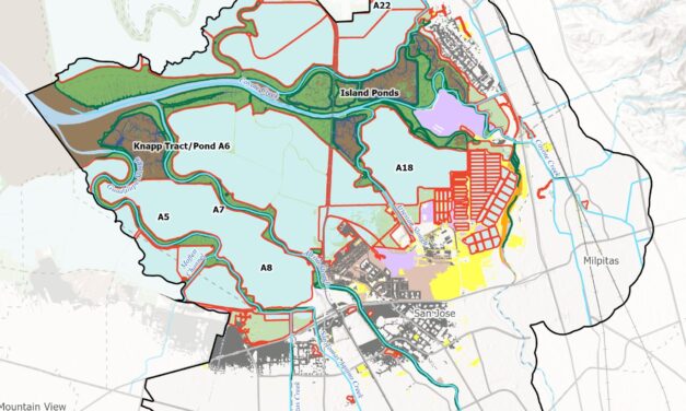
Nailing Down Opportunities for Nature-Based Infrastructure
A new tool from the Estuary Institute gives planners ideas for where best to work with nature around the Bay to protect shores from sea level rise.
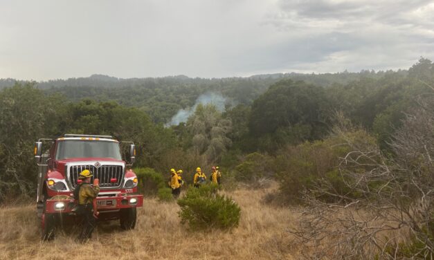
Chasing the Fireline
In California, climate change has has left a collection of wildfire hazard zone maps, published 15 years ago, out of date.
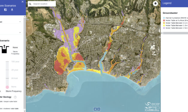
Coastal Mapping Tool Updated to Include Groundwater
In the past decade sea level rise models have popped up faster than fungi after a storm: today it seems like every agency has one. However in August USGS geologist Patrick Barnard and colleagues at Point Blue Conservation Science unveiled a new feature of their Our Coast, Our Future (OCOF) tool that none of the others have: a projection of how sea level rise will impact local groundwater along the California coast.

All Stories
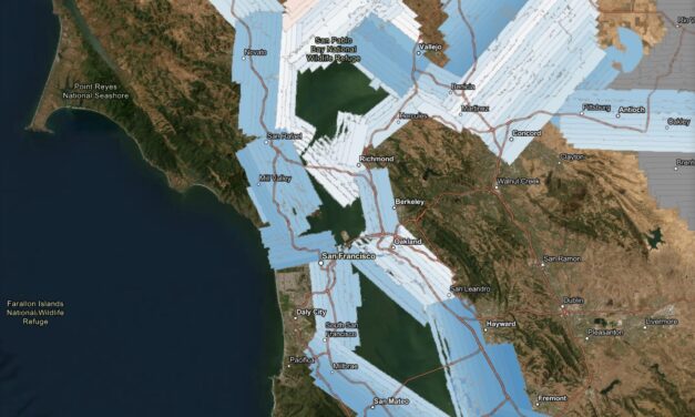
Change Detection Made Easier with New Lidar Survey
A new high-resolution lidar dataset gives planners a powerful tool to track flooding, levees, and wetland changes across the estuary.
Nailing Down Opportunities for Nature-Based Infrastructure
A new tool from the Estuary Institute gives planners ideas for where best to work with nature around the Bay to protect shores from sea level rise.
Chasing the Fireline
In California, climate change has has left a collection of wildfire hazard zone maps, published 15 years ago, out of date.
Coastal Mapping Tool Updated to Include Groundwater
In the past decade sea level rise models have popped up faster than fungi after a storm: today it seems like every agency has one. However in August USGS geologist Patrick Barnard and colleagues at Point Blue Conservation Science unveiled a new feature of their Our Coast, Our Future (OCOF) tool that none of the others have: a projection of how sea level rise will impact local groundwater along the California coast.