covers sea level rise, flooding, and other topics around the San Francisco Bay Area. His stories and essays have been featured in Sierra Magazine, Earth Island Journal, Estuary News, and the Progressive Populist, among other outlets.
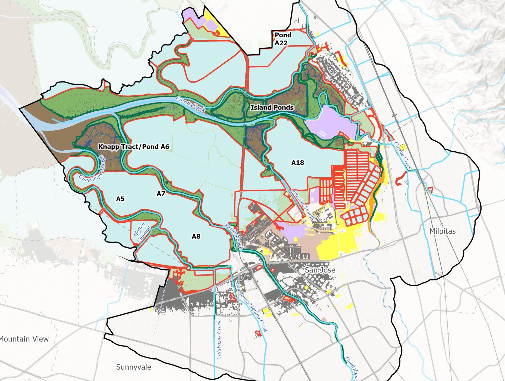
A new tool from the Estuary Institute gives planners ideas for where best to work with nature around the Bay to protect shores from sea level rise.... Read more.
A NOAA grant will fund flood mitigation, wildfire risk reduction, and habitat restoration — and green job creation — across Santa Cruz-Monterey.... Read more.
Musicians, storytellers, photographers, and an aerial dance troupe explore sea level rise in a year-long series of arts events in Alameda.... Read more.
The California Coastal Commission has updated their Sea Level Rise Policy Guidance with new Senate Bill 272 guidelines and more certainty about near-term sea level... Read more.
The futuristic radio play Forever Wave explores a San Francisco remade by 200 feet of sea level rise. The narrative floats in and out of the thoughts of more than... Read more.
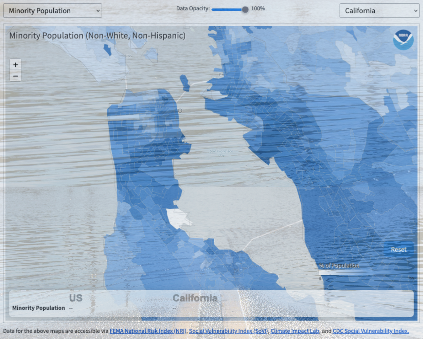
With NOAA's recent update to their Billion Dollar Disaster Map, urban planners and citizens can see for themselves how disaster risk and vulnerability vary at the... Read more.
Worried about heat and how it disproportionately affects certain neighborhoods where you live? This resource gives a step-by-step guidance on how to integrate urban... Read more.
After years of historical injustice, community action and vision, coupled with ballpark redevelopment opportunities, are raising East Oakland's resilience.... Read more.
In the past decade sea level rise models have popped up faster than fungi after a storm: today it seems like every agency has one. However in August USGS geologist... Read more.
On September 3, 2019, Golden State Warriors CEO Rick Welts stood proudly in front of the newly inaugurated $1.4 billion Chase Center basketball arena. “A brand... Read more.