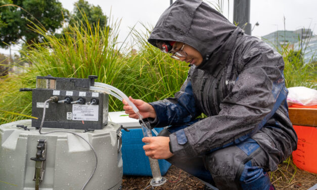
New Study Shows Rain Gardens Filter Chemicals Out of Stormwater
Scientists found rain gardens dramatically reduce toxic chemicals in stormwater while providing biodiversity and cooling.
Read More

City & County Initiatives

Bay Area Regional Initiatives

Resilience Hub
Scientists found rain gardens dramatically reduce toxic chemicals in stormwater while providing biodiversity and cooling.
Read More
Regional leaders say the Bay Area has built ambitious climate resilience plans. Now comes the harder task: funding and implementing them.
Read More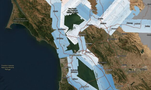
A new high-resolution lidar dataset gives planners a powerful tool to track flooding, levees, and wetland changes across the estuary.
Read More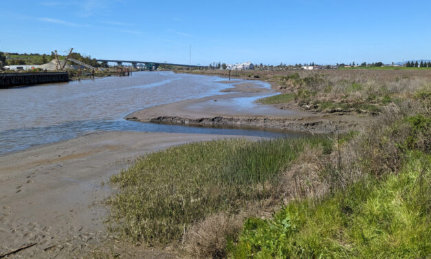
How Adobe Creek and the Petaluma River can help three parcels, including a popular park, evolve into one resilient shore.
Read More
Habitat restoration and pollution regulations are holding the Bay steady, but the Delta is losing some of its ecological diversity, says SF Estuary Partnership scorecard.
Read More
As new research hones in on the importance of sediment transfer, two rivers may hold the key to rescuing beaches and wetlands in Santa Cruz and the Bay Area.
Read More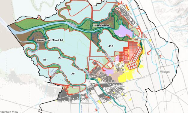
A new tool from the Estuary Institute gives planners ideas for where best to work with nature around the Bay to protect shores from sea level rise.
Read More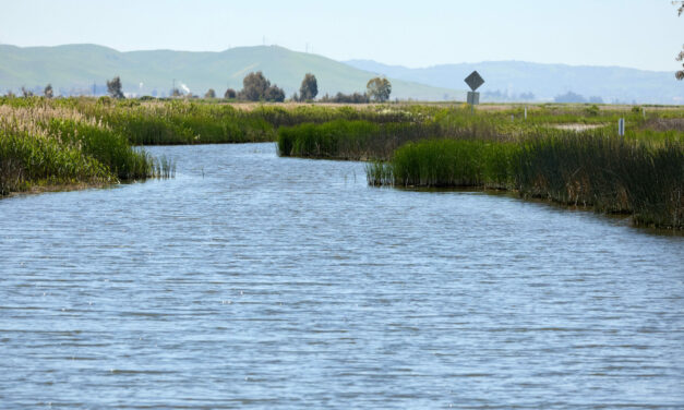
A fresh report from SF Estuary Institute and the prospect of major development along the marsh’s borders are putting Suisun back in the news.
Read More
By standardizing and coordinating data collection, the Wetlands Regional Monitoring Program will supercharge new analyses of restoration projects.
Read More
BCDC’s Regional Shoreline Adaptation Plan lays out four “Minimum Standards” that Bay Area municipalities must meet as they prepare for sea level rise.
Read More
A May 2024 environmental conference covers levees, seawalls, reefs, wetlands, and other climate resilient shoreline designs for the Bay Area.
Read More
The region is obsessing over beach-building. Whether it’s a degraded salt marsh in downtown San Rafael or a sliver of wetlands near the old San Francisco shipyards, local practitioners are adding beaches as nature-based buffers against waves and rising seas to adaptation projects around the Bay.
Read More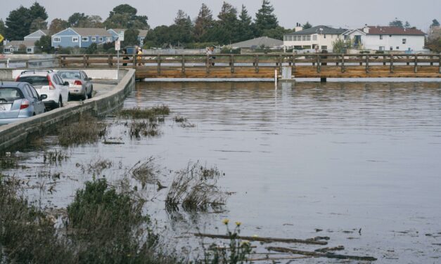
On an overcast June afternoon at Bay Farm Island’s Veterans Court, Danielle Mieler explains that if it weren’t for low tide, water might be at her feet.
Read More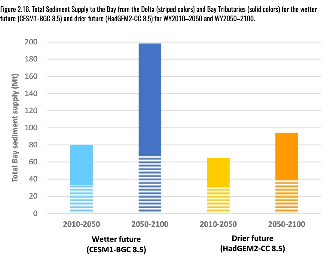
How much mud do we need to save Bay Area marshes from rising seas and how will we move it into position? If the future is drier there’s one answer, and if it’s wetter another (see chart), but the ballpark is 477,000,000 cubic yards. That’s the amount of sediment needed to sustain the ring of wetlands now protecting shoreline communities and infrastructure from a rising Bay, according to a new SF Estuary Institute report.
Read More