


Living Shorelines Test Run Reports Back
Scientists release five years of monitoring data for the Giant Marsh Living Shoreline Project, offering intriguing results and the beginnings of a blueprint for how to build nearshore reefs and transitional habitats in San Francisco Bay.
Biologist Kathy Boyer worries about Corte Madera Marsh. The gradual crumbling of an old levee has left this patch of endangered rail habitat in Marin County more exposed. It’s visibly eroding away to Boyer’s experienced eye. She thinks it might benefit from the installation of some new gray-green infrastructure: some nearshore reefs and coarse gravel beaches, perhaps? She imagines a project that reflects the latest thinking about how humans can help the natural engineers of the region’s shallow water and tidal habitats gain a stronger foot or roothold in the soft, shifting Bay mud while the water level of the Bay continues to rise.
“We can’t just leave it to erode down to nothing, but we’re sure to lose some mudflat and some marsh, even if we put something up against it to provide protection,” says Boyer. “It’s a perfect case in point for the kinds of compromises and tradeoffs we have to think about now.”
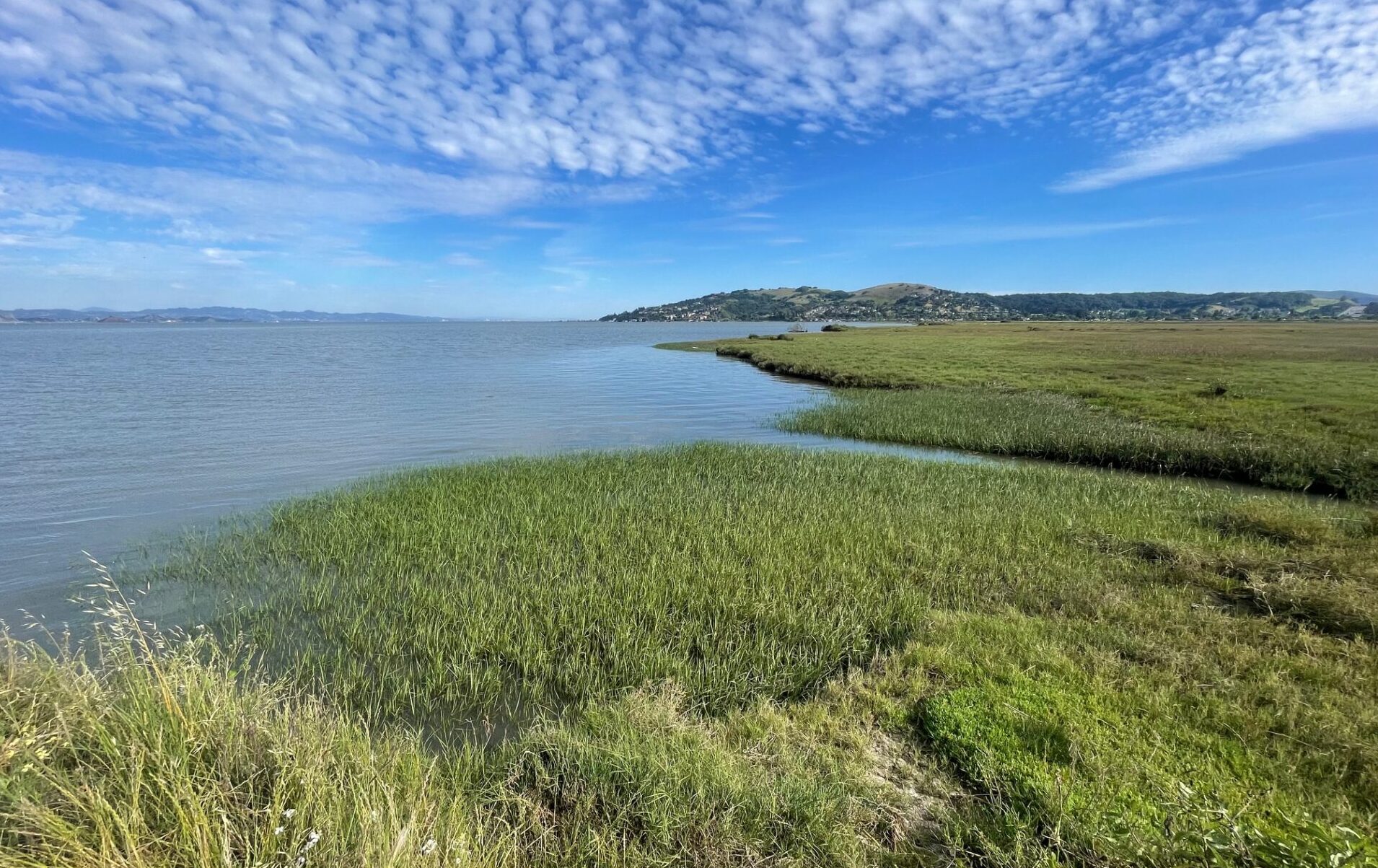
Corte Madera Marsh in Marin County at high tide this April. Photo: Michelle Orr
Boyer and a team of scientists and planners from half a dozen institutions and agencies have been thinking about this for two decades. Their first project involved the 2012 installation of 200 reef structures designed to attract local Olympia oysters near San Rafael. Ten years later, lessons learned from that pilot informed a 2.0 version, 368 acres across the Bay at Point Pinole called the Giant Marsh Living Shorelines project. Five years after installing 10 reefs and planting a variety of adjacent habitats, a project that after its first year attracted a million Olympia oysters, the team has released a much-anticipated monitoring report.
“There are very few examples of fully designed, permitted, constructed projects with robust monitoring data in our region,” says the Coastal Conservancy’s Marilyn Latta, project manager for the agency’s Living Shorelines program. “At this point, we have developed a huge amount of information and designs and actually tested these designs and gathered data on the results.”
In brief, the five-year monitoring report offers both solid outcomes and promising trends. In a water body that fluctuates as much as San Francisco Bay, whether it’s the usual ups and downs of ocean tides or a sudden flush of freshwater from atmospheric river storms, not to mention the occasional heat wave, five years of data is not quite long enough to be certain about every possible outcome. But if the main idea was to attract and grow oysters on human-made reefs, it worked. And if the second idea was to test whether planting eelgrass around the reefs attracted more species and created more biological richness than not, then that worked too, according to the data. It is in the weeds of the 72-page report that we find all the interesting nuances, however, because Giant Marsh wasn’t just any ordinary experiment.
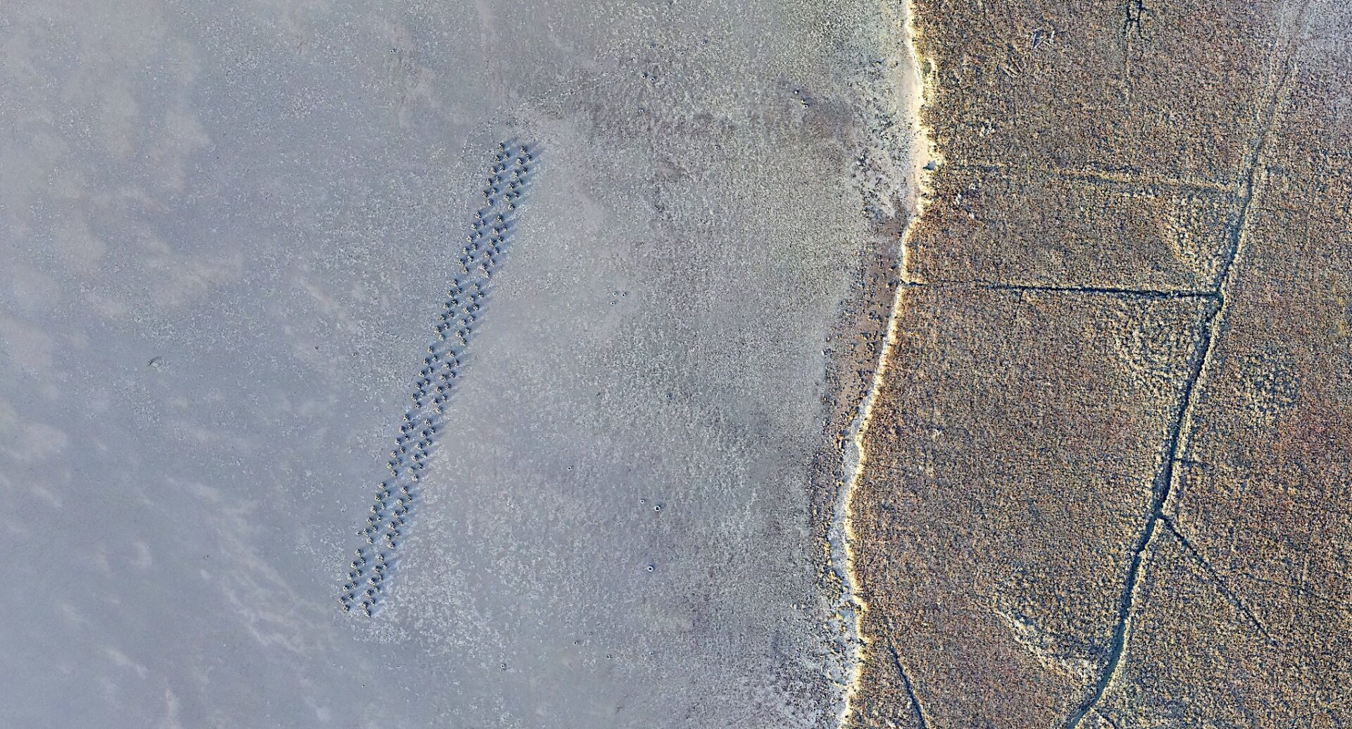
The shores and shallows off Point Pinole where the Giant Marsh experiment is underway. Photo: Ariel R Okamoto
“Part of the advantage of that site was that it was a really large space that allowed us to do a much greater amount of replication, and much larger size treatments, than what we’ve been able to do before,” says Boyer, lead scientist for Giant Marsh and director of the Estuary & Ocean Science Center near Tiburon.
The experiment involved not just oyster reefs in the shallows near the shore, but a full gradient of habitats including tidal marshes, transitional zones, and uplands. And in each of these habitat zones, project partners experimented with a variety of different sizes, shapes, densities, and orientations of both living and human-crafted elements of a healthy and resilient shore.
“We really tried to hit it hard with just about as many things as we could think of to do,” Boyer adds.
That included placing some reefs near the shore and others further out, installing reefs at different elevations in relation to the tides, and adding eelgrass to optimize the ecosystem-building synergy between the shellfish and the seagrass.
“We’ve shown a couple of times now that we get more species when we have the reefs adjacent to the eelgrass. And we now know it’s better to put the eelgrass on the shore side of the reef,” she says. “And we think this might even be a way to have eelgrass in more places in the Bay — places where conditions are too energetic, where there is too much wind and wave action, for eelgrass alone. So that was kind of a slam dunk.”
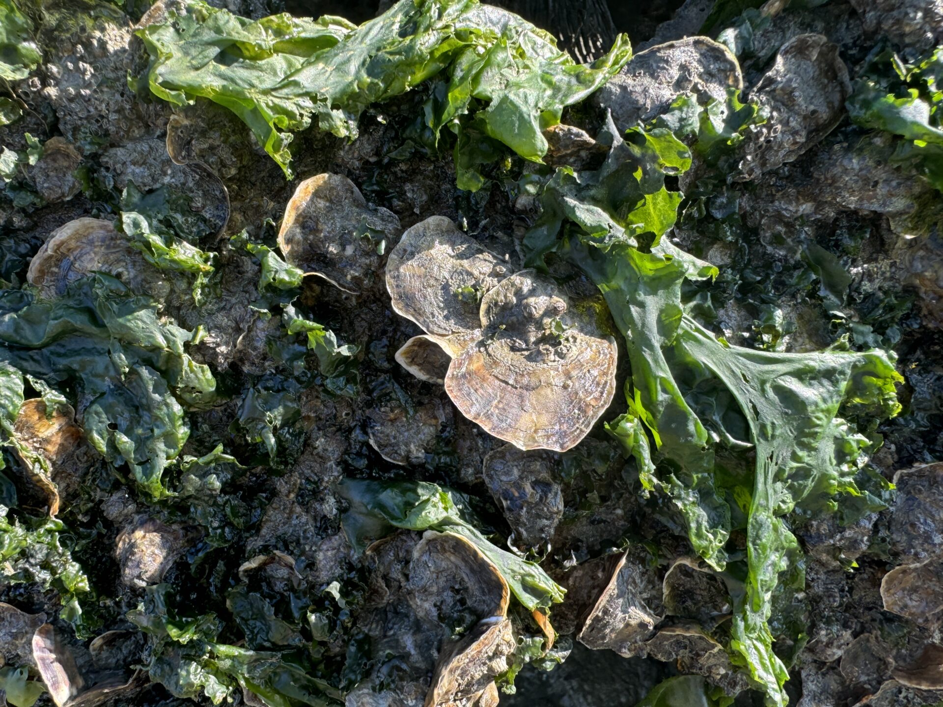
Oysters and fucus, a macroalgae. Photo: Chela Zabin
Meanwhile, the Bay has continued to rise, increasing the urgency of future projects.
“We’ve done five reef demonstration projects in the last 15 years,” says Latta, “but I would love to see five going in every year from now on.”
Finding the Goldilocks Zones
Goldilocks was a little girl who tried three different bowls of porridge before choosing the one that was just right: not too hot or cold or thick or sweet. And that’s what the team that designed, built, and monitored Giant Marsh did too, as KneeDeep has reported in multiple stories.
To recap, in 2019 the team and its contractors laid out seven different “treatments” they thought would contribute to a “living” shoreline across the 368-acre site. These treatments ranged from new nearshore and offshore reefs designed to attract not only oysters, but also ducks, fish, crabs, and other Bay life. They also experimented with bolstering the eroding edge of the adjacent salt marsh, trying out different techniques for planting eelgrass, cordgrass, and a rare but sturdy species called sea-blite, as well as with weeding and replanting transition zones and upland slopes with root-rich (rhizotamous) plants like creeping wild rye, western goldenrod, and Pacific aster.
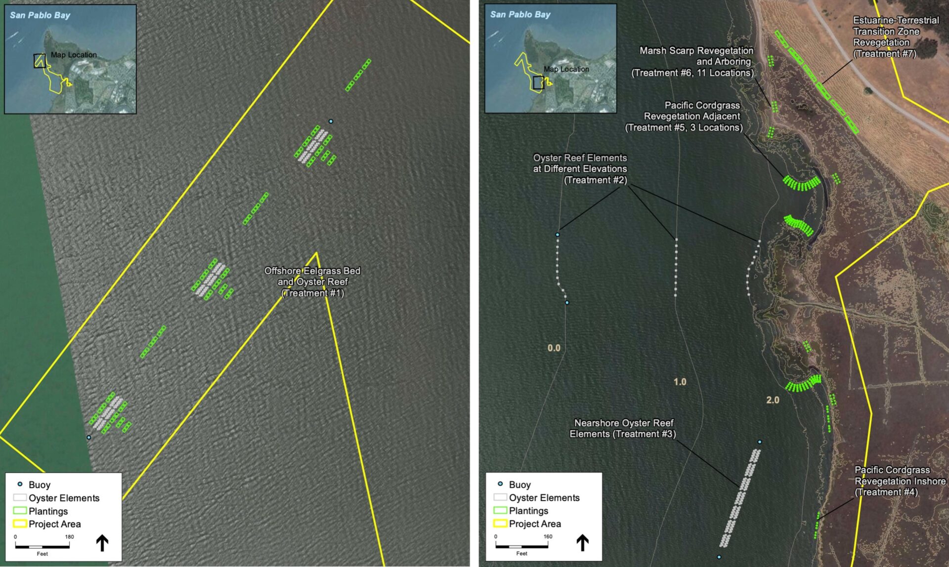
Map of seven different treatments. Map: EOS
The executive summary of the five-year monitoring report offers 22 key findings, with lots of nuances of interest to those planning or designing future living shoreline projects. Put more simply, here are a few takeaways.
For the reefs installed farther offshore, the reef balls topped with oyster shell bags were successful at recruiting abundant native Olympia oysters. The number of oysters rose steadily from 2020 to 2022, reaching ~1.3 million individuals at one point, only to drop down to around 320,000 several years later when conditions changed. Even in years with fewer oysters, the project greatly increased the local population.
Planting eelgrass adjacent to these oyster reefs proved beneficial. Monitoring showed evidence of greater eelgrass abundance on the shore side of oyster reefs.
“The worst outcomes in both patch sizes and total shoots came from low density plantings with no association with reefs,” says Boyer.
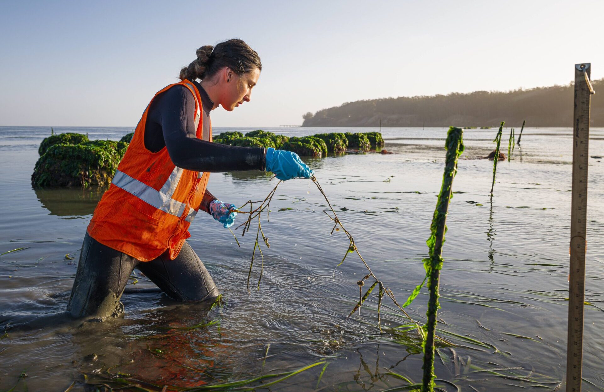
Graduate students do the wet work of measuring eelgrass density several years into the experiment (oyster reefs in background). Photo: Jak Wonderly
In reefs nearer to shore, the highest oyster densities were found on the deepest oyster blocks and on the north sides of the blocks, probably due to less exposure to direct sunlight and high air temperatures during low tides.
In terms of water birds, monitoring showed no overall change in abundance with the offshore reefs with adjacent eelgrass beds over the five years, but the shallower reefs attracted more water birds at low tides (with some variations due to tide height and season).
The team also monitored wave energy in and around some of the reefs. In particular, they hoped to see if placing a reef between a vulnerable tidal marsh and the Bay helped reduce erosion. Monitoring suggests the reef treatment nearest the shore and placed at the highest elevation did the most to soften waves, primarily in the wave “shadow” behind the reef and mainly during mid-to-high tides.
“You need the reef to be really close to shore to protect the marsh, but that higher elevation isn’t so good for oysters, so we had some competing objectives,” says Environmental Science Associates hydrologist Damien Kunz, who conducted the wave research. He says future projects may be able to look for site locations more in the “Goldilocks” zone to meet both objectives.
Kunz’s colleagues at ESA did some wind-wave hindcasting and modeling with wave energy data collected at one reef. The data suggested such reefs might reduce 10% of the total wave energy per year, but Kunz was quick to add that five years isn’t long enough to establish clear geomorphic response patterns resulting from that reduction.
“Geomorphic processes occur over much longer timescales, and shoreline erosion is largely driven by episodic big wave or big wind events, so with five years of data we’re starting to see promising trends, but need more years to confirm them,” says Kunz. While they didn’t see much difference in marsh erosion rates, he adds, they did see deposition suggesting a reduction in wave erosion of the mudflats in the wave shadow. “The reef did a good job of keeping wave energy across the mudflat low enough that sediment accumulated there rather than eroded or resuspended.”
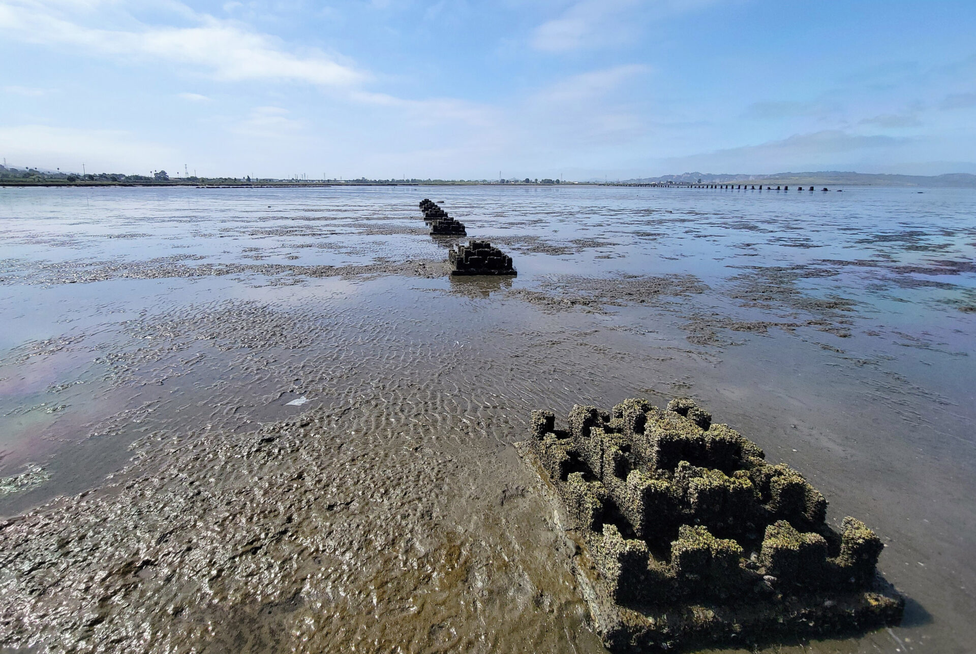
Mudflats near treatments. Photo: Marilyn Latta
The experiment also tested a bunch of different planting techniques. For eelgrass, higher density plantings led to more plants but didn’t seem worth the much larger effort. For fucus, a seaweed added to reef structures for shade, transplants proved problematic. For cordgrass, planting in squares of sod worked best to establish this native species. Adding arbor-like structures — using fallen branches — helped both newly planted sea-blite and existing pickleweed produce larger plants. Plantings in the upland zones, meanwhile, needed weeding, as well as fencing and signage to keep dogs and people from trampling plantings. Again, much more detail can be found in the report.
Climate Change v. Natural Fluctuations
If there is one thing the world is learning on every level today, it’s how to deal with uncertainty and be more flexible. Working in the shallows and along the intertidal intersection of water and land is always going to be dynamic. But climate change has made some fluctuations in conditions even more extreme than in the past, and it can be harder for some species to recover.
“With the Giant Marsh experiment, we’ve learned how these species react to heat waves and atmospheric rivers and long periods of low salinity, and we now know there will be places in the Bay where these species will just blink out for a little while as a result,” says Boyer.
To that end, the report recommends that restoration of living shorelines should be conducted over a range of sites to buffer across conditions that may become detrimental at any one site in a particular year. Within-site diversity in restoration design can provide insurance against physical and biological stressors, the report says.
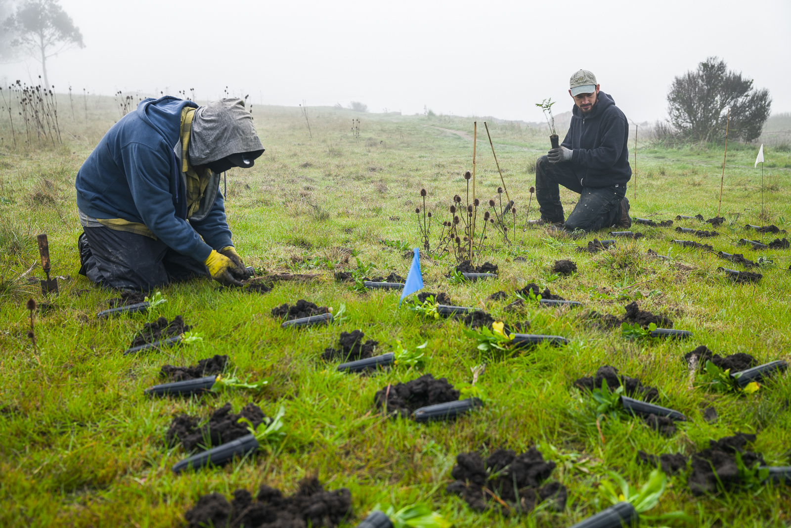
Planting in the upland transition zone above Giant Marsh conducted by Olofson Environmental. Photo: Jak Wonderly
Other recommendations are to assess both the short- and long-term survivability of these types of restored habitats in the context of variation in environmental conditions and especially extreme events, and to keep project goals and timeframes flexible for the same reason.
“With climate change and the increased frequency and severity of some of these extreme events, we are going to have to keep intervening,” says Boyer.
“Restoration and adaptation really need to be a series of measures over time, not one-time actions,” adds Latta.
Applications Around the Bay
After 15 years of experimenting with reef designs and living shorelines, Latta and Boyer have a lot of experience under their belt. They’ve also worked with partners at the Smithsonian, USGS, and UC Davis, and contractors like ESA, Olofson Environmental, Ducks Unlimited, Triton Marine, Dixon Marine Services, and Reef Innovations, as well as the regulatory agencies approving their permits, long enough to have the kind of trust and common language that can get projects done.
“It’s invaluable to have that type of relationship and knowledge building within a group. But that group is small, right? We can’t have one group do all projects in the Bay, nor would we want to,” says Latta. “We need to bring in new perspectives and constantly evolve.”
And evolve they must, and fast. Late in 2024, Latta and the Conservancy put together $6.5 million to pay a much bigger team to ramp up 10 living shorelines projects around the Bay. Called RALS (Regionally Advancing Living Shorelines), the effort aims to plan, permit, and create preliminary designs for the 10 new projects, as well as do the work of providing regional design and constructability guidance based on lessons learned to date at Giant Marsh, Heron’s Head, and a handful of other sites. (Funding also came from the SF Bay Restoration Authority, US EPA and NFWF).
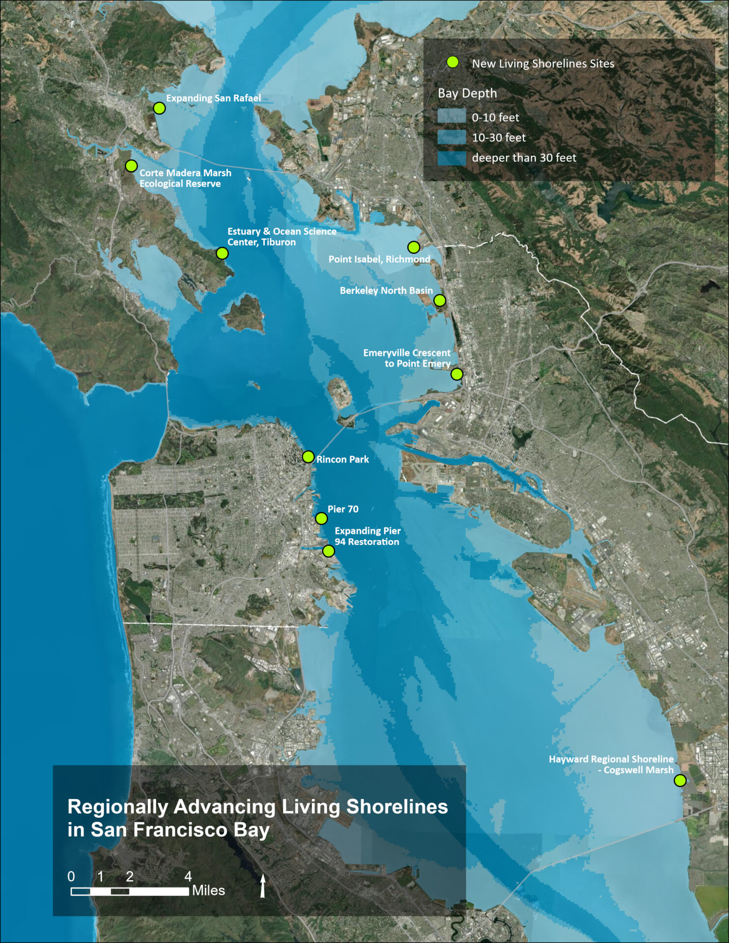
Map of proposed sites for living shorelines. Map: State Coastal Conservancy
In the last few months, RALS has deployed three different nonprofits (Marin Audubon Society, Ducks Unlimited, and Golden Gate Bird Alliance) and three different design teams (ESA, Moffatt Nichol, and GHD) to design new projects in three parts of the Bay (Marin, East Bay, and San Francisco).
“We are not moving fast enough,” Boyer warns. “We can’t do these projects one at a time, study them, learn from them, do another project, and in the meantime, sea levels are rising, and these shorelines are really starting to erode and drown. We have to have the will to move a bunch of projects forward all at once. It’s going to take a lot of money, a lot of people, a lot of capacity-building, but I feel like there’s a regional receptivity now that we didn’t have before. I feel like every municipality, every consulting firm, every graduate student wants to be a part of this, or is obligated to do a sea level rise resiliency project.”
In the meantime, Latta has been working hard to interest new landowners in living shorelines and nature-based engineering, including the Port of San Francisco (which is thinking about more marine life friendly seawalls as part of their long-term 7.5-mile waterfront resilience project). She hopes that with enough projects being planned, entities can invest more in staff and skills learning. The three new design teams will be a first step, she says, and they will bounce ideas off each other and transfer knowledge so that everything can move along faster.
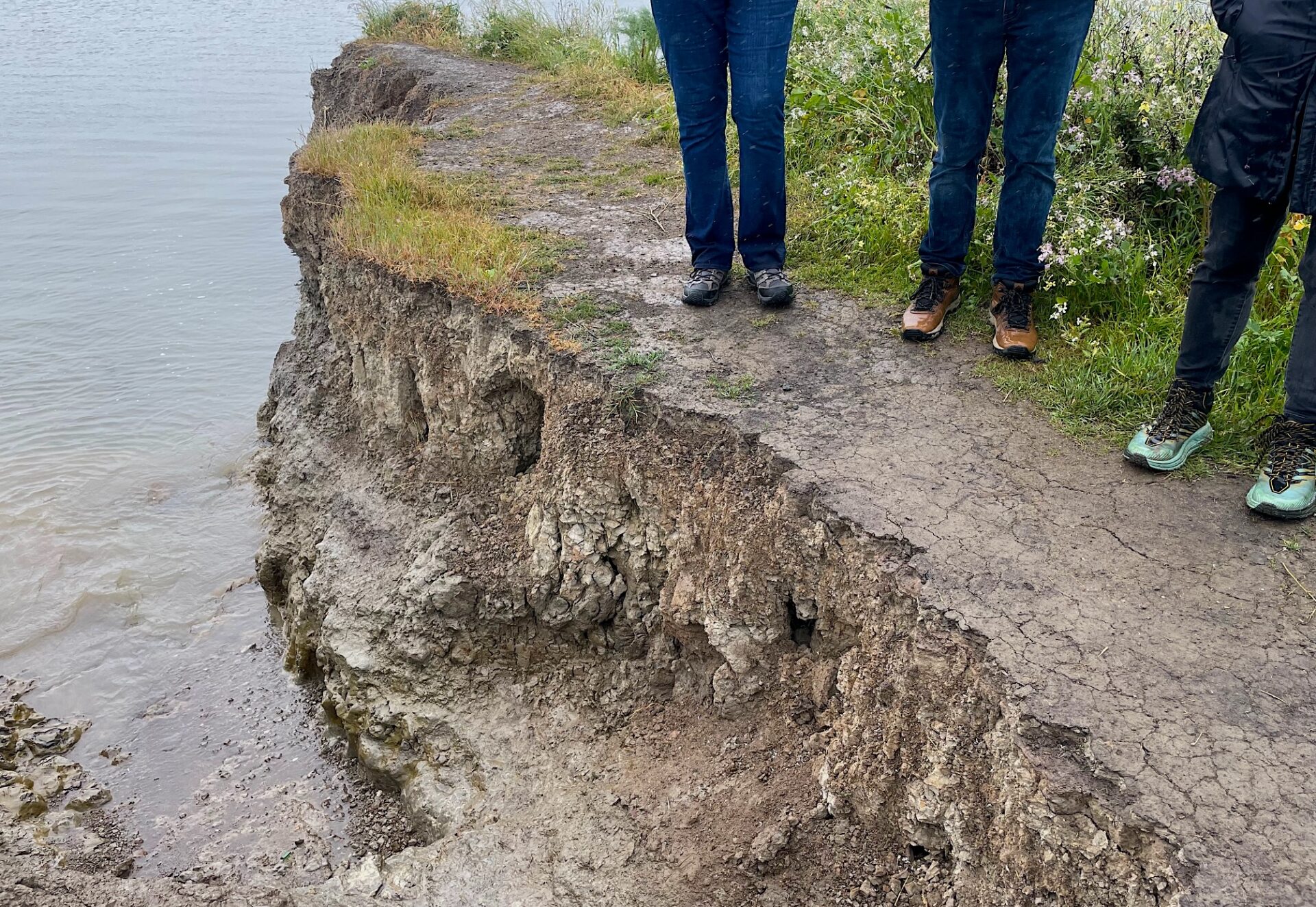
Active erosion on the Corte Madera marsh scarp. Photo: Michelle Orr, ESA
One of those teams recently drove out to Corte Madera marsh to eyeball the problem and begin thinking up solutions. At the moment, everything’s on the table — beaches, low marsh ramps, nearshore reefs, large woody debris, planting, and marsh enhancements for the rail and other species. One thing the team agrees on is the urgency of implementing a solution quickly.
“Corte Madera Marsh is eroding away before our eyes,” says ESA engineer Michelle Orr. “It needs our full attention — and our action — now.”
Top Photo: Nearshore reef at Giant Marsh courtesy ESA

