


Nailing Down Opportunities for Nature-Based Infrastructure

Area around San Jose/East Palo Alto suitable for nature-based adaptation measures: Source: SFEI
Ever strolled along the Bay Trail and wondered about the muddy, sloshy border where the bay meets the land? What values it might have, besides beautiful bay views? Unless you’re a wetland ecologist, you likely don’t think about the hard work that wetlands do every day to soak up rains and tides, store carbon, filter dirty water running off streets, and support a host of incredible species that live precariously on the water’s edge.

Report cover
Though it’s mainly aimed at planners and engineers, a new tool from the SF Estuary Institute offers a way to see these local wetlands in a completely different light. The San Francisco Baylands Resilience Metrics Mapbook highlights key wetlands around the Bay Area, and identifies where and how we can place sediment to lift wetlands above rising seas, improve connections between habitats, and take other “nature-based” actions to increase the resilience of these hard-working ecosystems.
“We provide the type of data planners need to better understand the potential benefits of doing a specific project in a specific place,” says one of the scientists behind the mapbook, SFEI’s Ellen Plane.
As an example, Plane described a restoration project called “Bel Marin Keys Unit 5.” According to mapbook metrics, restoring this particular patch of pasture (1,600 acres of subsided former baylands) would connect the completed Hamilton wetlands project (600 acres) with the “fringing marshes” along the mouth of Novato Creek. Taken as a whole, the project would create 3,000 acres of what Plane calls a “compact” marsh of contiguous tidal habitat.
And the word “compact” here does not mean small in terms of scientific definitions. “It’s not just about size, it’s about shape when it comes to wildlife habitat,” says Plane. “Areas closer to the shape of a circle, rather than a really convoluted shape, tend to be more beneficial. There’s more core habitat at the center that’s protected, as opposed to having most of the habitat be along the edges, which are more exposed to disturbances.”

Bel Marin Keys Unit V is a restoration project of the State Coastal Conservancy and the U.S. Army Corps exploring how best to beneficially reuse dredged sediment to raise subsided wetlands to elevations resilient to sea-level rise. Moving sediment can be costly unless habitat benefits are high. Photo: SCC
The new resilience mapbook details over 100 wetland resilience opportunities around the Bay, all of which are presented in visual and accessible maps. It also features an associated web map where planners can view and download a flood tide of data about their wetland of interest, and see how its resilience metrics compare to others.
For example, according to the SFEI tool, Corte Madera’s Muzzi Marsh is doing well elevation-wise and is important in connecting habitats for the Ridgway’s Rail and salt marsh harvest mouse, but it scores low on availability of connections to transitional habitats in the future. On the other hand, Mill Valley’s Bothin Marsh is currently lower in elevation and has less habitat connectivity, but has much more connected transition zone habitat than Muzzi. According to the data, therefore, each marsh has plenty of opportunity to increase its resilience by either adding sediment (Bothin) or increasing connectivity to adjacent areas (Muzzi).

Corte Madera example. Source: SFEI Resilience Mapbook
“One of the most valuable things that we did in this project is to look at the connectivity of existing marsh to undeveloped migration space and transition zone and really highlighted the areas where baylands could be protected or restored adjacent to that migration space,” says Plane.
Migration space refers to areas for wetlands to move naturally inland as tides and sea level rise. In the Bay Area, there is often little of it to be found for wetlands next to highways and metropolitan waterfronts. “There’s been a lot of work, over time, to map the transition zone and map the migration space, but not that connectivity component of it,” Plane says. “This should be really useful to planners.”
The SFEI tool has limitations, of course — in fact, the mapbook introduction lays them all out in typically cautious scientific detail. For example, these maps only focus on tidal wetlands, but future versions may include more shoreline habitats like beaches, rocky intertidal zones, or nearshore reefs.
The biggest limitation is that the data and strategies presented are for high-level planning, and as such they can be vulnerable to the cruel realities of designing, permitting, and building projects on the ground. Recommended strategies have also not yet been vetted by local communities, landowners or municipalities in the vicinity of the project.
Nonetheless, for cities and counties embarking upon their BCDC mandated sea-level rise adaptation plans, the SFEI resilience mapbook offers some tailor-made resilience ideas and recommendations for where best to do nature-based adaptation.
In the future, that wetland you see today from the Bay Trail now has a chance to continue to be there, still providing a wonderful bay view and access along with increased benefits like stouter flood protection or critical wildlife habitat.
Note: Isaac Pearlman previously worked with one of the SFEI tool authors at BCDC from 2017-2018.
Other Recent Posts
New Study Shows Rain Gardens Filter Chemicals Out of Stormwater
Scientists found rain gardens dramatically reduce toxic chemicals in stormwater while providing biodiversity and cooling.
The Tricky Art of Growing Oysters in the Lab So They Can Survive in the Field
The Nature Conservancy, the Amah Mutsun Tribal Band, and others are growing oysters in the lab and planting them in the wild in estuaries around San Francisco Bay.
Printing Without Plastic: The Vintage Machine Winning Over Eco-Conscious Artists
This comic guide to risograph printing explains how the 1980s Japanese machine cuts energy use and avoids plastic toner.
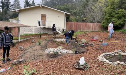
East Bay Kids Fight Extreme Heat in their Schoolyards
Many California schools are ill-equipped to tackle heat, with many campuses lacking sufficient tree coverage. These students are fighting to change that.
How a North Bay Regional Park Helped Me Reconnect With Nature — and Myself
A young Fairfield resident reflects on how hiking during the pandemic became a refuge from digital overload and the growing realities of climate change.
Wild Pigs Rough Up Bay Area Greens
They tear up landscapes in search of food, prey on native wildlife, and damage streams, and warming could bring them closer to urban areas.
Residents Chose Different Ways to Respond to Contra Costa Flood Challenges
Graduates of a shoreline leadership program in Contra Costa County recently pitched their ideas for sea level rise education and adaptation.