


Repurposing Urban Lots & Waterfronts: Ashland Grove Park, Palo Alto Levee, and India Basin
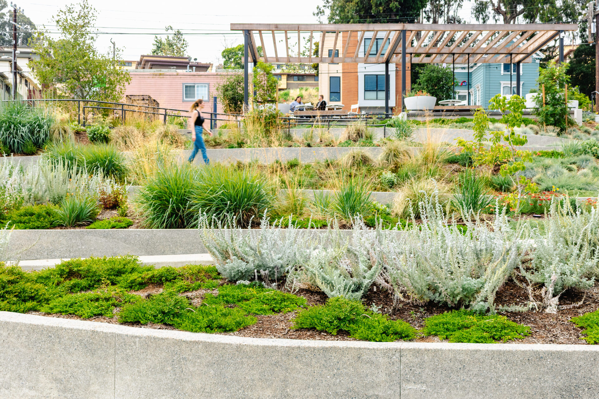
Photo: Aaron Ackerman
KneeDeep’s quarterly column, “The Practice,” highlights the work of designers, landscapers, engineers, and other practitioners on innovative projects across the state in different stages of planning and completion. Some of these efforts are small-scale and experimental; others are hefty, long-term infrastructure investments. All of them represent the on-the-ground climate adaptation work that doesn’t make big headlines, but is quietly helping California adapt to a future in flux.
On the Drawing Board: Ashland Grove
In Ashland, an unincorporated pocket of Alameda County, a new public space is taking root on two commercial lots better known for storefronts and asphalt than trees and trails. “The surrounding community previously lacked a park within a 10-minute walk, making Ashland Grove a much-needed addition,” says Meghan Tiernan, capital planning and development director for the Hayward Area Recreation and Park District. “Without this project, the former commercial properties could have easily become blighted.” Instead, they’re transforming into parkland — just like the nearby Ashland Zocalo Park, which opened in 2024. Construction is expected to begin late this year.
The site’s transformation hasn’t been straightforward. The lots, along East 14th and Mateo streets, were once home to a bar, mattress store, barber shop, auto repair shop, and RV storage facility, then the COVID-19 economic downturn shuttered the properties. By the time HARD acquired them, the structures had been cleared away. But the land carried other baggage: lead and asbestos. And “both sites have soil contamination from prior vehicle-related uses,” says Tiernan. That all means a pricey cleanup.
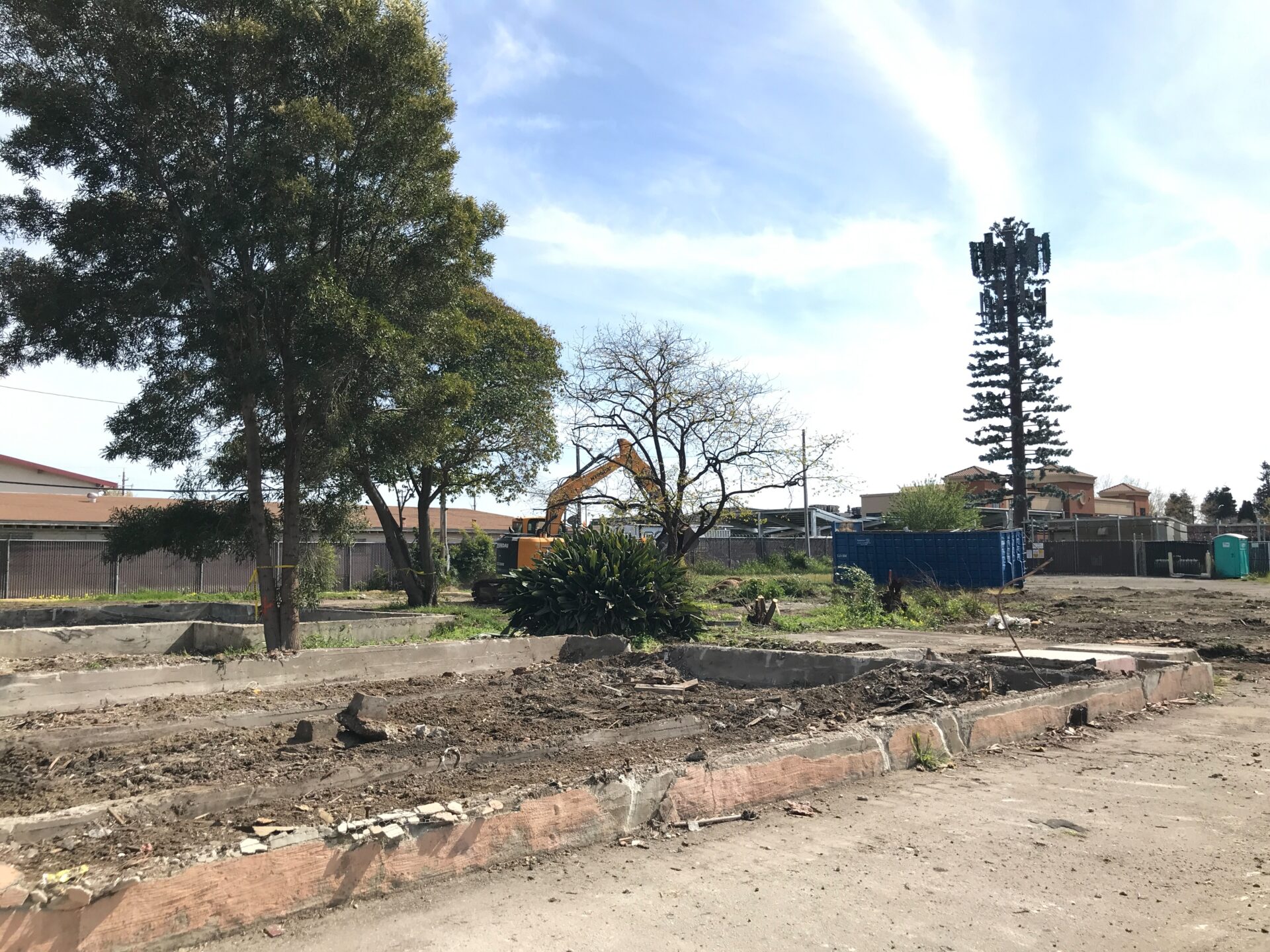
Demolition at the Mateo site. Photo: HARD
The effort is supported by nearly $24 million in local bond and grant funding. “Community support and strong partnerships are among the most critical aspects of this project,” Tiernan says. It was extra tricky because the two lots were acquired and are now being managed by different owners — HARD for the East 14th Street site, and the Trust for Public Land for the Mateo Street site. “The two sections will be constructed separately but must blend seamlessly once completed,” says Tiernan.
The new four-acre park will offer winding walking paths, courts for pickup games, and picnic lawns. “This one project can provide this dense community with numerous ways to recreate and get outside,” says Tiernan, and help “counteract nature-deficit disorder.”
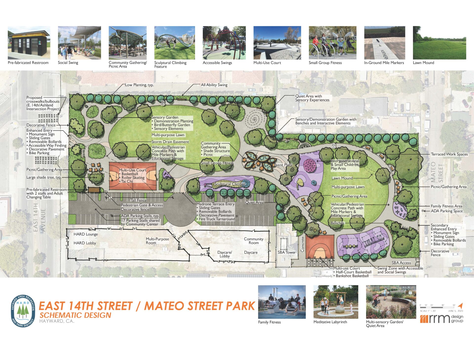
The concept plan. Image: RRM Design Group
The landscape will also include low-maintenance, drought-tolerant plants that attract birds and pollinators, as well as flowers and shrubs chosen for their scents, textures, and colors, turning an ordinary walk into a layered sensory experience. And in the planting of saplings lies a promise of the park’s future. “They are intended to mature into a shaded canopy, creating the ‘grove’ that gives Ashland Grove its name,” says Tiernan.
Just Underway: Palo Alto Horizontal Levee
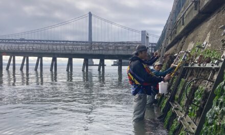
In a small pocket of Harbor Marsh, the Palo Alto Horizontal Levee Pilot Project is testing whether a wedge of land can protect the shoreline while cleaning the water that flows through it.
“It’s going to be the first horizontal levee that actually filters wastewater and discharges directly to the Bay,” says ESA engineer Mark Lindley. One complication: the site lies in the alignment of a much larger future flood-control levee. “What we’re trying to do here is build out our horizontal levee slope, maintain flood protection to current levels or a little bit above, while also providing space so that they can build the new big, burly, 2100 levee at the site,” he explains.
The challenges multiply in the details. “The area is currently occupied by Ridgeway’s rail, which really affects our ability to do work,” Lindley says. “We’re limited to September 1 through October 15.” After the 15th, heavy rain risk increases, which could botch the construction process.
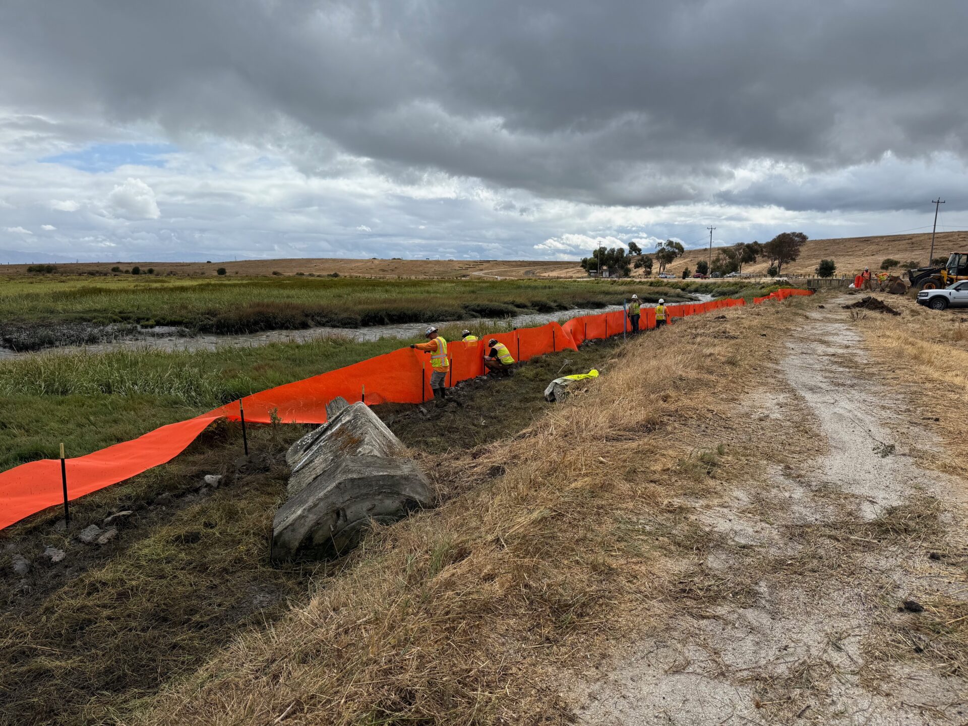
Construction begins. Photo: Zoon Engineering
That’s where the contractor, Corcus Construction, comes in. “They’re having to work fast, in a really compressed construction window, and on a site where every little thing matters,” Lindley says. “We’re working in this little postage stamp.”
Another challenge involves layering a series of different mixes — gravel with wood chips, sand filters, and a soil-Bay Mud blend — to help treat the wastewater and improve drainage. “You’ve got to figure out where to blend these materials, how to toss them around, how to get this levee built,” says Lindley.
Pumps and new piping from the wastewater treatment plant will feed the slope with treated effluent. By toggling the amount of water that comes through the levee from the plant, the designers aim to reproduce the hydrology that you would see along a traditional transition slope: wet in winter and slowly draining through summer. “I’m trying to mimic nature, but I’m doing it with pipes and pumps and flow gauges,” he says.
Next spring, after the underlying construction is complete, Save the Bay will lead community planting events. Then, myriad post-construction monitoring efforts will begin, including a look at the fate of microplastics as they travel through the levee. That focus came directly from conversations with residents, who wanted monitoring tied to the pollutants they worry about in their own communities.
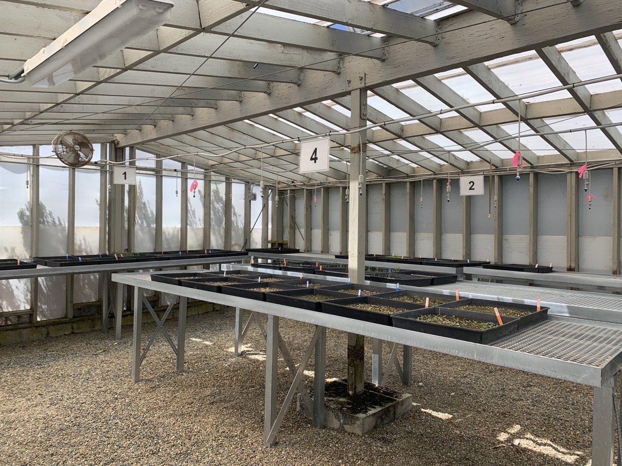
Seedlings destined for planting on the Palo Alto horizontal levee. Photo: ESA
“This is nobody’s perfect wheelhouse,” says Heidi Nutters, senior program manager with the San Francisco Estuary Project. But the challenges are part of the point. “Innovation is worth it on the shoreline. It takes partnership, it takes creativity, it takes dedication — but the eventual benefits are so much more lasting.”
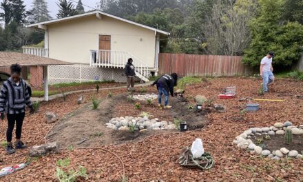
Halfway There: India Basin Waterfront Park
At San Francisco’s southeastern shoreline, the past is being folded into the future. Phase one of India Basin Waterfront Park opened at 900 Innes Ave. in October 2024; now, the second phase — another seven and a half acres — is about to break ground. It will be a park where different sorts of archives overlap: the shoreline’s ecological and commercial past both shape the project.
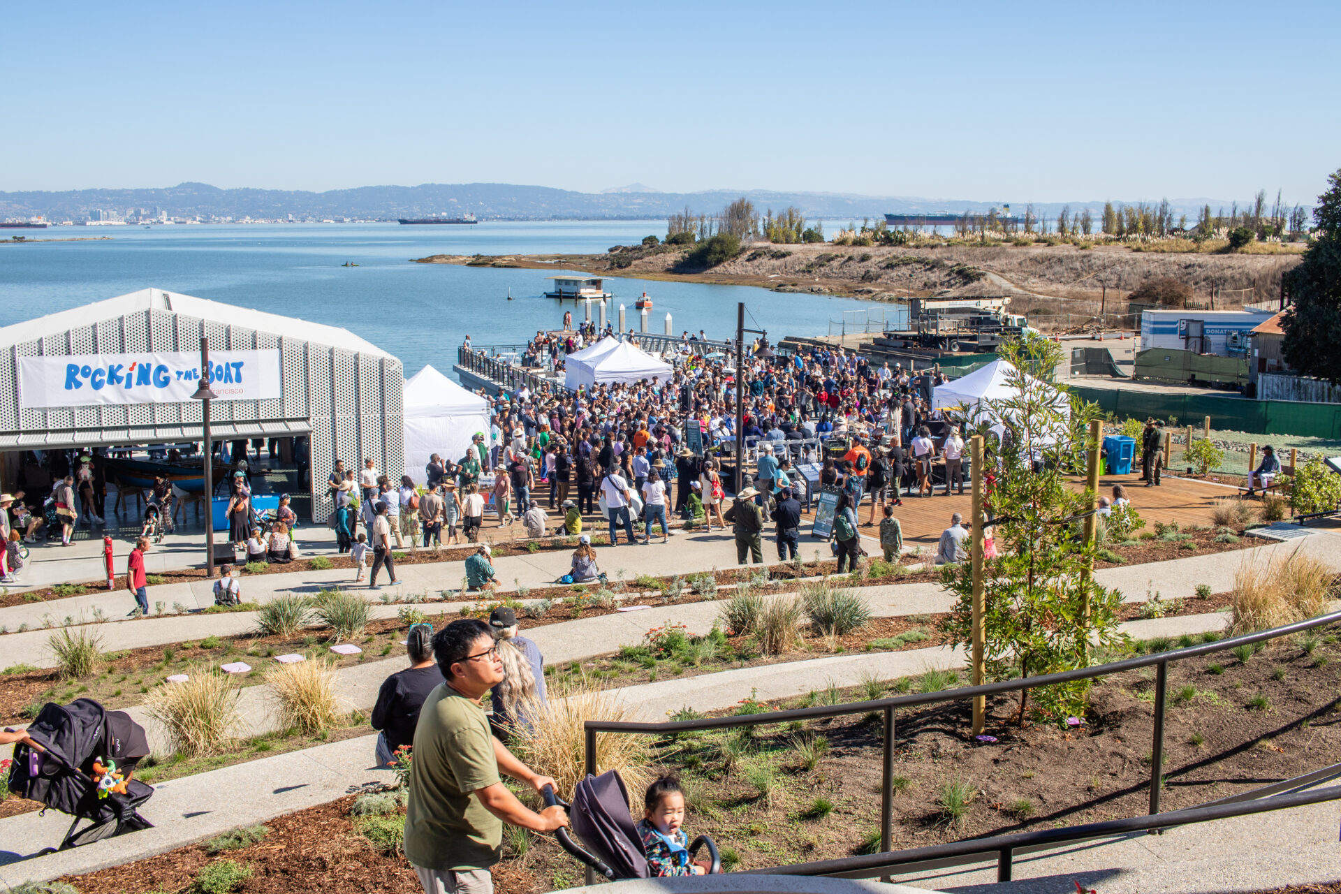
Phase One’s opening day. Photo: Aaron Ackerman.
“There was a real interest by the city and the design team to do something here that was inspired by the history of the site in multiple layers,” says Aaron Ackerman of ecological design company RANA. “Historically, this part of the coastline along the Bay, prior to development, would have supported a lot of marsh ecosystems. So there’s that aspect of it, but then there’s the cultural aspect of it, too. For a long time it operated as a boat yard.”
Ackerman says the park’s design will blend that human history with the restoration of a marsh “superecosystem.” The goal is to bring back biodiversity, carbon storage, and coastal protection, as well as prepare for higher tides. “We looked at different scenarios of sea level rise, and we’re interested in understanding: can the landscape respond proactively?” says Ackerman. “Can we see the marsh and the park actually start to shift with those tide changes?”
Instead of a hard edge where water once hit walls and pilings, the shoreline has been reshaped with gradual slopes. The new grades create a softer threshold where tides can flow in and out, allowing freshwater, saltwater, and land to mingle — the conditions a young marsh needs to take hold.
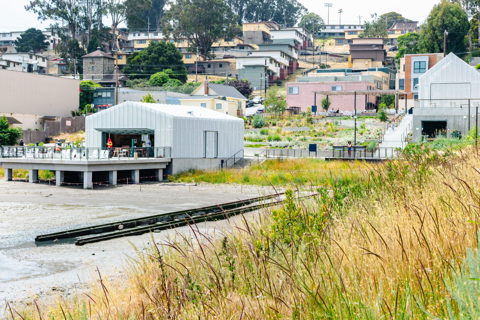
Old boat-building infrastructure blends into the parkland. Photo: Aaron Ackerman
The park’s human past lingers in weathered traces. “There are components that we were able to leave behind and refurbish for the project,” says Ackerman. One is the Ghost Ship: a remnant of a sunken ship that’s right at the shoreline. A historic boathouse has been turned into a community space. And the old, weathered boat launch rails will stay in place, blending into the shoreline. “We’re planting the marsh grasses in between,” says Ackerman.
The new waterfront will now “tell the story of the landscape in a really authentic and interesting way,” says Ackerman. “You can go to the park and enjoy it as just a park. But that information is there if you want to seek it out.”
Other Recent Posts
Building Sustainably with Mass Timber
This building method can help clear forests of smaller trees that burn easily while also reducing the carbon footprint of new homes and offices.
Hardscapes That Filter Rain
Heavy rain can overwhelm storm drains and pollute waterways, but materials like permeable pavements help filter runoff and prevent flooding.
The Gray-Green Alchemy of Baycrete
Baycrete is a nature-based hybrid of concrete, shell, and sand designed to attract oysters and create shallow water reefs in SF Bay.
Tools Tweak Beaver Dams
Humans find ways to co-exist with beavers, tweaking dams to prevent flooding and create more climate resilience.
Hopes and Fears for Sierra Snowpack
February’s drought and deluge confirms that uncertainty may be a given for California snowpack, western water supply, and wildfire risk.
Errands by E-Bike
Electric cargo bikes are climate-friendly car replacements for everyday activities, from taking the kids to school to grocery shopping.
A Rare Plant Tough Enough to Save the Future Bayshore
Sea-blite can thrive in adverse conditions, buffer shores from waves, hold sand and soil in place, and clamber up eroding cliffs.
MORE
- The Practice: Testing Adaptation Limits, April 2025