


How Rivers in the Sky Travel Across the Ocean
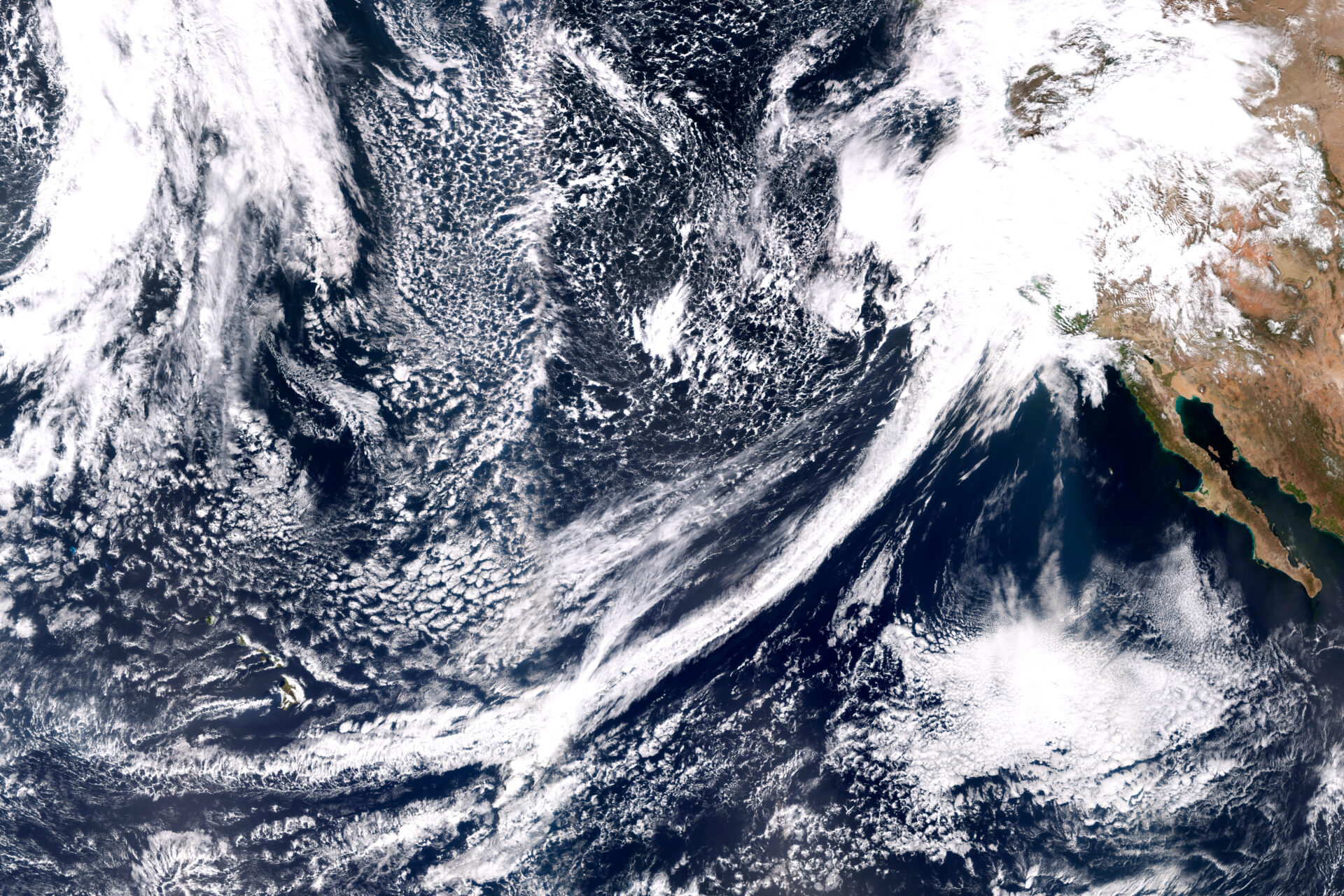
Winter in California is a time of promise and peril. We’re desperate for rain, only not too much please. Our fate swings from drought to floods, depending largely on whether or not we get rainstorms called atmospheric rivers. These ribbons of extraordinarily wet air shoot across the Pacific Ocean, dropping the moisture they carry upon landfall.
The Bay Area’s latest “wet” season began with the bang of a record-breaking atmospheric river in late October but then fizzled out. These storms have been so scarce in the last few months that the state is facing a third year of deepening drought.
Atmospheric rivers typically begin over oceans in the tropics, where it’s so warm that water evaporates readily, filling the air with moisture. Then all it takes to start an atmospheric river is a storm called an extratropical cyclone, which spins over the ocean and sweeps up the wet air.
“Atmospheric rivers are seeded by convection storms that move water vapor from the surface to a couple of kilometers high,” says Alan Rhoades, a hydroclimate scientist at Lawrence Berkeley National Laboratory.
Atmospheric rivers that form over the Pacific Ocean are then launched and propelled toward the West Coast by strong winds. “You need a driver like a low-level jet stream,” says Zhenhai Zhang, an atmospheric scientist at Scripps Institution of Oceanography. “The jet carries the moisture and moves fast in a narrow corridor.”
This airborne stream of water vapor then traverses a series of low and high pressure regions that are strung across the ocean. These regions set the path of the atmospheric river, which can be so long that it extends halfway across the Pacific. “A low grabs the water vapor and moves it northward, and a high then steers it toward the West Coast,” Rhoades says.
He likens this process to a conveyor belt, where the low and high pressure systems are like rollers that direct the atmospheric river. Another way to look at this process is that the low and high pressure areas are like the pegs of an enormous pinball machine, guiding and redirecting the flow of the atmospheric river and so shaping its trajectory toward land.
Other Recent Posts
Wild Pigs Rough Up Bay Area Greens
They tear up landscapes in search of food, prey on native wildlife, and damage streams, and warming could bring them closer to urban areas.
Residents Chose Different Ways to Respond to Contra Costa Flood Challenges
Graduates of a shoreline leadership program in Contra Costa County recently pitched their ideas for sea level rise education and adaptation.
Strong Leader, Light Touch: Caitlin Sweeney
Ahead of her retirement earlier this month, the Estuary Partnership director sat down with KneeDeep to discuss her achievements and the future of the Bay.
Unmasking Regionalism
Regional leaders say the Bay Area has built ambitious climate resilience plans. Now comes the harder task: funding and implementing them.
Pacheco Pass Is Getting a Second Wind
In Pacheco Pass, a decades-old wind farm is getting an upgrade that will double CleanPowerSF’s wind energy.
Climate Change, A Scorpion’s POV
From the Sierra Nevada to the Mojave Desert, the state’s native scorpions are losing habitat as heat, wildfires, and development reshape ecosystems.
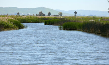
12 Creek Types: Which One Is In Your Backyard?
Geomorphologist Gregory Pasternack and his team documented 12 types of Bay Area creeks to help residents protect themselves from flood threats.
Could Avocados Be A Transformational Fruit for the Bay Region?
Local growers and activists are planting avocado trees to build climate resilience, local food systems, and alternatives to imported fruit.
Radar Gap Filled on Marin Mountaintop
A new weather radar installation will help the region’s northern counties read incoming storm clouds, hours before they drop their rain.
The Climate Questions Facing Bay Area Voters This Spring
Important details about votes on transit funding, open space preservation, wildfire prevention, and earthquake prep this Election Day.

Instruments on this Sonoma County ridge measure precipitation, temperature, humidity, winds, barometric pressure, and more. Scientists use the data to connect the hydrology of the Russian River watershed to atmospheric river forecasts. Photo: Scripps, UCSD.
That trajectory is hard to predict, however. “Atmospheric rivers are often called whips or hoses because their path can shift in different directions,” Rhoades says. This is partly because these storms depend on wind, which changes from hour to hour. Atmospheric river speeds are difficult to pin down but may vary from 20 to 100 kilometers per hour.
And while the path can look fairly smooth at a global scale, up close it’s a different story. “At a small scale, it’s challenging to predict the exact path of an atmospheric river,” Zhang says, adding that an atmospheric river’s size, shape and intensity are also in flux.
Taken together, all this variability makes it hard to know exactly how strong an atmospheric river will be and exactly where it will make landfall. Another complication is that atmospheric rivers can be just a few hundred kilometers across. This is very close to the uncertainty in predictions of where they will hit, which can be off by a couple hundred kilometers. “That’s the difference between landfall in Los Angeles or in San Diego,” Zhang notes.
