

Radar Gap Filled on Marin Mountaintop
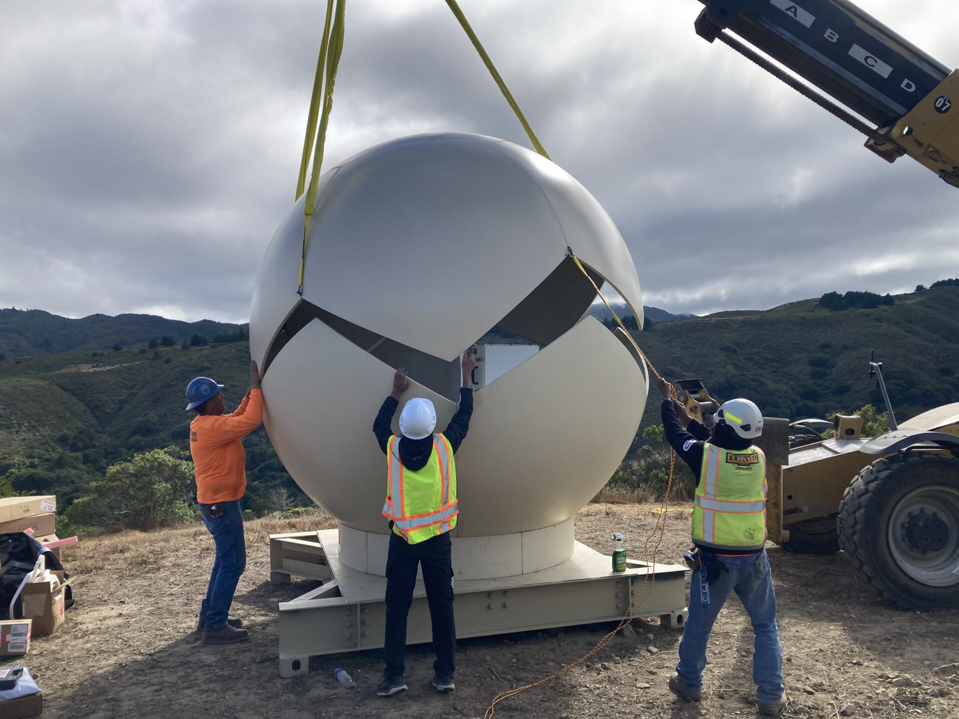
Barnabe Mountain in Marin County, elevation 1466’, is nobody’s idea of a commanding height. From nearby valleys, you can hardly pick out this rounded knob. But the layout of the Marin hills makes this a splendid spot for gathering and transmitting data. Along with lots of communications equipment, there’s a fire-protection webcam here. And in early March, a new structure joined the hilltop crowd: a weather radar installation meant to read incoming storm clouds, hours before they drop any rain, allowing time for flood preparation just when and where it counts.
Radar is basic to weather forecasting, but the Doppler or S-band radars used by the National Weather Service look high and far. They work well across mostly flat landscapes, but in the rumpled topography of the Bay Area, they miss crucial details. They often fail to pick up the very local, very intense rain bands that can cause streams to overflow their banks and storm sewers to back up, with little warning, in critical places.
In the coming era of weather extremes, finer-grained prediction is essential. For that, you need radars that are focused more locally and lower in the sky. These use frequencies called X-band for very local readings and C-band for a somewhat wider view.
The Barnabe Mountain debut completes a regional system 10 years in the making. It includes five X-band radars: on Sawyer Ridge above San Mateo, on Rocky Ridge between Oakland and Moraga, and on buildings in Santa Rosa, Santa Clara, and Santa Cruz. These instruments survey circles about 50 miles across.
“They are near-sighted,” says Dale Roberts, principal engineer at Sonoma Water. “Deliberately so.” They provide about an hour’s warning before local downpours. They can’t look very far out to sea, where atmospheric rivers come from. And they don’t cover the whole region; Marin County has been a conspicuous gap.
Other Recent Posts
Regional Housing Agency Invests in Affordability
The Bay Area Housing Finance Authority is launching a loan program to support the construction of mixed-income rental properties.
The End is Coming for California’s Untouchable Grass
The law, which applies to grass that isn’t used for recreational purposes, could cut urban water use across California by more than 20% says Oakland thinktank.
Sonoma Vineyard Workers Burn toward a Better Future
A group of immigrant farmworkers are forming a worker-owned cooperative to bring back Indigenous burning practices that used to revitalize the soil.
Los trabajadores de los viñedos de Sonoma queman por un futuro mejor
Un grupo de trabajadores agrícolas inmigrantes está formando una cooperativa de propiedad de los trabajadores para recuperar las prácticas indígenas de quema que solían revitalizar el suelo año tras año.
New Voices Shape Design of Berkeley’s North Basin Strip
Twenty acres of parkland between the highway and the Berkeley shore are slated for a coast-resilient makeover, with input from locals and stakeholders.
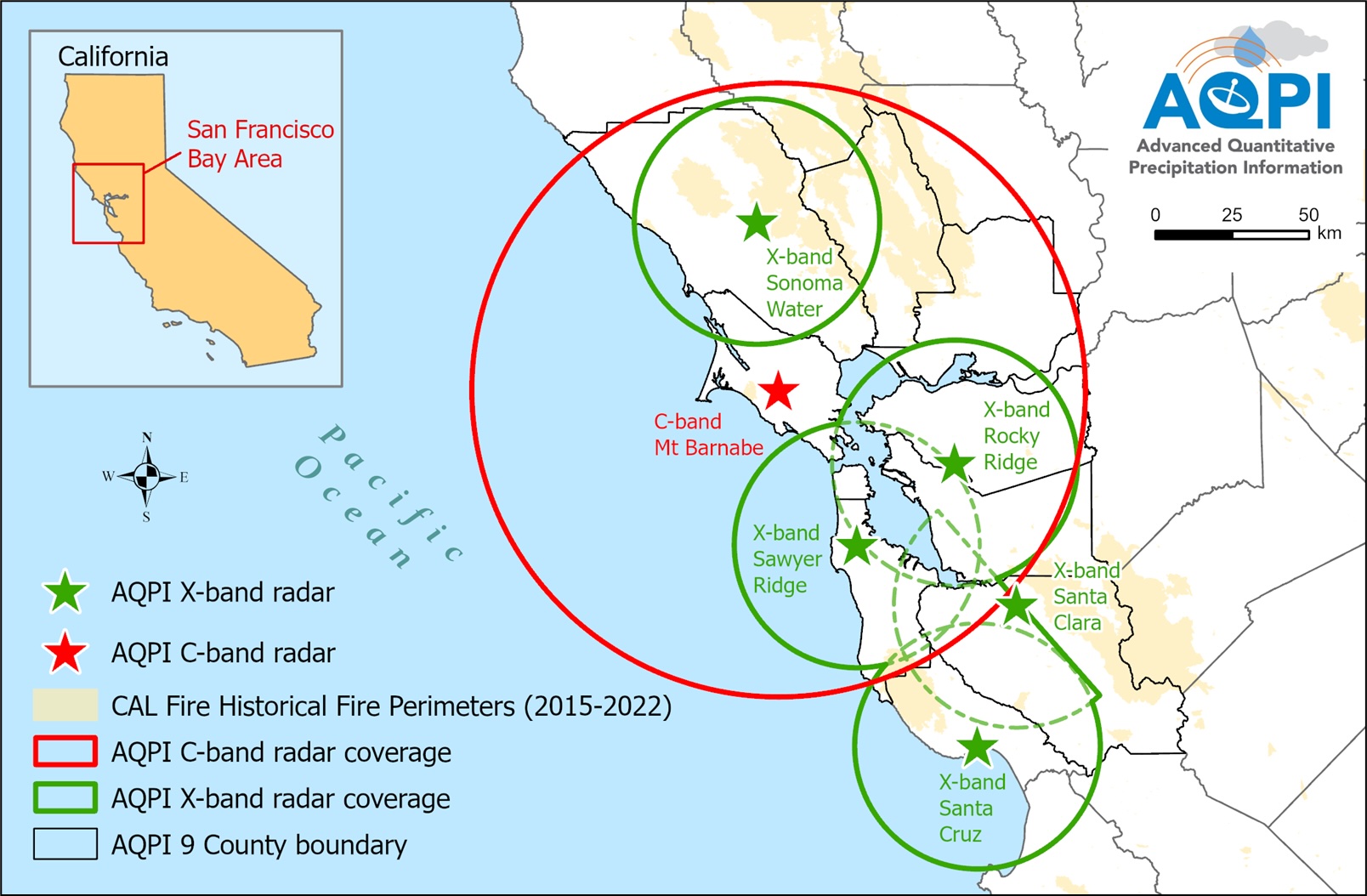
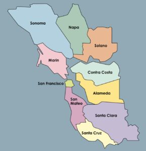
AQPI coverage map for the Bay region. Map: Sonoma Water
The new C-band installation on Barnabe Mountain fills that gap and much more: it is the keystone. With its 120-mile field of vision and unimpeded Pacific view, it can provide six, eight, and even 10 hours’ notice ahead of potential local flooding. Most of all, it’s this facility that allows the combined radars to build a mosaic — a regional weather picture.
“The system detects every raindrop,” Roberts says enthusiastically. “It tells us how much precipitation is in the whole sky.”
That quote gives life to the program’s formal name: San Francisco Bay Area Advanced Quantitative Precipitation Information, or AQPI.
This system is the first in the U.S. to combine X-band and C-band units in one network. It’s also a model for regional cooperation. Though Sonoma Water took the lead as fiscal agent, eight Bay Area agencies — covering water, wastewater, and flood control — have shared the work. This consortium arose at the urging of a dynamic man named Carl Morrison and survived his untimely death.
“We are good at getting things built,” says Sonoma Water chief Grant Davis. “Now we are handing off to Scripps.” That is the Center for Western Water and Weather Extremes, “C3WE,” a part of the Scripps Institution of Oceanography at UC San Diego. Detailed results will be posted on the C3WE website. Researchers are itching to exploit the new data, like in tracking the double danger when swollen streams pour into tidal waters elevated by storm winds blowing onshore, for example. “There’s some really neat work happening here,” says Mike Anderson, the state climatologist at the Department of Water Resources.
Will the new system help water agencies manage their lakes and their groundwater storage for maximum supply? Not directly, at least not yet. The prediction window is too narrow. AQPI doesn’t now interlock with its acronymic sister FIRO, which stands for Forecast-Informed Reservoir Operations. But AQPI is more than its radars: it’s an experiment in integrating data from many sources.
“FIRO and AQPI are pretty separated now,” Roberts says. “But I’m a dreamer. I think they will converge.”
MORE
- Tracking Atmospheric Rivers on the West Coast, Estuary News, February 2022
- Why California’s Water Extremes are Wilder Than Ever and What We Can Do About It, KneeDeep, March 2023