


The Race to Reinvent State Route 37
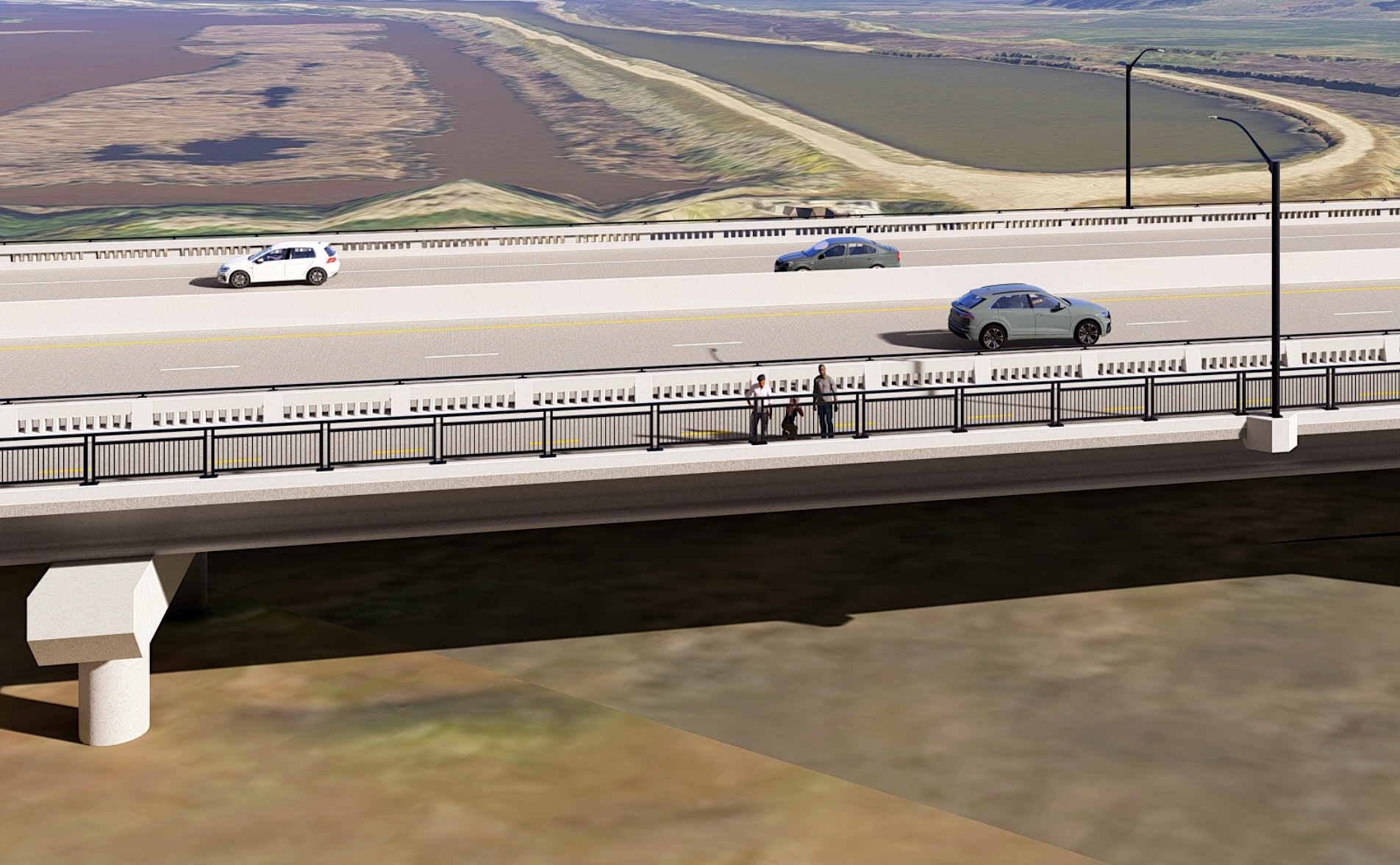
Many, many years and billions of dollars in the future, a 21-mile, four-lane causeway will skim above hundreds of acres of restored wetlands at the Bay’s northern edge, replacing traffic-clogged, often water-logged, State Route 37. This spring, despite last minute funding challenges that threatened to derail a key component, the first glimpses of that vision began coming into focus.
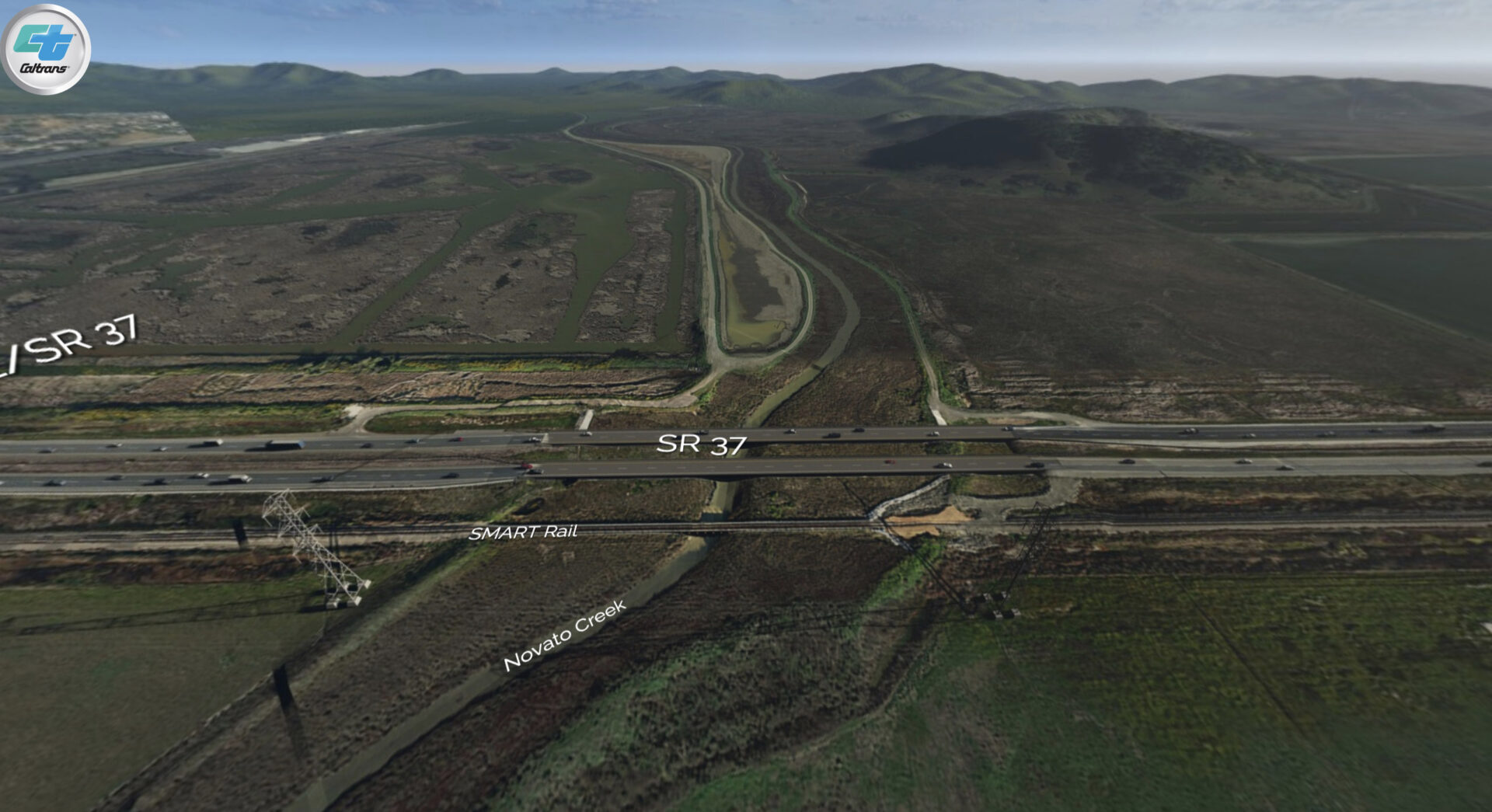
In April, Caltrans will complete the first construction project related to the ultimate alignment of the new SR 37, a diverging diamond interchange at the eastern end of the highway in Vallejo.
“It’s a safer, more efficient way to create an interchange where you have a highway that goes over roads in a community,” says Caltrans spokesman Bart Ney. “It’s going to accommodate more efficient access to State Route 37, relieving some of the chronic congestion in the area.” Eventually, the Solano County Transportation Authority will build a public transit hub nearby to facilitate trips along the 37 corridor.
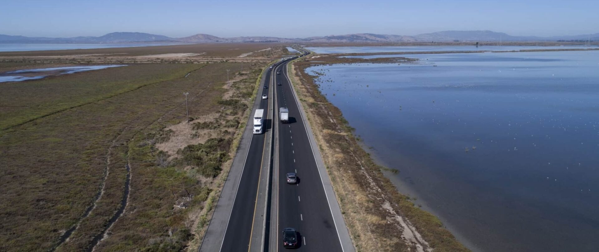
Photo: Karl Nielsen
As North Bay residents know all too well, traffic congestion is just one of the urgent problems Caltrans and other transportation agencies must address.
“There are three things that we’re striving to solve, all at the same time,” says Ney. “There’s congestion on the eastern side, flooding has been happening for decades, and now sea level rise, which is a different thing and progressive, is coming on.”
It certainly is: Projections from the San Francisco Bay Conservation and Development Commission and Ocean Protection Council predict that the entire span of SR 37 between Novato and Vallejo will be permanently underwater by the end of the century.
To tackle these issues, Caltrans brought together the myriad stakeholders to develop a solution that addresses immediate and future threats to the corridor. An elevated causeway was identified as the best long-term solution; however, given the costs, complexities and long timeframe involved, the project was broken into eight smaller segments, and several interim improvements were identified to address the most urgent flooding and congestion problems in the near-term.
The taller and wider Novato Creek Bridge of the future. Rendering: Caltrans
The first segment of the final causeway is taking shape on the western side of the Bay, between US 101 and Atherton Avenue in Novato. Permits are expected this summer for the replacement of flood-prone Novato Creek Bridge. The bridge will be widened to accommodate more traffic and raised to 26 feet, which is expected to keep it above water until at least 2130. Eventually, the bridge will connect to the rest of the causeway.
Like several other near-term projects, elevating Novato Creek Bridge will bring benefits to the marshlands that lie beneath the roadway. Although the project does not directly include habitat enhancement, a coalition of groups working to restore the Novato Creek Baylands has long called for the bridge to be raised.
“There are going to be opportunities for better tidal flow through the area when the bridge is raised,” says Ney.
Further east on SR 37, marsh restoration is also key to an interim project that will not replace the existing roadway so much as buy it some time.
Although the causeway will eventually replace all of SR 37, the Sears Point to Mare Island Improvement Project will relieve both traffic and environmental bottlenecks in the meantime, says the Metropolitan Transportation Commission’s Jeanette Weisman. The project is broken down into three construction “packages,” the first of which — widening and lengthening Tolay Creek Bridge — is wrapping up design and permitting.
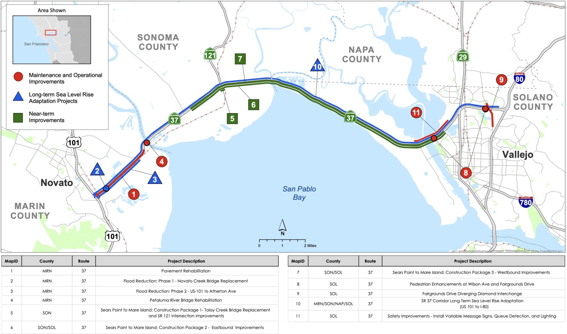
Active components of the State Route 37 project, including maintenance to keep the road safe and functioning (red); near-term improvements to ease congestion (green); and long-term improvements needed to address sea level rise (blue). Map: Caltrans
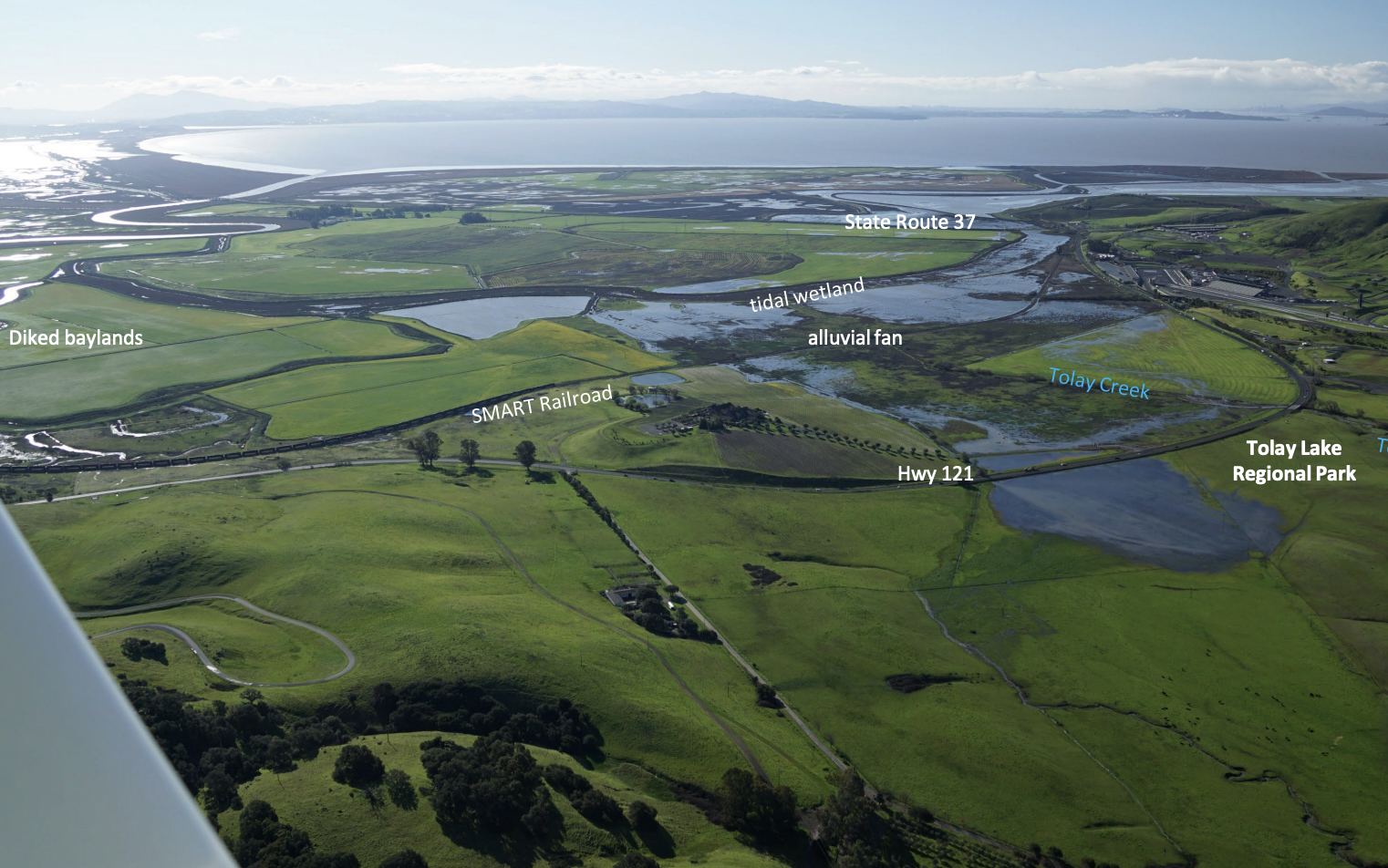
The bridge replacement is the keystone of the ambitious Tolay Creek Baylands Restoration project, which seeks to reconnect Tolay Creek to San Pablo Bay and restore 280 acres of tidal and freshwater wetlands, alluvial fan, and transition zone. The longer bridge will enable the creek channel beneath it to be widened, and reconnect the north and south sides of the creek, according to Julian Meisler of the Sonoma Land Trust.
“There are all these pieces [in this area] that people have been working on for a long time,” says Meisler, pointing to the Tubbs Island Restoration Project, the Sears Point Restoration Project, and Tolay Lagoon. “But they don’t connect — a fish couldn’t swim north of 37.”
Remaking the north-south creek connection would allow tidal waters, as well as freshwater and marsh-building sediment, to flow back and forth under the bridge. “Lengthening the bridge is the key to opening up more than 1,000 acres of restoration north of the highway,” Meisler adds.
Plan for Tolay Creek restoration adjacent to State Route 37. Underlying Image: Robert Janover for Sonoma Land Trust
Noting that MTC, Caltrans, and county transportation agencies have been working closely with the environmental community on plans for SR 37, Weisman says the Tolay Creek Bridge was identified as one of the most pressing and time-sensitive ecological enhancements in the corridor.
“We need to do the restoration ahead of sea level rise, to give the wetlands the chance to become established and not just drown in the rising waters,” says Weisman. “That’s why we’ve been really pushing ahead with these improvements rather than simply waiting two plus decades for the long-term project.”
With funding cobbled together from various federal, state, and local sources, the project hit a snag this winter when revised budget projections revealed a $55 million gap. If the additional funds aren’t identified by May, the project could lose already committed funds. County supervisors, facing a variety of Trump administration budget cuts, have been clear that the counties cannot help; however, according to Ney, Caltrans, MTC, and North Bay county transportation authority partners are working to identify potential funding sources, and he is confident the project will meet the deadline and be able to solicit construction bids for the Tolay Creek Bridge this summer.
Subsequent construction packages of the Sears Point to Mare Island Improvement Project will address traffic congestion around the SR 121 interchanges, widen the roadway from two lanes to four, and improve drainage for 900 acres of strip marsh just south of the highway. Together with Tolay Creek, Strip Marsh East serves as a pilot project for integrating ecological restoration with a public infrastructure project.
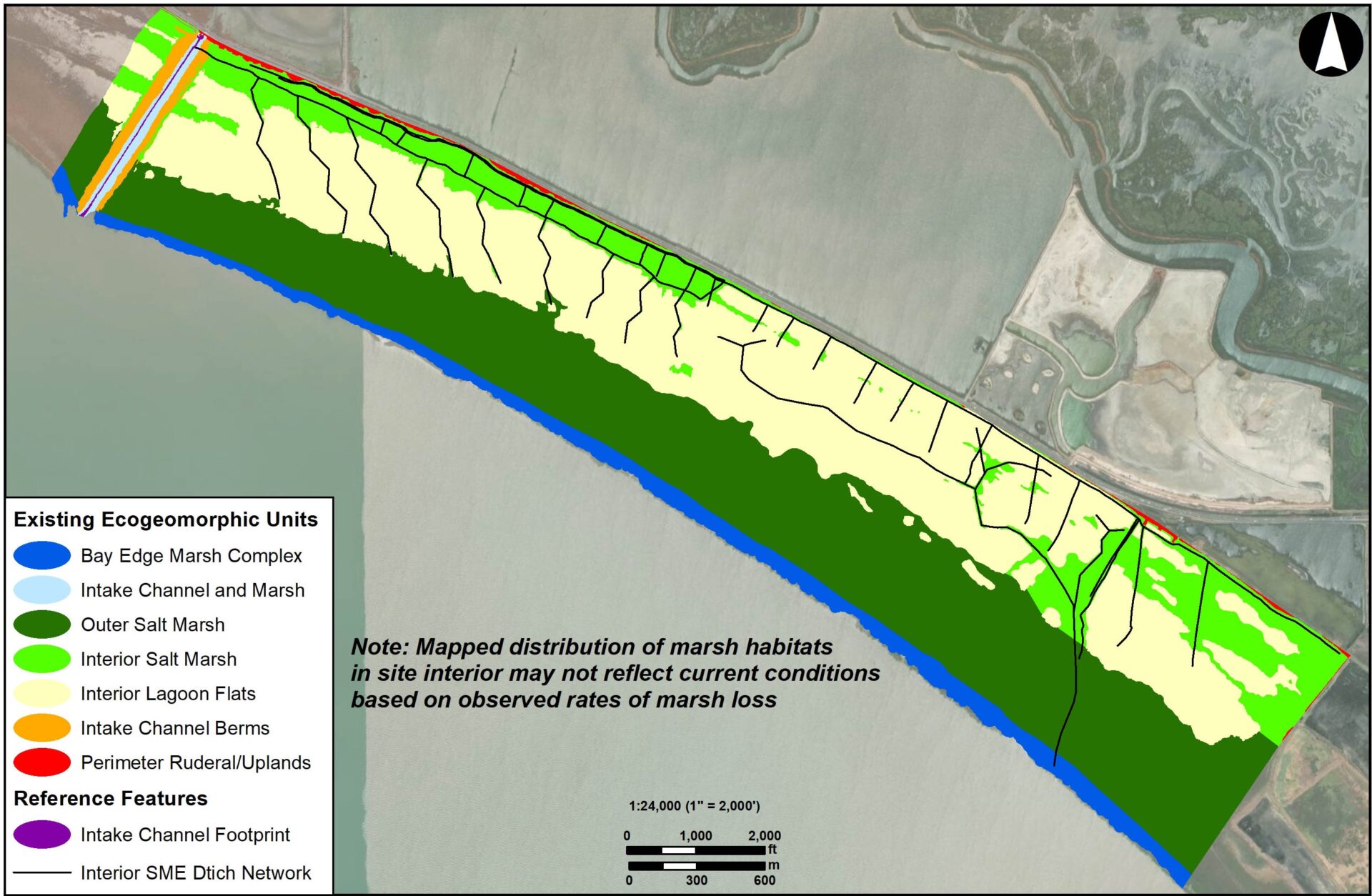
Strip Marsh East current habitats and landscape features to be preserved and restored. Image: Stuart Seigel, Peter Baye, Gillenwater Consulting
“The restoration functions as a minimization measure for environmental impacts that might be associated with the roadway, and avoids the need for compensatory mitigation,” says consultant Stuart Siegel, who is leading the strip marsh project. Notably, however, funding for the restoration projects is separate from the highway construction funding.
“By helping to restore the drainage at Strip Marsh East and bring back elevation in this area, we can improve the length and lifespan of the buffer to storm surge, to protect 37 during the time that we need to build the long-term causeway,” says Weisman. Construction on that project will likely kick off about a year after Tolay Creek.
