


Teaming Up to Tackle East Bay Wet Spots

Photo: Maurice Ramirez
When a community engagement campaign centered around three projects designed to protect a critical swath of the East Bay shoreline from sea-level and groundwater rise kicks off this spring, it will boast an unusual feature: paid community partners will lead the effort.
“This is an awesome direct benefit to our community members,” says the City of Alameda’s Gail Payne, one of more than 30 members of the Oakland-Alameda Adaptation Committee (formerly the San Leandro Bay/Oakland-Alameda Estuary Working Group), which is spearheading the three projects.
All three projects focus on addressing key vulnerabilities along the Alameda Island, Bay Farm Island, and Oakland shores. Although the projects are separate they are closely linked through both hydrology and the three-year-old committee developing them. Together, they have secured $3.4 million in funding from sources that include Caltrans, the City of Alameda, and the federal government.

Map of proposed projects under the BRIC grant.
The first project is a long-term adaptation plan to protect those living and working in the area between the Bay Bridge touchdown and Oyster Bay. The goal is to reduce climate risks to communities throughout the San Leandro operational landscape unit (OLU) as defined in the San Francisco Estuary Institute’s San Francisco Bay Shoreline Adaptation Atlas.
“We will identify actions over time as the shoreline changes,” says Payne.
The second project focuses on protecting the tunnels connecting Alameda and Oakland, and downtown Oakland including the Jack London Square area and the Port of Oakland. The third project will develop a conceptual design for a high-priority area along Bay Farm Island‘s northern shoreline and a long-term adaptation strategy for all of Bay Farm Island.
“This whole area is hydrologically connected,” says Payne, noting that only a coordinated solution will be effective. Kris May of the Pathways Climate Institute, a consultant to the project, notes that any solution centered around Bay Farm Island’s lagoon outfall and Veterans Court would still leave homeowners at risk from floodwaters overtopping Doolittle Drive. “It needs to be treated as one project because the water is just coming from so many different directions in this area.”

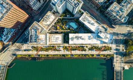
Alameda shoreline. Photo: Maurice Ramirez
In February, the committee submitted an application to the Federal Emergency Management Agency for a $55.5 million grant under the Building Resilient Infrastructure and Communities (BRIC) program to implement the Bay Farm Island adaptation project.
May notes that the project is located in an area with a new FEMA designation, called a Community Disaster Resilient Zone; projects located in these zones are eligible for federal funding of up to 90% of the cost.
“When this designation was announced [last fall] it was a really pivotal moment that made everybody come together to formulate a BRIC grant that would meet the needs of the program.” The Port of Oakland committed $2.6 million, the City of Alameda $1.9 million and the City of Oakland $1 million to meet the 10 percent non-federal share. “This really just shows the true collaboration,” between stakeholders, says Payne.

Trails and bikeways along the Alameda shore will be first to flood with sea level rise. Photo: Maurice Ramirez
In addition to the BRIC grant application, which Payne says she hopes to hear about by summer, the OAAC has submitted a federal Water Resources Development Act request for implementation of the project to protect the tunnels on the Alameda side and Oakland’s Jack London District.
May notes that the committee has been aggressive about pursuing implementation grants while still in the design phase, partly to maintain the trust of the project’s community partners and the public, who could become disillusioned if there is a big gap between concept and implementation.
“I’ve been working on projects like this in the Bay Area for decades, and this one is just so authentic,” she says. The community partners “have a seat at the table and a voice, so keeping up momentum for these projects would be fantastic.”
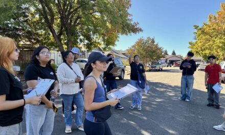
Top Photo: A committee gathering on the waterfront including some community partners. Partners involved in the linked projects will include CASA, Greenbelt Alliance, Hood Planning Group, Ninth Root, REAP Climate Center, and the Sororea Te’ Land Trust. Photo: Maurice Ramirez

