

New Voices Shape Design of Berkeley’s North Basin Strip
While what to do with the vacant East Bay’s Golden Gate Fields site has been in the public eye, a neighboring project — just 20 acres squeezed between the highway and the bay — has recorded an unusually high level of community buy-in.
The site, a quiet border of Berkeley known as the North Basin Strip, was often used by dog walkers, bird watchers, and fisher folk before the East Bay Park District launched a plan to improve its recreational amenities. The remodel will make the urban park more people- and flood-friendly and better connect the hodge podge of public spaces along this stretch of shore.
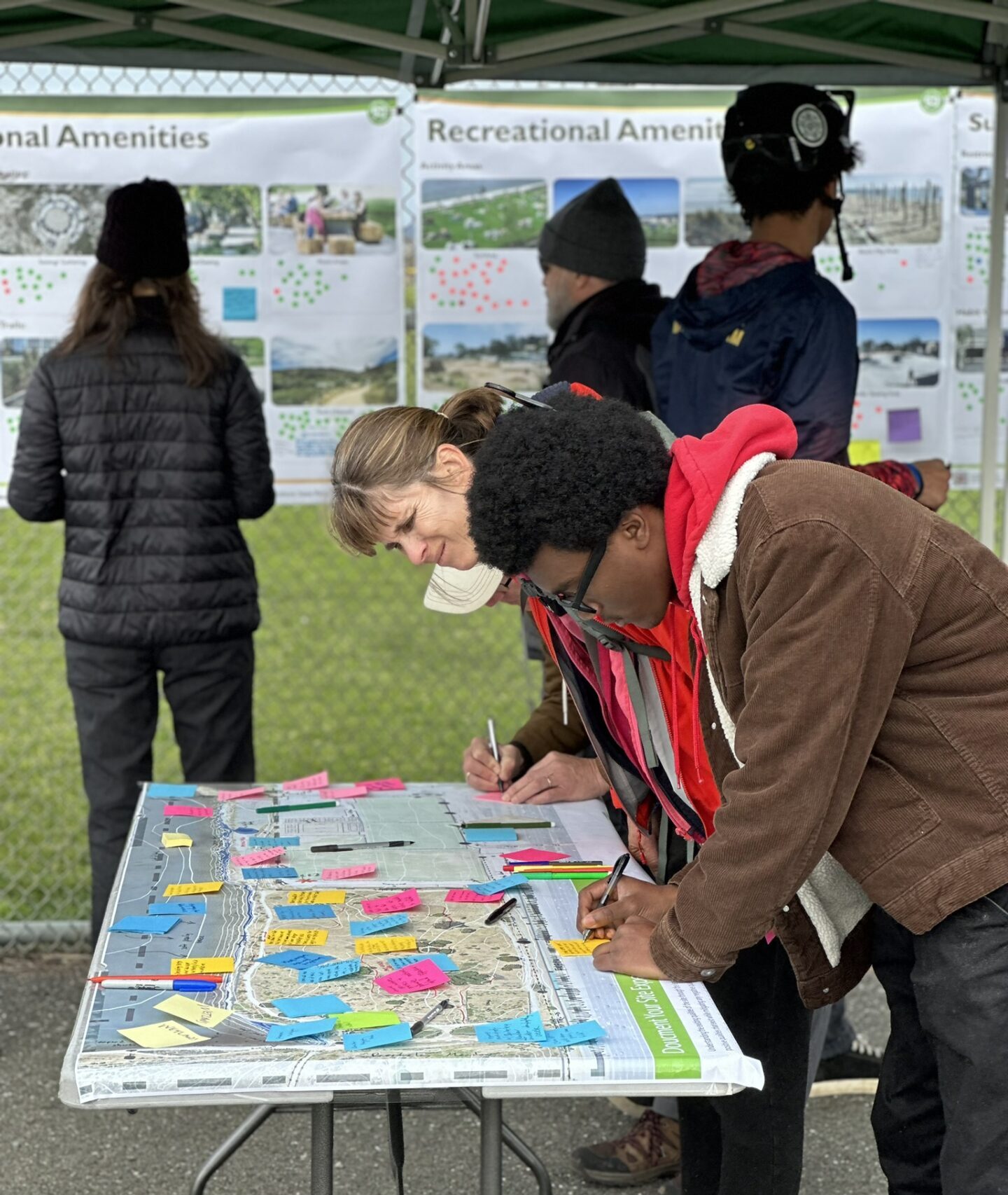
Photo: WRT
“It’s a linchpin, a hub, a really important gateway and transition zone between the Tom Bates sports fields on the north side and the Berkeley Meadow and other parklands in the Eastshore State Park to the south,” says Susan Kuramoto Moffat, a professional planning consultant and Albany resident hired to shepherd neighbors and local organizations in planning for the park upgrades.
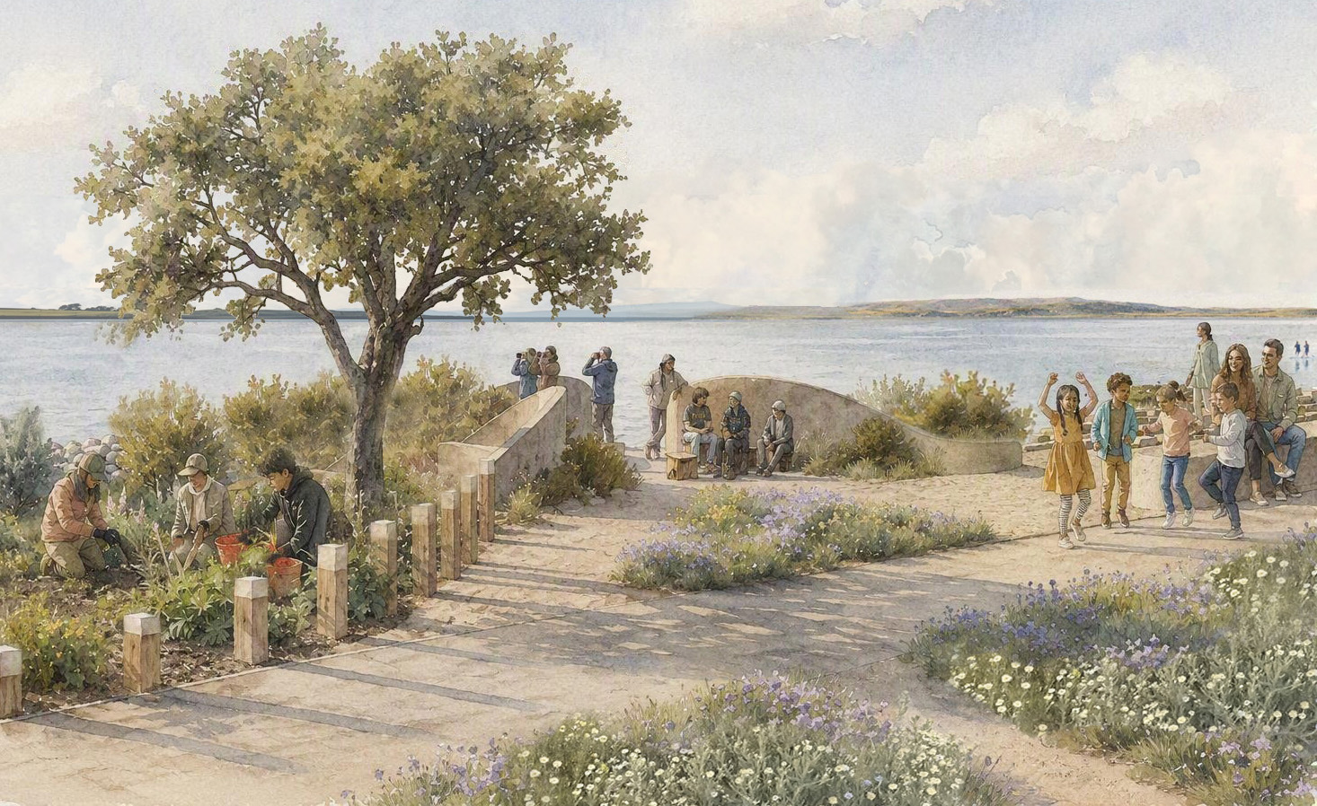
“The people we heard from wanted to be able to enjoy the park even if they weren’t outdoorsy or didn’t own a pair of hiking boots,” she says. That meant places to sit and stare at the Bay, push a stroller or wheelchair, smell the roses, or get a coffee.
“We’ve delivered a community vision that’s coastal resilient through the end of the century,” says landscape architect Peter Trio of design firm WRT.
WRT’s partners in crafting the plan included the environmental engineering firm ESA and two committees, one of underrepresented local interests led by Moffat and one of more established stakeholders like big environmental groups. Both committees participated in planning meetings.
“In the end, the engagement process became the design process, and vice versa,” says Trio.
Design for All
WRT recently produced three illustrations capturing the design vision developed for the North Basin site. From north to south, the revived strip of land starts with an improved promenade along the soccer fields, opens out into a central beach with wading terraces for entering the water, then wraps around the Berkeley Meadow to connect with the marina. Down here at the south end, visitors will find a wilder spot for watching birds and bees. In another area, a bit inland from the shore, teen and adult mountain bikers can practice their skills on a course of paths and jumps interspersed with native plants.
The plan seeks to balance a lot of things: habitat for wildlife, space for sea level rise and marsh migration inland, and amenities like restrooms, picnic tables, and hardscape for roller-skating. According to Trio, the most unique thing about the project was working right at the “intersection” of what shoreline resiliency was traditionally and is today. Historically, it was more about technical challenges and engineering. Today, equity, mental health, community needs, and even brokering partnerships between cities, park districts, and property owners have all become part of the resiliency practice, he says.
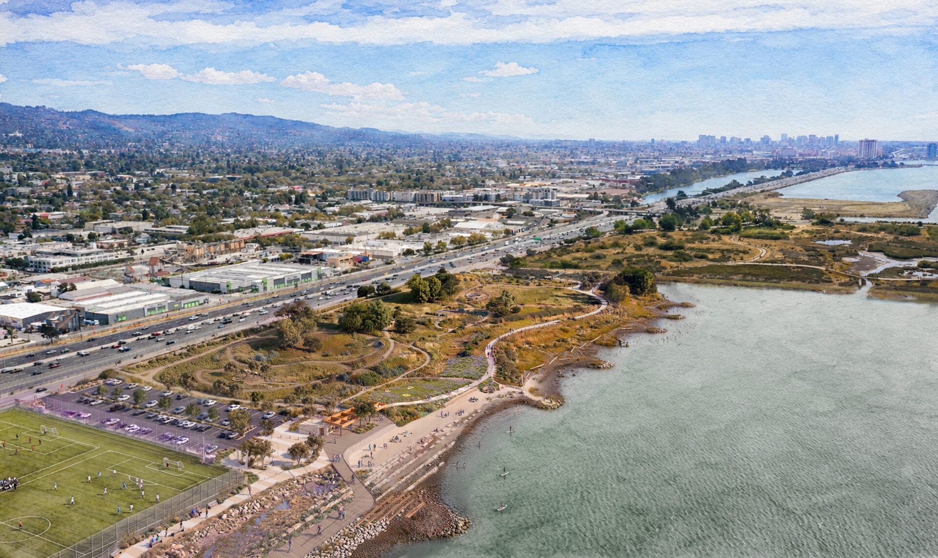
North Basin Park future vision. Art: WRT
In terms of sea level rise, the 20-acre site itself presented some specific challenges, including the culvert at the mouth of Schoolhouse Creek. Early on, creek activists wanted to take the creek out of its concrete casing, but the culvert was already clearly backing up. “Because of its depth, daylighting would literally mean baylighting,” says Trio, meaning the Bay would have rushed in rather than the creek spreading out.
Another design breakthrough was identifying the Berkeley Meadow as a suitable space for future tidal marsh. “It’s the first part of the area already showing signs of saltwater intrusion and groundwater rise, with king tides already causing flooding,” says Trio.
“The meadow is one of the few locations where we have marsh migration space,” adds his WRT colleague Cristina Bejarano, a resilience planner. “This plan helps us make sure we don’t just keep adding riprap to the levee, which would ultimately produce a stranded asset by the end of the century. As sea levels rise, as subsidence continues, we can let that happen and reroute some of the secondary trails through the meadow to make room for it.”
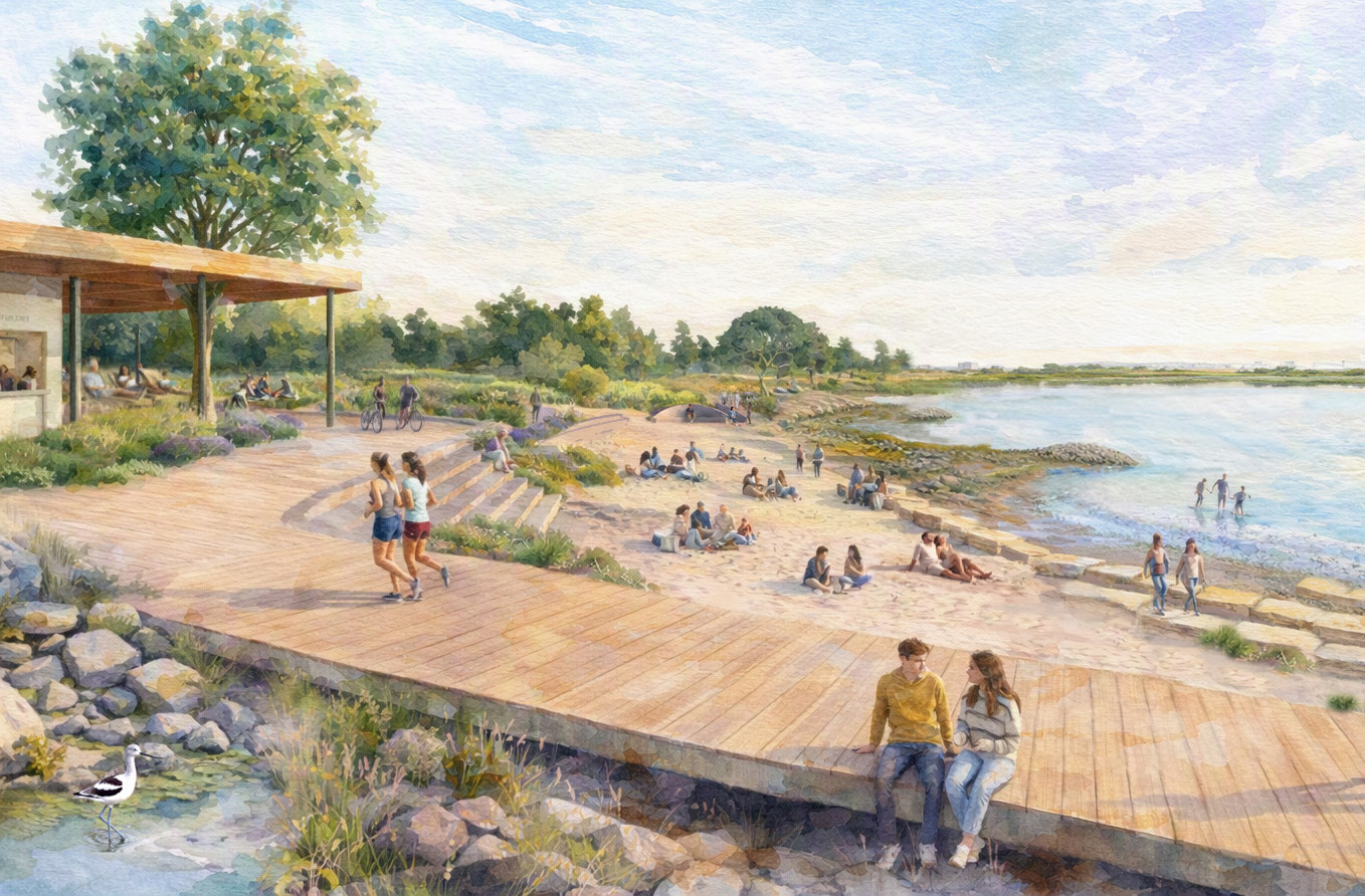
A ‘perched beach’ provides a place for families to gather, and step down into the bay on stone terraces. Boardwalks overlook seasonal ponds used to treat stormwater from the soccer fields, and designed to transition to salt marshes as sea levels rise. Art: WRT
An additional innovation was finding a way to get people to the water, where the elevation wasn’t quite right for a big beach (see above). The resulting “perched” beach sits higher up the waterfront than a natural beach. But it still offers a sandy experience and stone terraces from which visitors can wade, fish, or launch paddleboards.
Just south of these amenities, ESA and WRT designed some mini peninsulas protected by gravel piles, which in time may help build up more beaches.
“It’s one option in keeping with the site limitations, where you can build on the existing topography, and you don’t need as much width. It doesn’t require as much fill to provide a resilient edge, and it’s compatible with natural processes like the wave energy,” says Bejarano.
Tombolos and coarse grain beaches can also be a better choice for a shoreline that is actively eroding than riprap, which many communities now educated about natural shoreline processes have a loud aversion to, according to Bejarano.
“Soft vegetation is able to migrate and colonize these pockets of coarse gravel in a way that they can’t on riprap,” adds Trio.
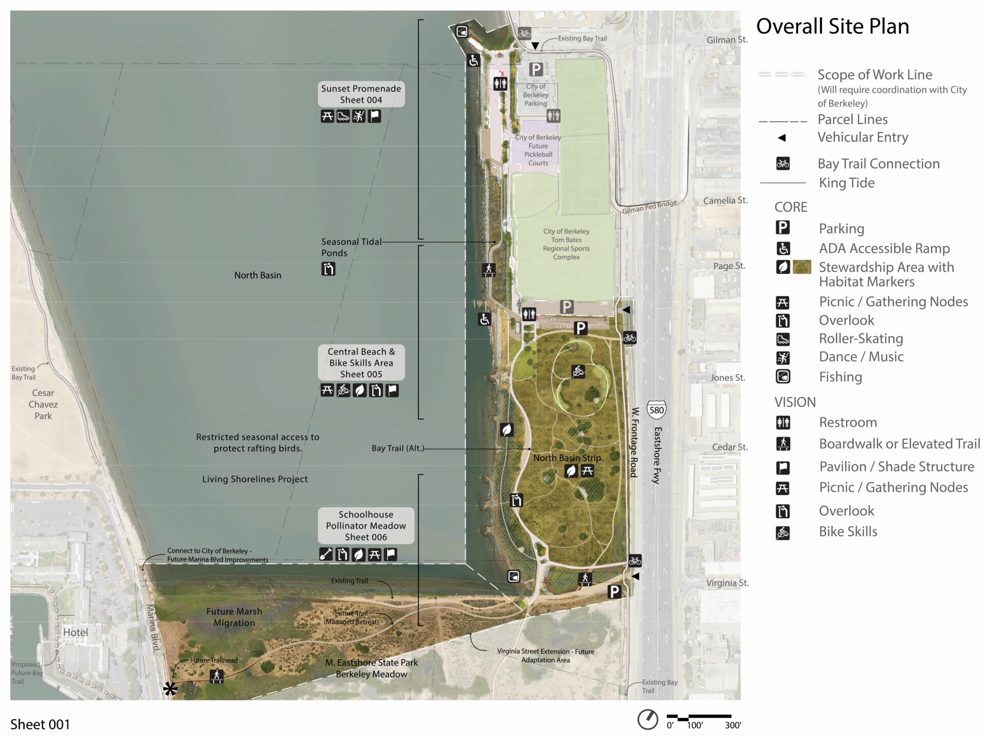
Detailed plan for site features. Map: WRT
Building a Community of Influencers
Back in 2018, the lofty Resilient by Design Challenge was heavily criticized for not building up a vision from the community, instead imposing it from the top down. Since then, Bay Area leaders have learned their lesson, investing heavily in public engagement processes to distill local proclivities, including in the North Basin project.
“The basic principle is that communities who are underrepresented do not want participation. They want influence. They don’t want outreach — they want power,” says Moffat. So instead of just reaching out with invitations to meetings, the project team actively recruited organizations to participate in the process and paid them for their time and transportation. Moffat, who led the effort, also trained participants in how to influence public decision-making, and took them on field trips with the WRT team to educate them about the project site.
The result was the New Voices Partnership, which included 20 participants from 10 organizations (ranging from Latino Outdoors and Friends of Five Creeks to artists, birders, and bikers with disabilities). Meetings looked very different than they had for other projects Moffat had worked on previously.
“There were more young people, more people of color, more people with disabilities,” says Moffat. “As a result, the public meetings were friendlier, more open, more congenial. People came with fresh eyes and a sincere interest in a good outcome for everyone at the table.”
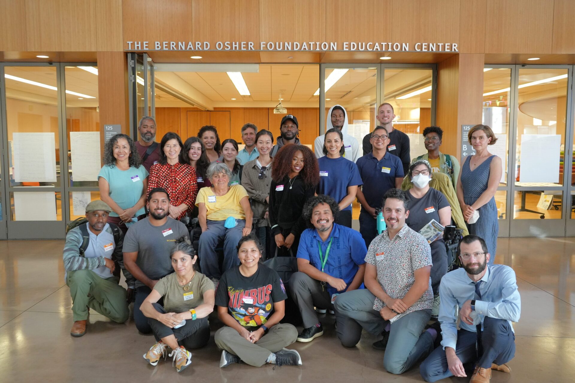
Members of the New Voices partnership, with Susan Moffat in red shirt. Photo: WRT
The new voices had lots to say. They didn’t just want just another trail to the shore or more bird habitat, like traditional advocates at park planning meetings. “They wanted social spaces, spaces for comfort, quiet places to de-stress, picnic areas and food truck parking, low barriers to entry. Some participants felt uncomfortable in local parks because park or city police, and even other visitors, could be unwelcoming,” she says.
They also wanted lots of signage. “It’s not enough for a park to be accessible. You have to know that where you are headed, your wheelchair won’t get stuck,” Moffat says.
She sees the project as part of a larger vision for the entire Eastshore State Park and City of Berkeley efforts to improve the sports complex, which 500,000 players and visitors use every year. “When North Basin is built, a parent leaving one kid at a soccer practice could take their other kid to the new park right across the parking lot,” she says. “That’s a big positive.”
“A beautiful outcome of this project was new voices and legacy voices finding shared values,” adds Trio.
Navigating the Process
Despite wins for urban recreation, projects involving so many partners with passionate opinions can be a headache in terms of reconciling hopes and fears. ESA, for example, wanted to try new things like reshaping the shore, but East Bay Parks felt the uncertainty of disturbing old landfill was a risk not worth taking.
“We were caught in the middle trying to strike that balance,” says Trio.
Bayfill of all shapes, sizes, and history promises to continue to complicate matters for sea level rise adaptation, however. As old fill is eroded and flooded, contaminants and the associated liabilities will surface. Likewise, new fill may need to be imported to keep elevations above ground. Even if the new fill comes from an upland construction site or “clean” (water quality vetted) dredged material, the uncertainties make even a big landowner like East Bay Parks nervous. That’s because there are so many rules around excavation and fill in the intertidal zone of the Bay overseen by the SF Bay Conservation and Development Commission and the U.S. Army Corps of Engineers. While both have updated their fill regulations in recent years, they haven’t evolved at the same pace as design innovation for sea level rise adaptation along the bayshore.
“If you were to try to permit any of our original project vision today, like carving up the landscape and building a nature-based solution like an ecotone slope instead of a seawall, it would still not be possible. That’s the harsh reality,” says WRT’s Bejarano.
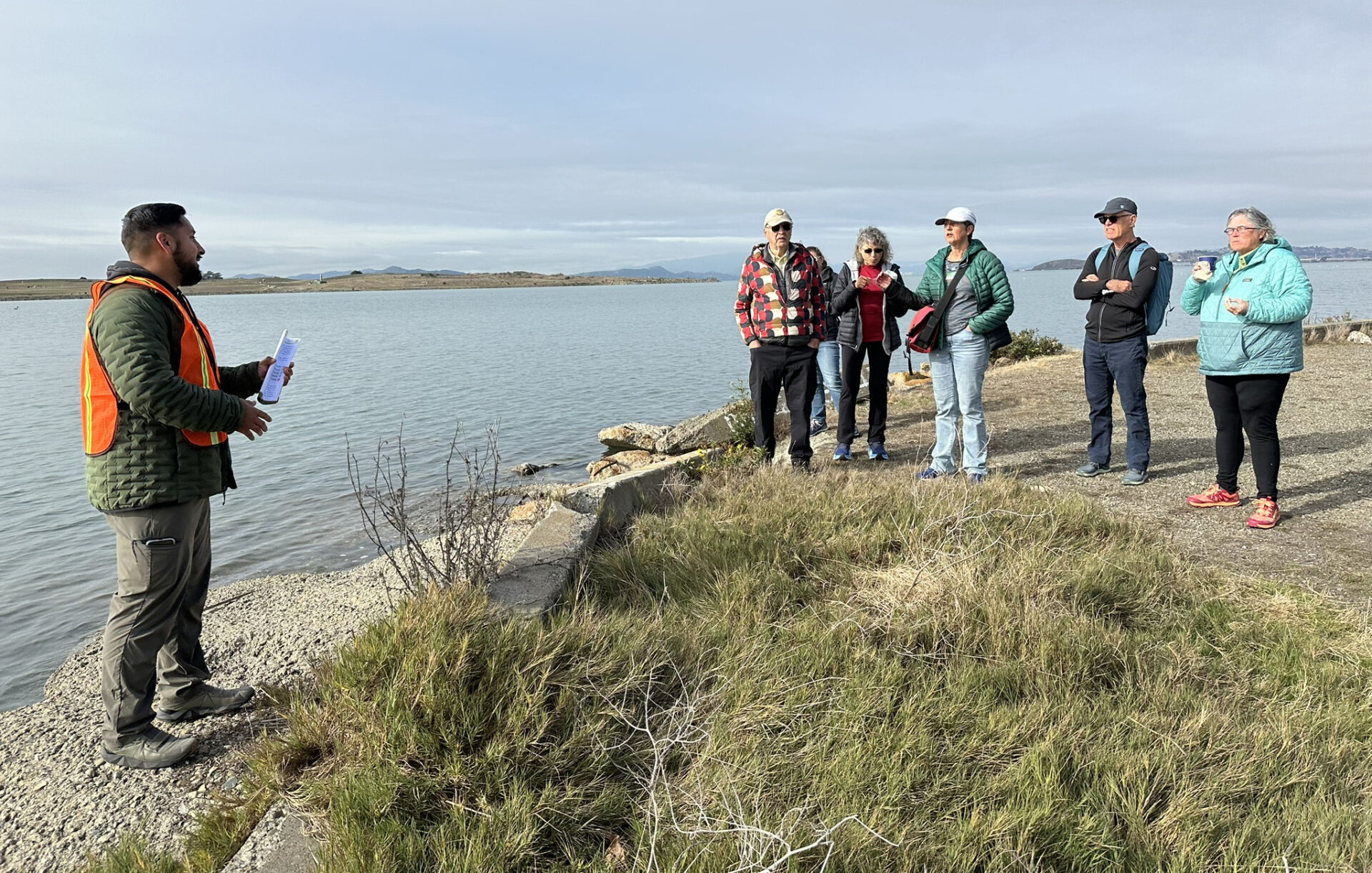
North Basin today is a quiet place lined with rip rap. Photo: WRT
The project did benefit from early consultation with regulators through the BRITT (Bay Regulatory Integration Technical Team), which offers advice from five different federal and state agencies all in one. “There was a lot of knowledge sharing that helped inform our design,” says Bejarano.
More consideration for regulations is coming down the pipeline, meanwhile, as property owners along the entire East Bay shore must produce subregional shoreline adaptation plans to address rising sea levels (RSAP) by 2034.
While North Basin’s legwork will help inform subregional planning, the project currently remains in the wind, even though, as parks with diverse offerings go, the projected price tag for completion isn’t that expensive: just $25 million. The good news is the board of East Bay Parks approved the conceptual design this spring. The bad news is the project must still rise to the top echelons of the district’s priority list.
“At a time when everyone is talking about the high-profile Golden Gate Fields site,” says Moffat, “the North Basin Park offers a smaller scale, less controversial testing ground for experimental design of transition zones between protected habitats and urban recreational spaces, and how humans can be involved in stewardship.”