


How Two Rivers Could Rescue Sinking Beaches and Marshes
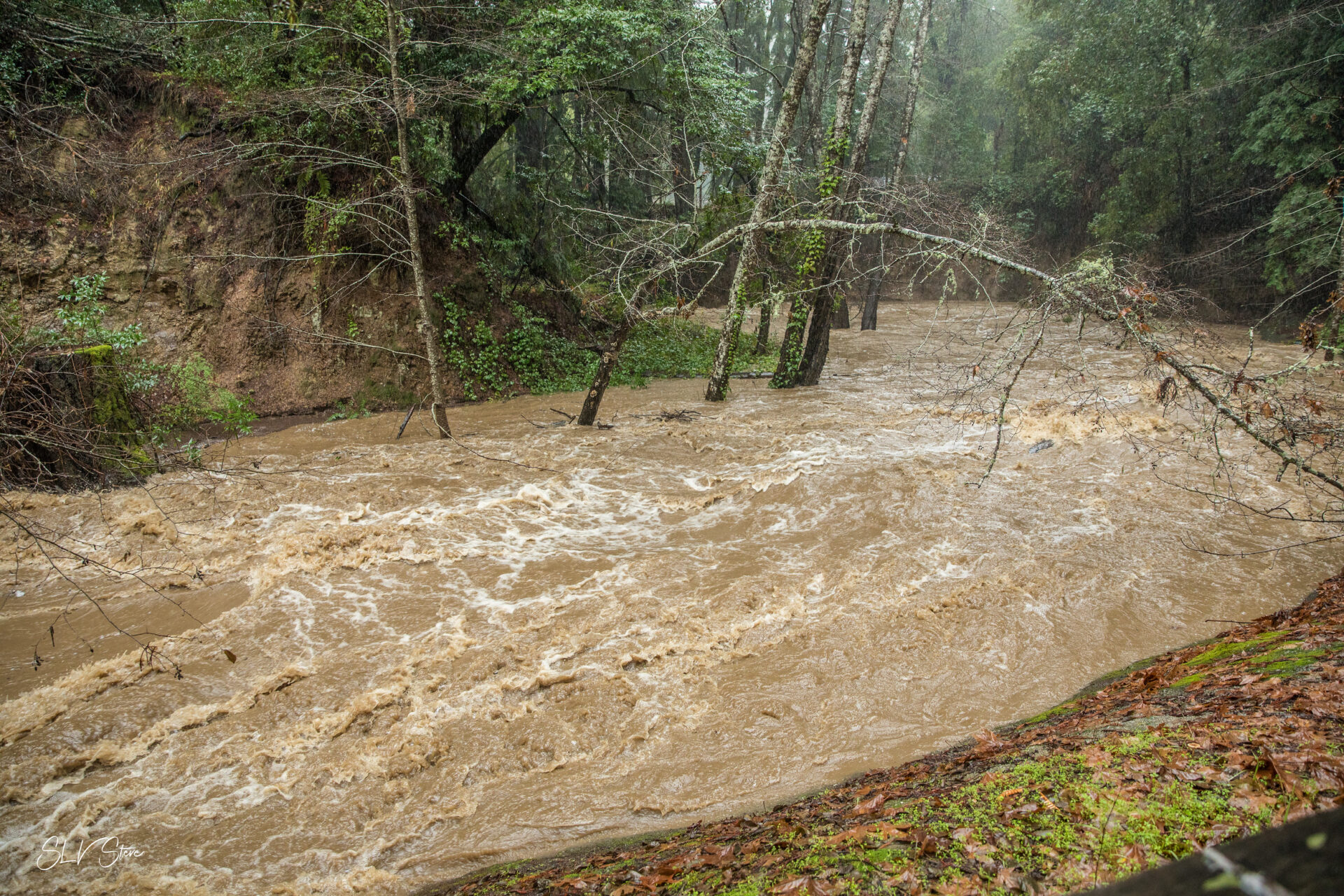
San Lorenzo River swollen with sediment-laden water post storms. Photo: Steve Kuehl
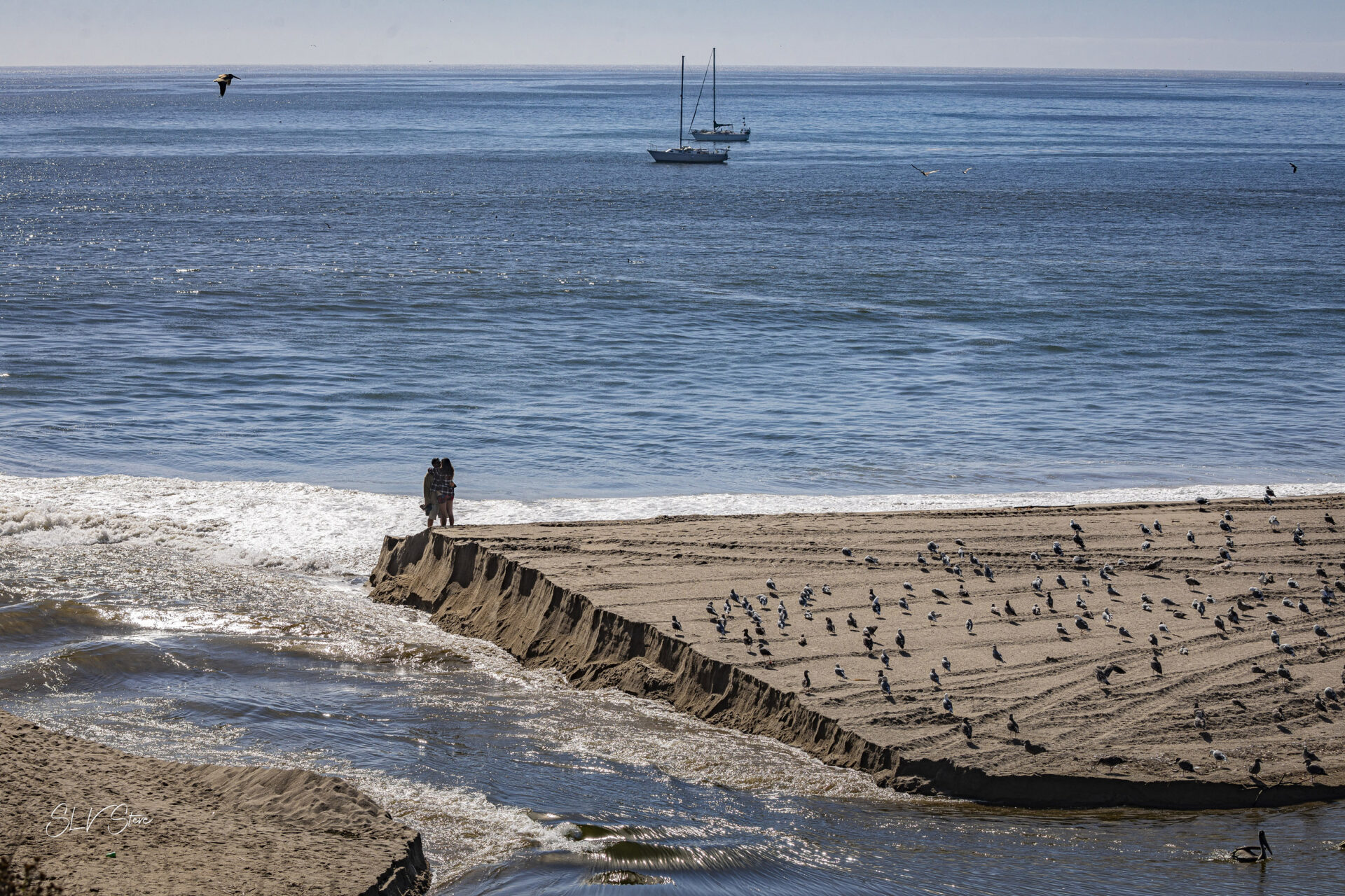
On the west side of the mouth of the San Lorenzo River, where it flows into Monterey Bay, sits the oldest amusement park in California — the 118-year-old Santa Cruz Beach Boardwalk. The only barrier between the Boardwalk and the sea is Main Beach, which, at less than 100 feet wide in some spots, is vulnerable to sea level rise — like so many other beaches and wetlands in the Bay Area.
But in this case, the San Lorenzo River has been giving the beach a much-needed and all-natural boost. Researchers with the U.S. Geological Survey have found that flooding events during particularly wet years result in the river sending loads of beach-building sediment to Santa Cruz, giving the dwindling Main Beach an elevation boost that lasts for three or four years before it starts to wane again.
Their study, published in Geophysical Research Letters earlier this year and first covered by KneeDeep in January 2024, is one of a handful of similar efforts in the San Francisco Bay Area examining the movement of mud, clay, silt, and sand through watersheds to better understand how to prepare for and benefit from sediment transfer to shorelines and coasts that need to bulk up.
“We want to come up with these management sweet spots where we’re doing right by the watershed and we’re also doing right by … our marshes and our mudflats,” says Scott Dusterhoff, senior scientist at the San Francisco Estuary Institute.
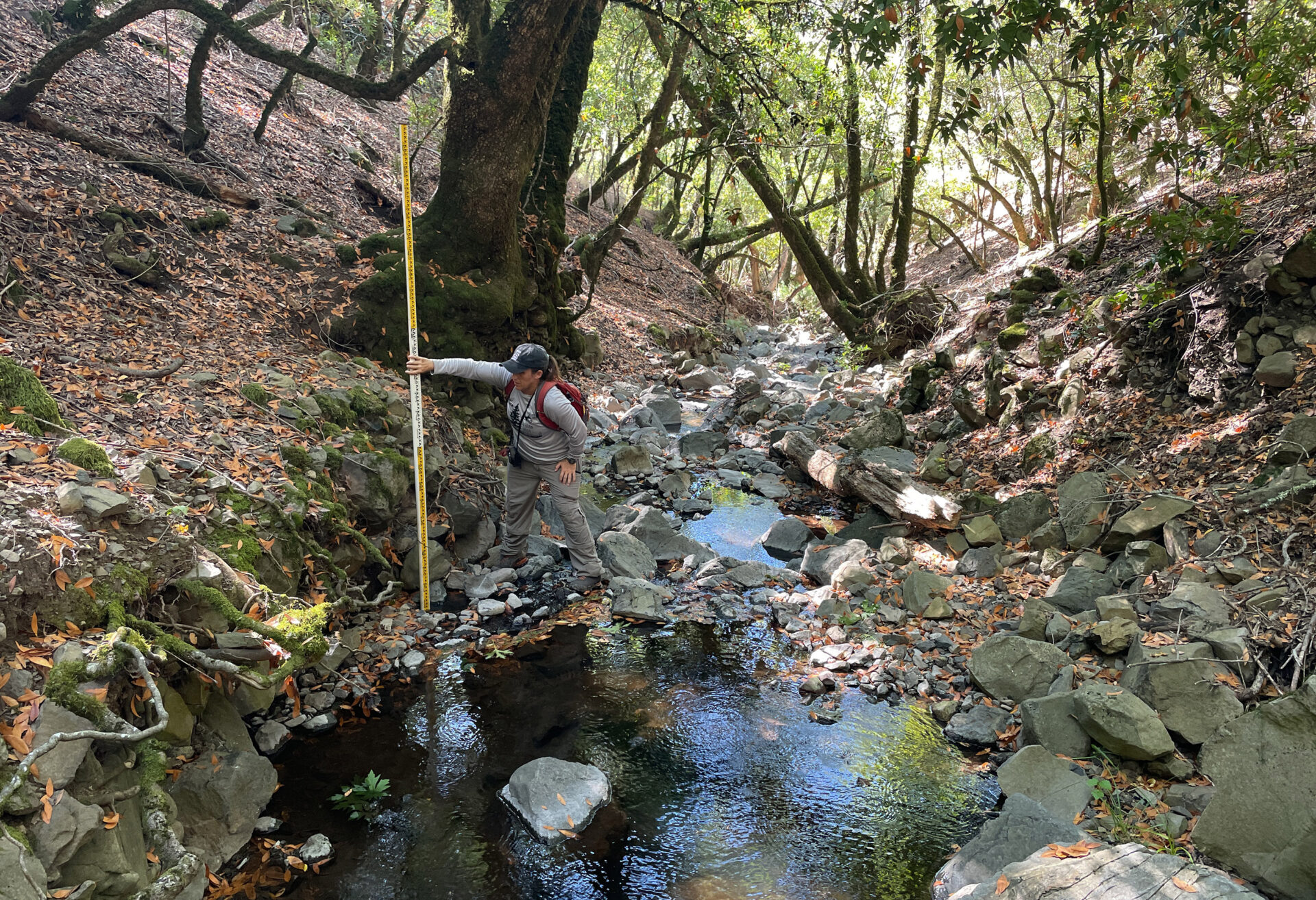
Field measurements of channel height in the Petaluma River watershed. Photo: SFEI

SPECIAL SERIES
EXTREMES-IN-3D
FOLLOW UP STORY
As the climate continues to change, scientists say extreme weather events will only become more frequent and more severe. Protecting coasts, beaches, and marshes from increased erosion and flooding exacerbated by sea level rise can’t be done with concrete and human engineering alone. Careful management of watersheds and sediment transfer can help avoid catastrophes, according to Dusterhoff.
“We know that letting nature do the work for us is always going to be the cheapest option,” he says. “Those are the types of processes that we are trying to reestablish in many areas around the region right now.”
A River-Fed Beach
The 29-mile long San Lorenzo River stretches from the Santa Cruz Mountains south to Monterey Bay. More than 41,000 people live in the 137 square mile watershed, and thousands more are affected by the river’s transport of sediment to the Santa Cruz shoreline.
USGS geologist Amy East and her colleagues have been studying this small but mighty river for nearly 20 years. Since 2008, they’ve been collecting water and sediment samples during every major storm or flood event.
Their data set is unique, she says, because most people don’t “have the luxury” of getting data in the middle of a storm. “But we do, because Andy will go out there.”
Whenever a storm hits, East’s colleague Andy Ritchie suits up in his rain gear and heads to a pedestrian bridge about a mile upstream of the river mouth. Once there, he collects water samples every 30 minutes.
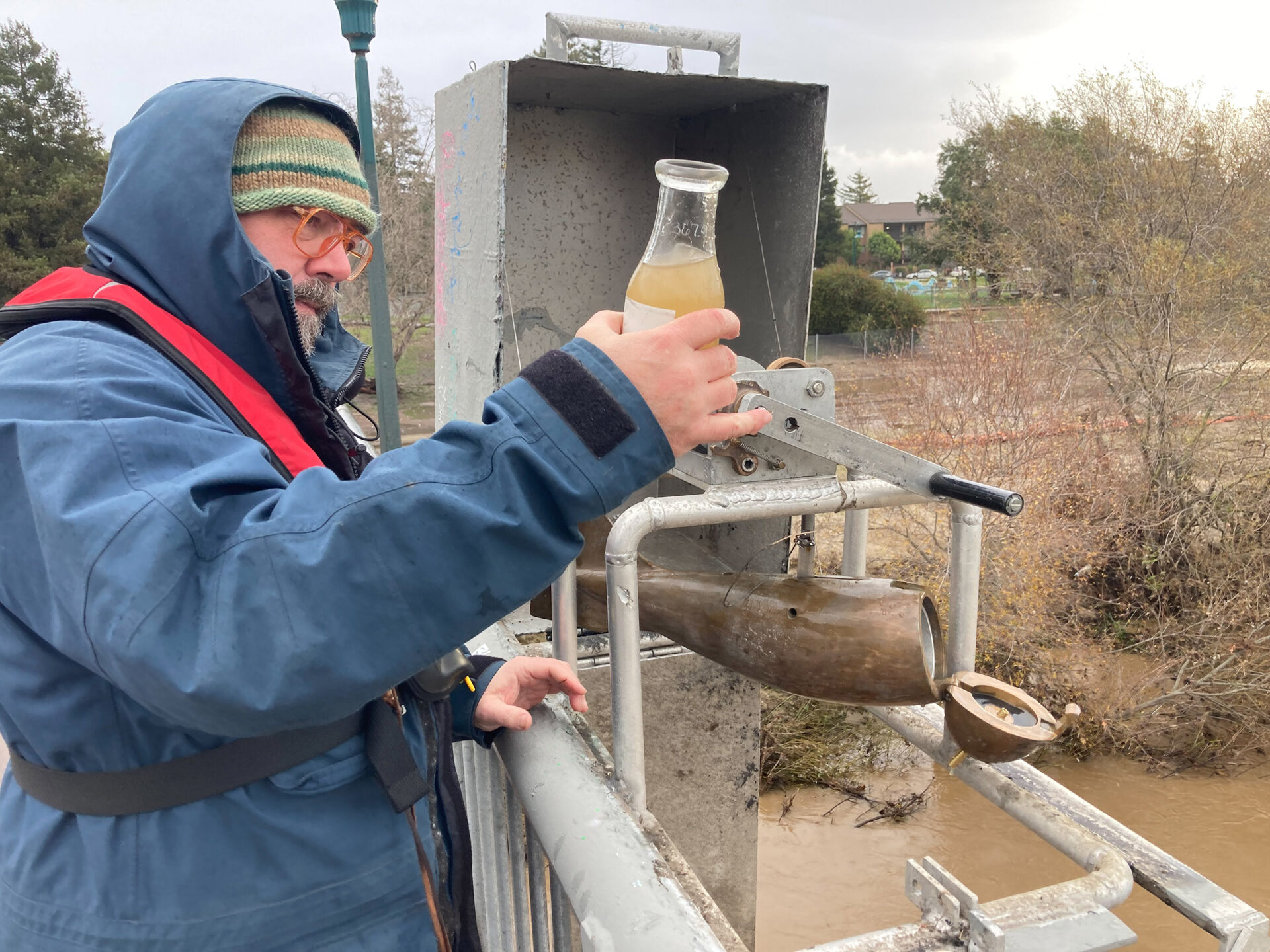
Andy Ritchie braving the weather. Photo: Peter Pearsall
“In the middle of the night, when it’s pouring rain and it’s windy … he’s out there collecting these samples,” East says.
Attached to the bridge railing is a metal box housing a torpedo-shaped brass sampler weighing about 60 pounds. Inside the sampler is a one liter collection bottle. The sampler is hooked up to a winch used to lower the sampler to the riverbed and haul it back up.
After collecting several hundred samples from more than 20 flooding events over the years, the researchers began to notice a trend. They found that later in years with extreme rainfall, like 2017 and 2023, the river was not only carrying a higher amount of sediment to the coast, but also a much higher proportion of beach-building sand than compared with normal rainfall years.
That means in really wet years, enough large sediment flowed down the river to the coast that the beaches grew and stayed wider for four or five years, which helps beaches better withstand sea level rise and increasingly brutal storms. Beach build-up has beneficial economic impacts, too, as it provides valuable recreation space for people to enjoy.
San Lorenzo River carves up beach in 2024. Photo: Steve Kuehl
Although an extremely rainy year can be good for the beach, it also comes with a different set of environmental risks, such as flooding and landslides. Plus, extra sand coming from the river mouth also comes with extra work. For instance, the harbor mouth, only a half-mile from the river mouth, requires much more dredging work during and after extreme wet years due to sand build-up.
Another potential downside of increased sand, East says, is that it may cause many of the creatures close to shore to struggle a bit, at least temporarily, because they’re better adapted to what is normally a rocky shoreline.
The researchers found that in the years following the sudden beach boost, the extra sand gradually disappeared to the point where the beach reached its previous size after about four or five years.
East is certain this is happening in other areas, but “we’re not aware of any other data sets that are detailed enough to show it,” she says. The team attempted to compare their results with data sets from the Eel River in northern California and the Santa Clara River, but the data collected from those other locations isn’t nearly as thorough as what East and her team have from the San Lorenzo River.
Findings of the 2025 USGS study showing sediment and sand transfer to Santa Cruz waterfront beaches. Source:USGS
Sediment Solutions
Further north, in the San Francisco Bay, Dusterhoff and his colleagues at SFEI are similarly working to find out how sediment transfer can help save disappearing marshlands and mudflats without destroying the watershed. If the bay or ocean is going to get higher, the shoreline has to as well. So where will that material come from?
Understanding how sediment moves through the watershed will help us better predict how creeks, rivers, and shorelines are going to respond to a changing climate and rising sea level, Dusterhoff says.
Their EPA-funded project, called Sediment Solutions, aims to answer three key questions:
- Where, when, and how does the sediment move?
- What will sediment transfer look like in various climate scenarios?
- What management actions will result in the greatest sediment transfer benefits?
Estimated annual sediment yield from each major tributary in the Petaluma River watershed. Map: SFEI
In April, the SFEI team published a report describing the amount and source of sediment entering the watershed of the Petaluma River, which is 18 miles long and flows from the Sonoma Valley into San Pablo Bay. The researchers found that sediment in this river comes mainly from four sources: channel bed/bank erosion, soil creep and sheetwash, landslides, and road-related erosion.
Now, the researchers are incorporating the data they’ve gathered into models.
The final piece of the puzzle is figuring out how to manage channel systems and banks to direct sediment supply via erosion and water flow to where it’s needed most, Dusterhoff says. That includes understanding what large storms “can do for us with respect to delivering sediment and getting it where it’s needed,” he says, whether that’s bolstering a threatened beach, as the San Lorenzo River does, or building up a sinking marsh or mudflat.
Estimated annual sediment yield from each major tributary in the Petaluma River watershed. Map: SFEI
The Institute’s sediment assessment is set to finish up by this coming spring. The team has also started investigating the same questions in the San Tomas Aquino Creek Watershed in the South Bay.
As the rate of sea level rise is predicted to increase, it’s imperative that we prepare our landscapes now, Dusterhoff says.
“By no means will we have it all worked out, but at least we can set up our landscape to be resilient.”
![]() The story is a follow up to another in KneeDeep’s Extremes-In-3D series.
The story is a follow up to another in KneeDeep’s Extremes-In-3D series.
Series funded by the CO2 Foundation.
