
ADAPTATION ATLAS
Nature-Based Climate Adaptation Opportunities
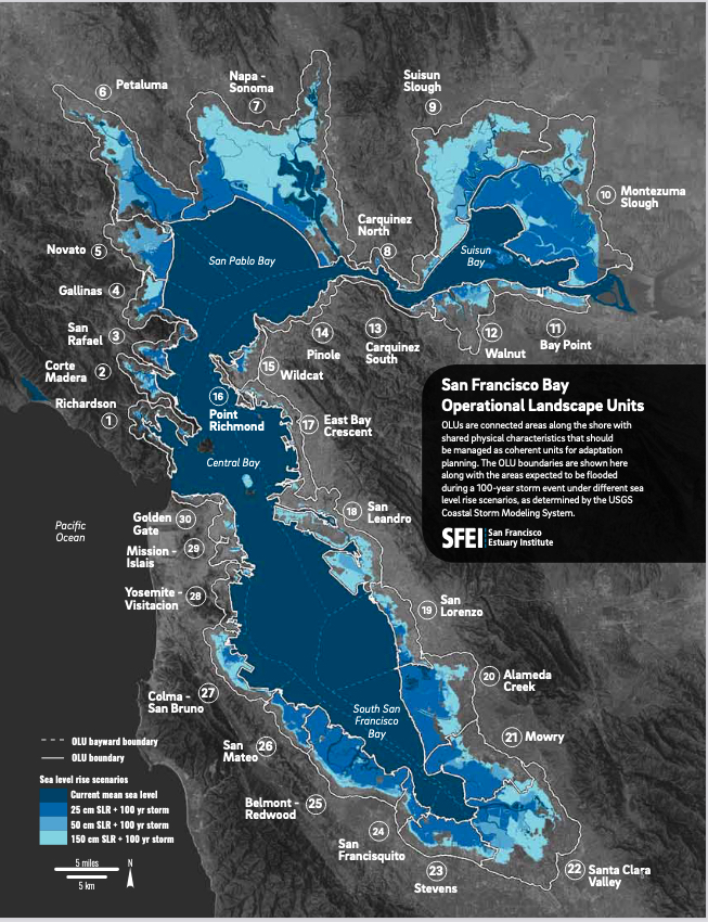
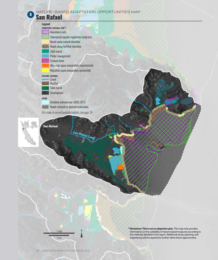
To help planners and citizens wrap their head around what to do next in terms of “nature-based” solutions (rather than seawalls) to sea level rise, scientists and planners came up with 30 places to focus around the Bay’s 400-mile shoreline.

In this Adaptation Atlas, scientists and planners identify 30 distinct operational landscape units (or OLUs) that share common physical characteristics. It is in these places, say the experts, we should invest in natural resilience because the units make sense in terms nature’s boundaries, rather the jurisdictional boundaries crisscrossing them with county lines and zoning limits.
MORE ABOUT THE ATLAS
The atlas uses Operational Landscape Units (OLUs) as a practical way to manage the physical and jurisdictional complexity of the shore, where there is no one-size-fits-all solution to rising sea levels.
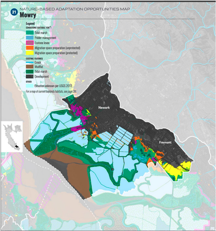
A key purpose of OLUs is identify where nature-based approaches (such as beaches, marshes or subtidal reefs) will work best and create multiple benefits. The atlas explains its science-based framework, describes more than 25 possible adaptation measures suitable to be deployed around the Bay, and provides opportunity maps for 30 specific OLUs in places ranging from San Rafael to Pinole to Colma and the Santa Clara Valley. The atlas also discusses some nitty gritty policy, regulatory and financial adaptation approaches.
Read KneeDeep Stories Related to the Atlas