


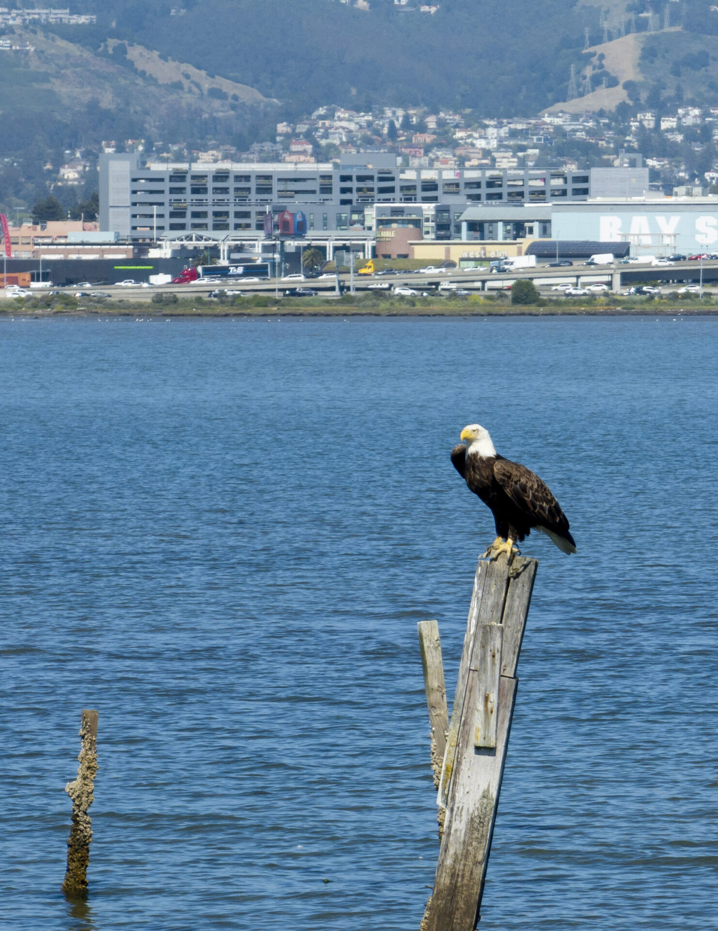
Emeryville Crescent is a birdwatcher’s favorite. Photo: Karl Nielsen
Saving Two Marshes From the Squeeze
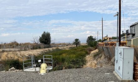
The ribbons of marsh squeezed between the Bay and the highways that skirt its edges are living relics of California gold mining history. Everyone who has ever been in a traffic jam by the Bay will have noticed these green fringes, brown mudflats, and shallow waters merging into deep. Today, at locations in the East and North Bay, they are also the focus of intense efforts not just to save and restore critical wetland habitat, but also to protect the highways themselves from rising seas and bigger storms. Two particular projects, one scheduled to start construction in the next few years along State Route 37 and one now being planned near the Bay Bridge toll plaza, could help protect thousands of acres of centennial marshes. “These marshes are just disintegrating, there’s nothing to hold the sediment together, and [the worry is that] the whole marsh platform will come apart,” says water board planner Christina Toms.
FULL READ
Saving Two Marshes From the Squeeze
The ribbons of marsh squeezed between the Bay and the highways that skirt its edges are living relics of California’s gold mining history. Today, at locations in the East and North Bay, they are also the focus of intense efforts not just to save and restore critical wetland habitat, but also to protect the highways themselves from rising seas and bigger storms.
“None of these marshes were here 100 years ago,” says watershed planner Christina Toms of the San Francisco Bay Regional Water Quality Board. And with continued erosion, poor drainage, and sea level rise, they might not be here 100 years from now, either.
Two particular projects, one scheduled to start construction in the next few years along State Route 37 and one now being planned near the Bay Bridge toll plaza, could help protect thousands of acres of centennial marshes.
Why These Marshes are Different
Starting in the late 1800s, sediment from hydraulic gold mining poured out of the Sierra Nevada through the Estuary and began to accrete along the bayside levees that were built to reclaim the Bay’s millennial tidal marshes for agriculture and urban development. During the late 19th and early 20th centuries, says Toms, “well over 90% of the Bay’s historic marshes were levied off and reclaimed. A tremendous amount of the tidal marsh that persisted throughout the 1900s was this centennial marsh [also called strip marsh] which helped buffer a little bit of the wetland loss.”
Over time, roads and highways were built along the landward side of these marshes. The original State Route 37, for example, was a toll road built in 1928 on top of a natural berm along the northern end of the Bay. Over the next 50 years or so, roughly 3,000 feet of marsh formed outboard of the road. At the same time, the roads and highways became a hard edge preventing the natural migration of marshes inland to escape rising seas.
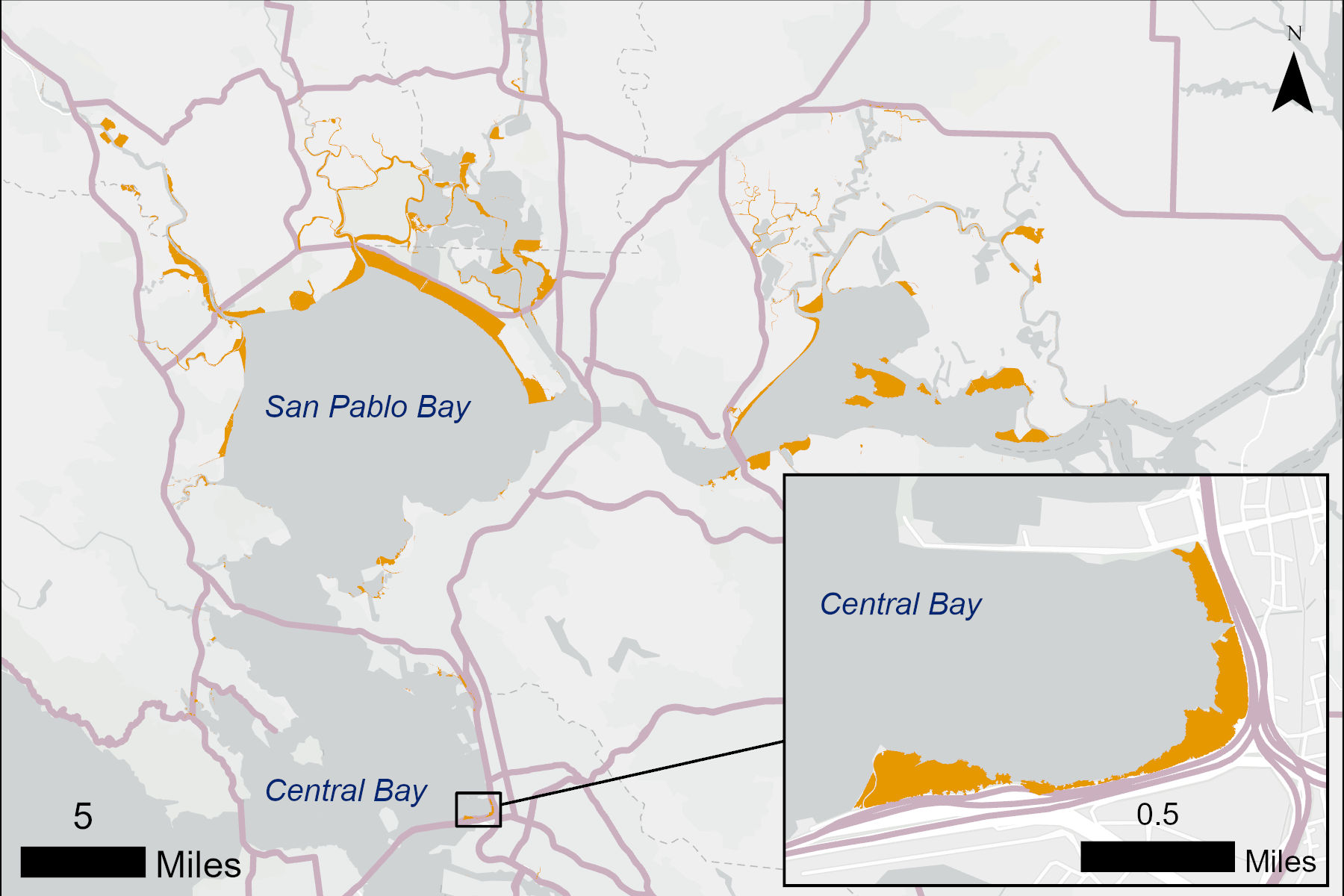
Centennial marsh extent in the Central Bay (including Emeryville Crescent) and the North Bay analyzed for the Wetlands Regional Monitoring Program. About 20,000 acres remain baywide according to available data (see MORE below). “Centennial” roughly refers to marsh formation over a 100-year-period, as compared to “millennial” marshes formed over thousands of years. Source: SFEI, Esri, TomTom, Garmin et al
As dams were built on California’s mighty rivers in the 20th century, the sediment that fed the marshes was trapped behind them, and no longer makes its way to the Bay. As a result, marsh edges are eroding at locations all around the Bay.
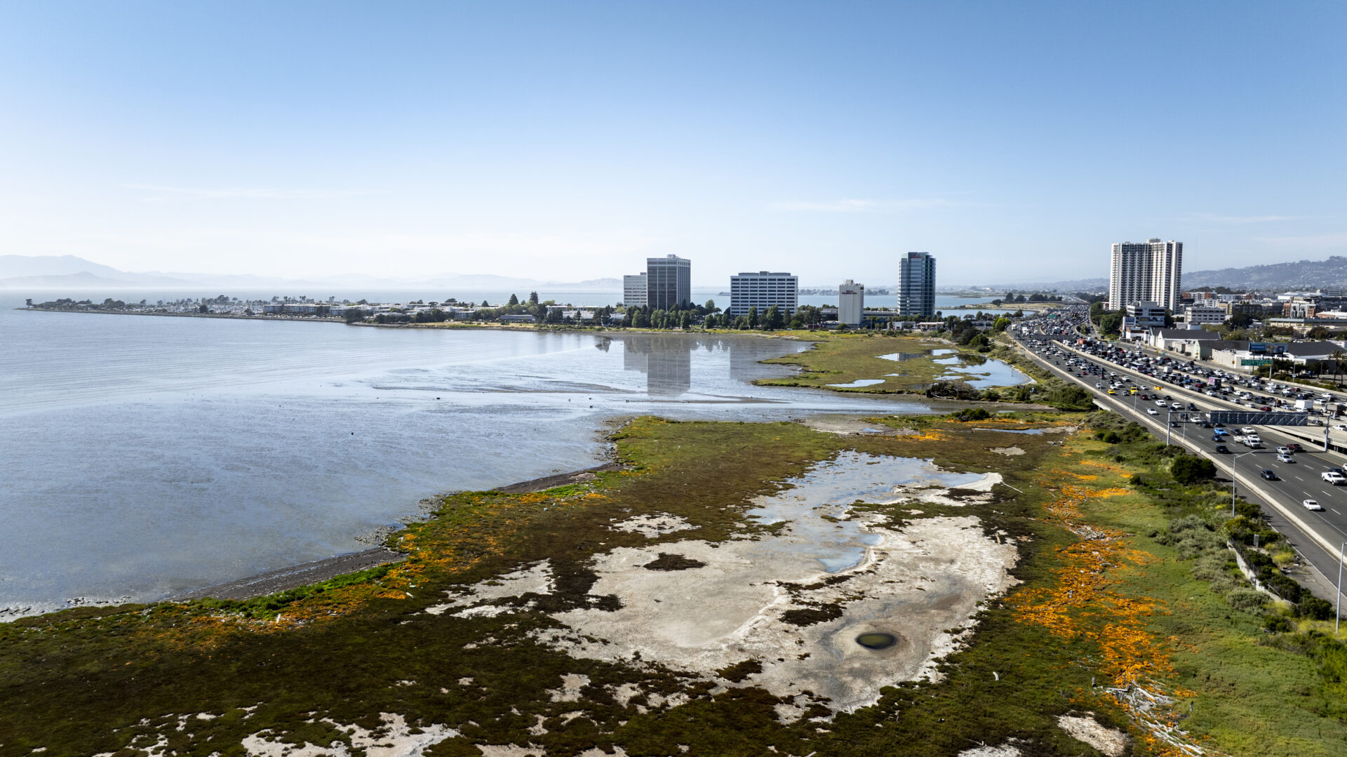
But erosion at the edges is not the only threat to these marshes; they are also facing an enemy within. The Bay has seen eight to nine inches of sea level rise over the last century, says Toms. Because the marshes at Strip Marsh East and the Emeryville Crescent were built by wave deposition of sediment, as opposed to tidal deposition, “the interior of these marshes, which are older, is lower than the exterior. The upper edge got higher and higher because sea levels were going higher and higher.”
The result is the formation of pannes, areas of the marsh where water that enters during a big high tide or a storm cannot get out, drowning wetland vegetation. When the water eventually evaporates during the summer, it leaves behind barren mud flats and hypersaline soils.
Pannes in Emeryville Crescent. Photo: Karl Nielsen
“These marshes are just disintegrating through these two different mechanisms, [erosion and panne formation],” says Toms. “The concern is that, should the eroding edge meet the interior of the marsh that’s lost its vegetation, there’s nothing to hold the sediment together, and the whole marsh platform will come apart.”
Rescuing the marshes will mean stopping erosion at their edges and improving drainage in the pannes so the vegetation can recover and the marsh can survive sea level rise.
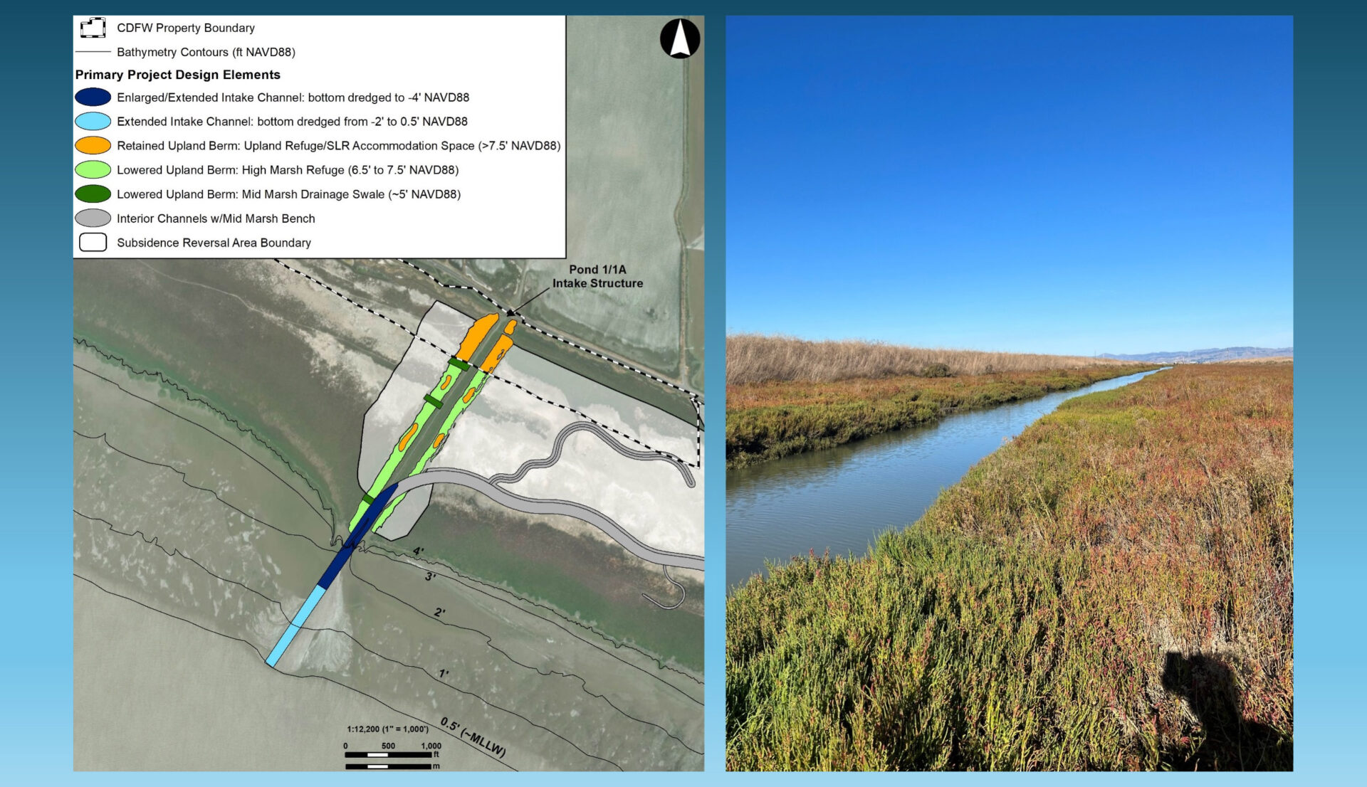
Strip Marsh East on State Route 37
Strip Marsh East is the focus of a restoration effort tied to a long-term, multi-agency plan to improve the entire length of State Route 37.
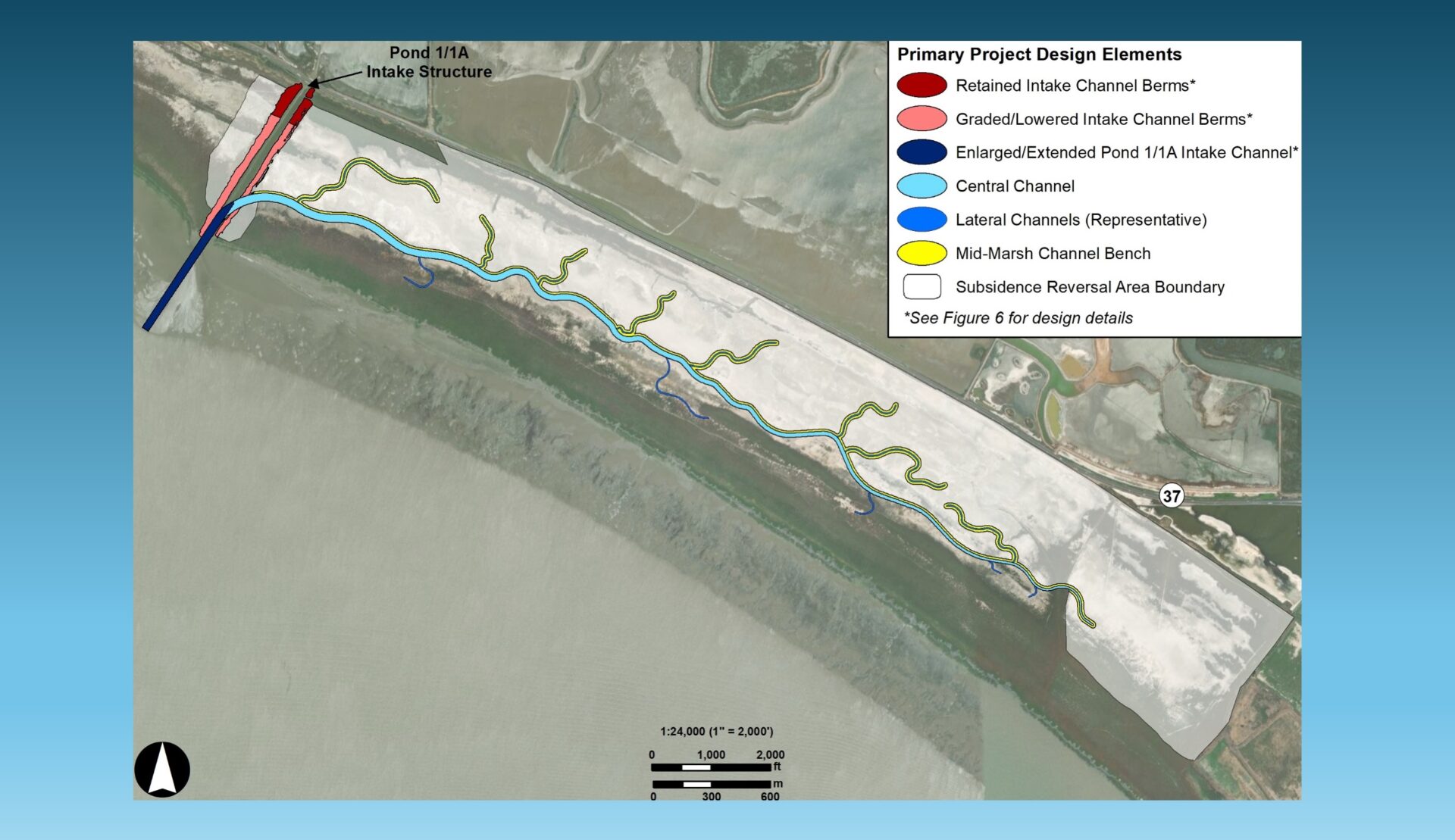
“At Strip Marsh East, we’ve lost 900 acres of vegetated marsh over the last 15 years,” says Toms. Restoration plans call for several strategies to improve drainage and restore daily tidal exchange to the remaining acres.
“The main thing is to dig a huge channel down the middle of the marsh, so it goes from ponding water for three to six months at a time, to holding water for a few days at a time,” says project lead scientist Stuart Siegel. Smaller channels will connect to the Bay. “All the dirt that we dig out from the channel will be used to backfill the areas that have subsided over the past 20 years or so,” adds Siegel. The project is also mapping and analyzing the shoreline to determine what kind of stabilization is needed.
Emeryville Crescent & the Toll Plaza
At Emeryville Crescent, the situation — and possible solutions — are still being evaluated.
“Everybody has an opinion about the future of the Crescent,” says Heidi Nutters, assistant director of the San Francisco Estuary Partnership. “There’s a lot of public access, and people like to walk there. Bird watchers love it. There’s really sensitive habitat. And it’s highly threatened by sea level rise.”
The Bay Bridge toll plaza, which sits next to the marsh, is already subject to minor flooding during extreme weather events, says climate adaptation planner Cody Hedges of Caltrans; as the climate warms, those events will become more frequent, and flooding will become more severe.

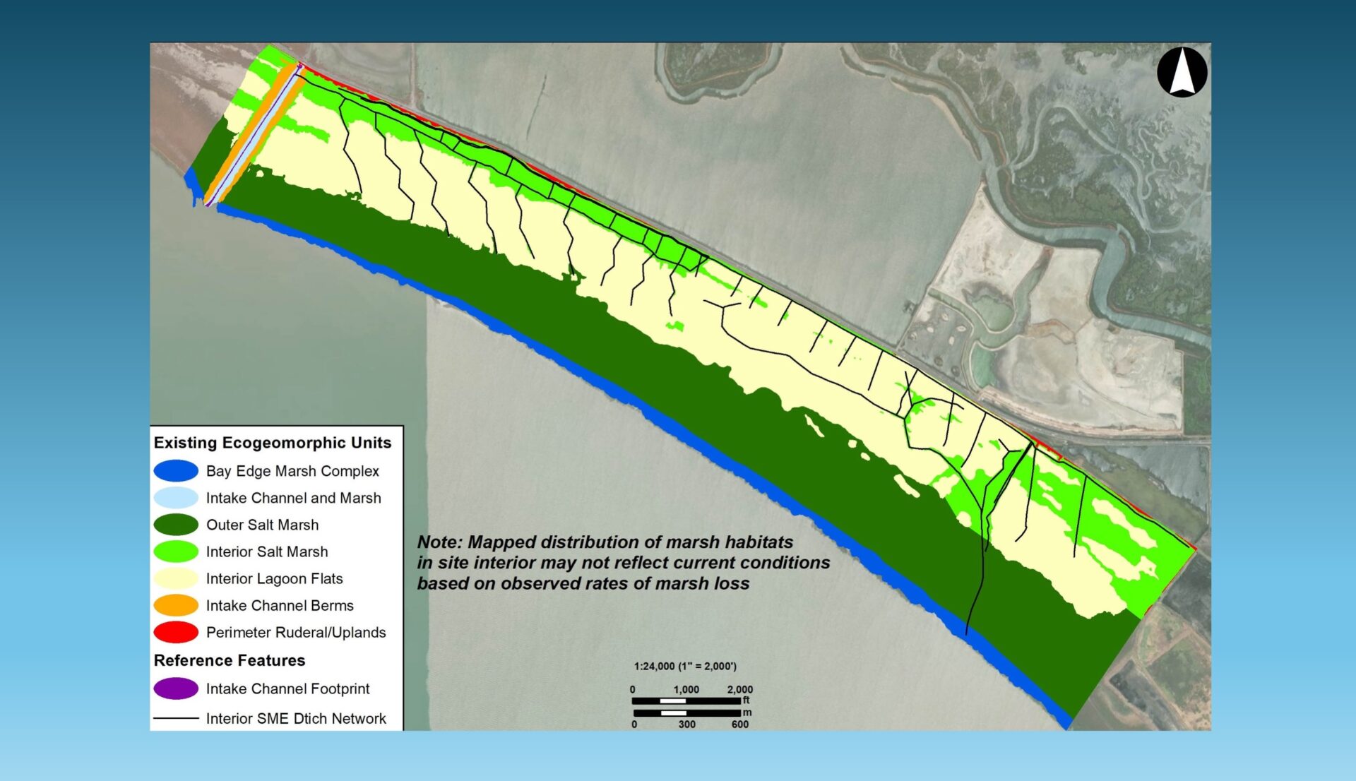
Mouth of Temescal Creek creates sediment deposition and a sinewy channel through the Emeryville Crescent marsh, something absent from Strip Marsh East where rapid formation created the straight channels and straight marsh edge characteristic of some centennial marshes. Photo: Karl Nielsen
In 2024, Nutters and her colleagues began meeting with Caltrans and local stakeholders, including the City of Emeryville, the East Bay Parks District, and the East Bay Municipal Utilities District, to work on coordinated planning for the future of the Bay Bridge’s eastern end and the marshes next to it. By 2026, they had begun identifying potential solutions.
“We need to talk to each other, because their solution can very well be part of our solution,” says Hedges, who notes that state policy has encouraged the use of nature-based infrastructure where possible for several decades. “If their solution is going to protect our road, then we should help fund their solution. What does that look like?”
“Multiple initiatives have emerged from those discussions,” says Nutters.
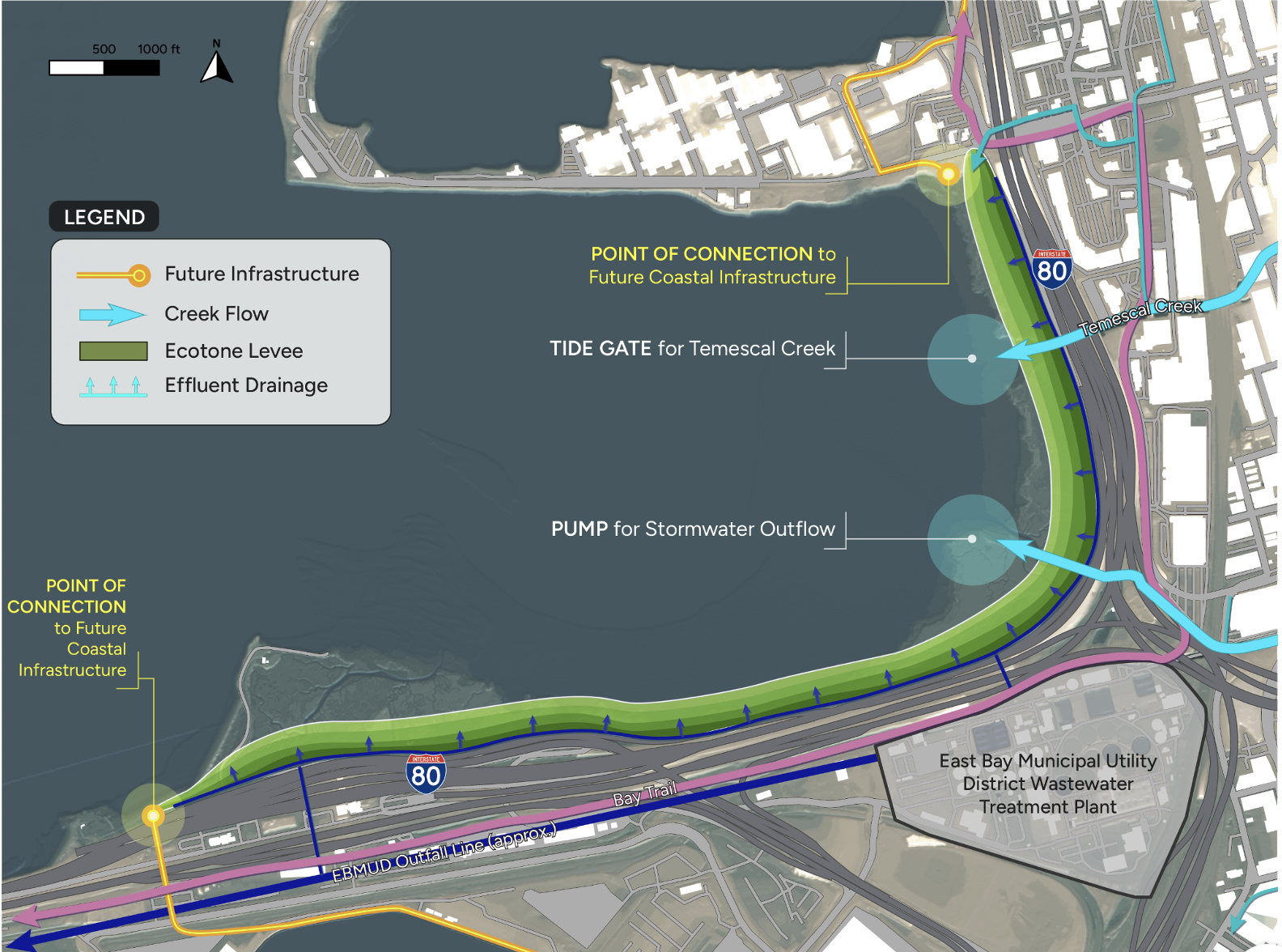
For example, the Estuary Partnership is evaluating the feasibility of a horizontal levee along the Crescent that could provide nature-based sea level rise protection for the bridge touchdown area and nutrient removal for the EBMUD wastewater facility located nearby. (Nutrients are removed by passing wastewater through native vegetation on the levee.)

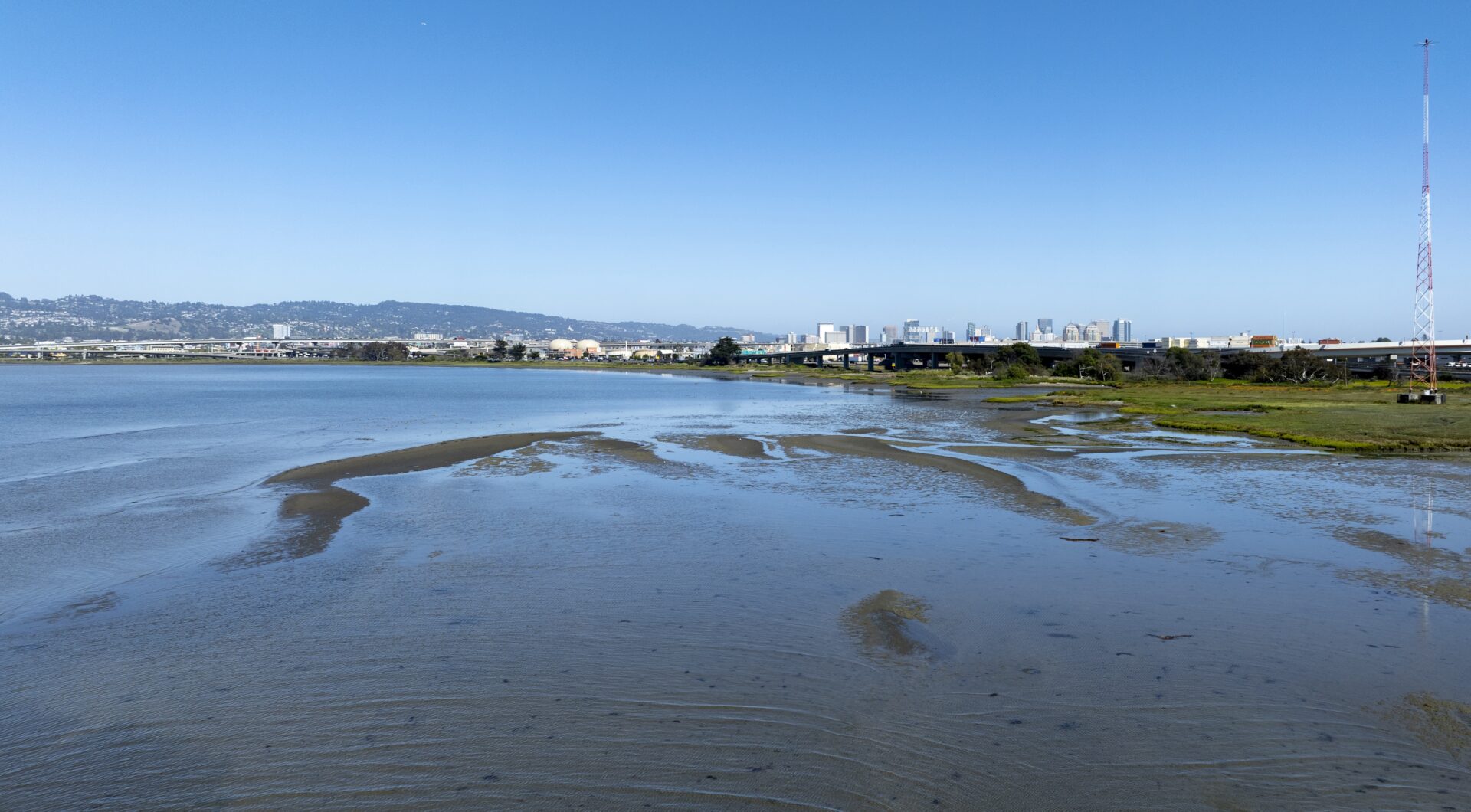
Toll plaza and Radio Beach, a favorite fishing area. Photo: Karl Nielsen
“We’re trying to understand the site conditions at this particular location,” says Nutters, noting that the marsh is very narrow and starved for sediment. “It’s a really windy area where you get a lot of wind-wave action on the shoreline, and the natural infrastructure that’s there, as minimal as it is, is already providing really important protection services for one of our most critical transportation assets in our region, the Bay Bridge.” The question, she says, is “how to develop a design that’s really rooted in that place and is going to be able to continue the ecosystem services that the system is providing.”
Meanwhile, the Army Corps of Engineers is studying the use of “strategic shallow water placement” to bolster sediment supplies to the area and help the marsh keep pace with sea level rise,” says the Corps’ Julie Beagle. The Corps piloted the strategy in 2023 at Eden Landing with promising results.
“We’re going to take material that’s dredged from the Port of Oakland, scoot it around the corner, and place it offshore of the Emeryville Crescent marsh,” says Beagle. “We have to figure out a place in the shallows where the waves can touch the bottom enough to resuspend sediment that gets placed on the Bay floor.” The placed sediment will create a sort of “feeder mound” for the marshes, she explains. “They need sediment in kind of an IV drip way, as opposed to a big dump.”
Natural sediment accumulation due to wave patterns. Photo: Karl Nielsen
The Crescent area has also been selected as one of the sites for the Coastal Conservancy’s Regionally Advancing Living Shorelines project, which seeks to develop design guidance for multiple living shoreline projects simultaneously.
With so many nature-based solutions in the works within a small area, the challenge is to ensure that they all work together to maximize system resilience and provide lasting benefits for the surrounding communities and infrastructure.
“If you need an off loader to come in and place that sediment at the bottom of the Bay like the Corps is considering, you don’t want to plant eelgrass beds in an area that’s going to be harmed by the offloader,” says Nutters. “So how do we think about the design of these interventions in such a way that they’re really complementary to each other and that they’re adding value and benefit?”
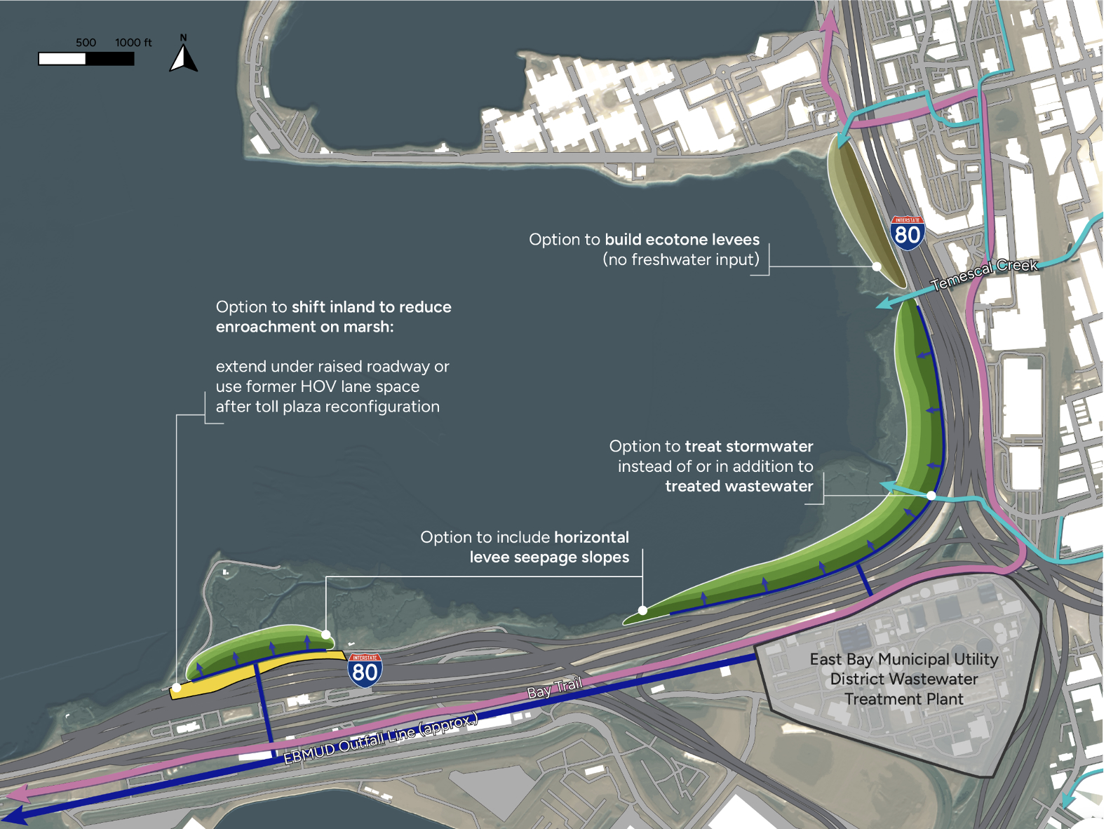
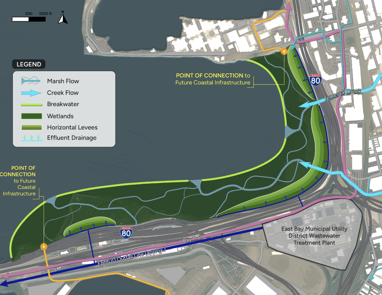
Three preliminary concepts for how nature based infrastructure might deploy in the Emeryville Crescent. For discussion purposes only (none of these designs, only the general elements, have been approved by project partners). Art: Sherwood Design Engineers
In April, the Estuary Partnership received a grant from the Ocean Protection Council to help the cities of Berkeley, Emeryville, and Albany create 3 coordinated Subregional Shoreline Adaptation Plans within the region’s evolving overall plan (RSAP).
“The RSAP will become the umbrella” for the various studies and projects in the Crescent, says Nutters. “It will provide a broader context because we want to treat the Crescent as a holistic and complete planning unit, because it is one system.”
The plan is expected to be complete in March 2028.
Top banner image: Emeryville Crescent by Karl Nielsen
MORE
- Testing Living Shorelines Five Years Later, Local Results, KneeDeep April 2026
- Bay Area Centennial Marshes Data from Wetland Regional Monitoring Program. See “analysis units” data layer under the field “typology” on the SFEI website via this link.